Area Overview for B31 3JE
Photos of B31 3JE
Area Information
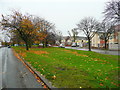
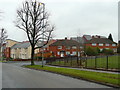
Living in B31 3JE means residing in a compact residential cluster in south-west Birmingham, England. The area covers 1,281 square metres and is home to 1,648 people, making it one of the most densely populated postcode areas in the country, with 1,286,814 people per square kilometre. This small cluster is part of the broader West Heath suburb, historically a heathland area that transitioned into a post-war housing development. Its proximity to Worcestershire and Birmingham’s southern edge gives it a unique blend of suburban calm and urban accessibility. The area’s character is shaped by its origins as a post-1940s prefabricated housing estate, later replaced by permanent homes. Today, it serves as a dormitory suburb for Birmingham commuters, with limited local industry but a strong residential focus. Residents benefit from nearby schools, rail links, and a mix of retail and leisure options, though the area’s compact size means amenities are concentrated within a short walk or drive. The high population density reflects its role as a compact, well-served residential hub for those seeking proximity to Birmingham’s central districts.
- Area Type
- Postcode
- Area Size
- 1281 m²
- Population
- 1648
- Population Density
- 4056 people/km²
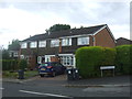
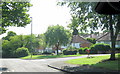
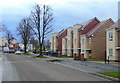
The property market in B31 3JE is characterised by a 36% home ownership rate, indicating that the majority of properties are rented rather than owner-occupied. This suggests a rental market that caters to a range of demographics, from young professionals to families seeking affordable housing. The accommodation type is primarily houses, meaning the area consists of single-family homes rather than high-rise or multi-unit developments. This housing stock is typical of post-war suburban estates, where homes are spread across a relatively small area. Given the high population density and compact size of the postcode, the housing market is likely limited in scale, with properties concentrated in a narrow geographical footprint. Buyers should consider that the area’s small size means competition for available homes may be intense, particularly for those seeking larger properties. The predominance of houses also implies that the area is less suited to investors looking for high-yield rental portfolios, though it may appeal to buyers seeking a traditional suburban lifestyle with garden space.
House Prices in B31 3JE
Showing 4 properties
| Address | Type | Beds | Baths | Last Sale Price | Last Sale Date | |
|---|---|---|---|---|---|---|
| 18 North Walk, Birmingham, B31 3JE | house | - | - | - | - | |
| 14 North Walk, Birmingham, B31 3JE | house | - | - | - | - | |
| 20 North Walk, Birmingham, B31 3JE | Terraced | - | - | - | - | |
| 16 North Walk, Birmingham, B31 3JE | Terraced | - | - | - | - |
Energy Efficiency in B31 3JE
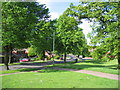
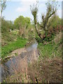
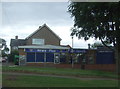
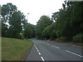
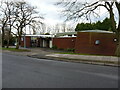
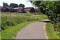
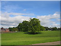
The lifestyle in B31 3JE is shaped by its proximity to retail, transport, and community amenities. Nearby shops include Tesco West, Co-op Longbridge, and Spar, providing essential grocery and convenience services. The area’s rail network connects residents to Northfield, Kings Norton, and Longbridge stations, while metro links to Edgbaston Village, Centenary Square, and Town Hall offer access to Birmingham’s urban centres. Parks and open spaces, such as West Heath Park and Cofton Park, provide recreational opportunities, though the data does not specify their size or condition. The presence of community centres, churches, and pubs like The Man On The Moon suggests a social fabric that supports local interaction. For leisure, the area’s industrial heritage includes the Lightning Way industrial estate, though its role in daily life is limited. Overall, the compact layout ensures that amenities are within walking or short driving distance, fostering a convenient, community-oriented lifestyle.
Amenities
Schools
Residents of B31 3JE have access to three primary schools within the area: West Heath Infant School, West Heath Junior School, and West Heath Primary School. The latter holds an Ofsted rating of ‘good’, reflecting its quality of education. All three schools cater to primary-age children, providing a comprehensive foundation for local families. The presence of multiple primary schools suggests a well-established educational infrastructure, reducing the need for long commutes to secondary schools. Families with young children benefit from the proximity of these institutions, which are likely to be among the most convenient options in the surrounding area. The ‘good’ rating at West Heath Primary School indicates that it meets or exceeds national standards in teaching and facilities, offering reassurance to parents. However, the absence of secondary schools in the immediate vicinity means that students will need to travel to nearby areas for further education, a factor to consider for long-term family planning.
| Rank | School | Type | Entry gender | Ages |
|---|
Explore more schools in this area
Go to Schools tabDemographics
The community in B31 3JE is predominantly middle-aged, with a median age of 47 and the most common age range being adults aged 30–64. This suggests a mature, stable population with established households. Home ownership stands at 36%, indicating that a significant portion of the area is rented out, likely to younger residents or those in temporary housing. The accommodation type is primarily houses, reflecting a residential area with single-family homes rather than flats or apartments. The predominant ethnic group is White, aligning with broader demographic trends in Birmingham’s suburban areas. The high population density—1,286,814 people per square kilometre—suggests a compact, tightly packed community where space is limited. This density may influence local services and infrastructure, with amenities concentrated to serve a large population in a small area. The data does not provide explicit deprivation figures, but the high density and moderate home ownership suggest a mix of economic profiles, with some residents potentially relying on local rental markets or public services.
Household Size
Accommodation Type
Tenure
Ethnic Group
Religion
Household Composition
Age
Household Deprivation
NS-SEC
Explore more demographic insights in this area
Go to Demographics tabPlanning
Planning Constraints
- Flood RiskPremium
- Ramsar Wetland SitesPremium
- Area of Outstanding Natural BeautyPremium
- Protected Nature ReservePremium
- Protected WoodlandPremium