Area Overview for B31 3DG
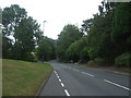
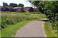
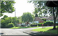
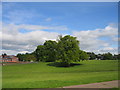
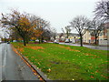
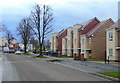
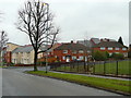
Photos of B31 3DG

Area Information
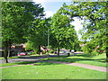
B31 3DG is a small, densely populated postcode area in south-west Birmingham, England, encompassing a residential cluster within the broader West Heath suburb. With a population of 1,648 spread over 5,427 square metres, the area is highly compact, reflecting its role as a dormitory suburb for Birmingham’s central districts. Historically, West Heath evolved from a 19th-century village into a post-war housing estate, blending traditional heathland with modern residential development. Its proximity to Kings Norton, Northfield, and Longbridge places it at the edge of Birmingham’s urban sprawl, with easy access to nearby towns like Alvechurch. The area’s character is defined by its mix of older homes, community amenities, and proximity to green spaces like West Heath Park. While it lacks the commercial vibrancy of Birmingham’s core, its compact nature and established infrastructure make it a practical choice for commuters seeking affordability and connectivity.
- Area Type
- Postcode
- Area Size
- 5427 m²
- Population
- 1648
- Population Density
- 4056 people/km²
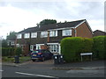
B31 3DG is a small, predominantly owner-occupied area, with 36% of homes owned by residents and the remainder likely rented. The accommodation type is houses, which, given the area’s size and density, may include smaller properties or semi-detached homes. As a suburb with limited industrial activity, the housing stock reflects post-war development, featuring both older homes and newer builds. The small size of the postcode means property availability is constrained, potentially leading to competition among buyers. For those seeking homes in B31 3DG, the focus is on practicality rather than luxury, with proximity to transport and schools being key selling points. The area’s role as a commuter suburb suggests demand is driven by affordability and ease of access to Birmingham’s central districts, though the lack of large-scale development limits options for buyers seeking larger properties.
House Prices in B31 3DG
Showing 33 properties
| Address | Type | Beds | Baths | Last Sale Price | Last Sale Date | |
|---|---|---|---|---|---|---|
| 109 Staple Lodge Road, Northfield, Birmingham, B31 3DG | house | 3 | - | £110,000 | Nov 2012 | |
| 121 Staple Lodge Road, Northfield, Birmingham, B31 3DG | Semi-detached | - | - | £117,000 | Apr 2006 | |
| 107 Staple Lodge Road, Northfield, Birmingham, B31 3DG | Semi-detached | - | - | £91,000 | Jul 2004 | |
| Flat 2, 111 Staple Lodge Road, Northfield, Birmingham, B31 3DG | Flat | - | - | - | - | |
| Flat 3, 113 Staple Lodge Road, Northfield, Birmingham, B31 3DG | Flat | - | - | - | - | |
| Flat 1, 119 Staple Lodge Road, Northfield, Birmingham, B31 3DG | Flat | - | - | - | - | |
| Flat 5, 117 Staple Lodge Road, Northfield, Birmingham, B31 3DG | Flat | - | - | - | - | |
| Flat 4, 115 Staple Lodge Road, Northfield, Birmingham, B31 3DG | Flat | - | - | - | - | |
| Flat 3, 117 Staple Lodge Road, Northfield, Birmingham, B31 3DG | Flat | - | - | - | - | |
| Flat 4, 111 Staple Lodge Road, Northfield, Birmingham, B31 3DG | Flat | - | - | - | - |
Energy Efficiency in B31 3DG
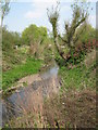
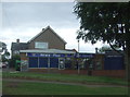
Living in B31 3DG offers a blend of practical amenities and suburban convenience. Nearby retail options include Co-op Longbridge, Tesco West, and Spar, providing essential shopping needs. The area’s rail stations connect residents to Birmingham’s broader transport network, while nearby metro stops like Edgbaston Village and Centenary Square offer access to the city’s cultural and commercial hubs. Parks such as West Heath Park and Cofton Park provide green space for recreation, and the area’s historical character is reflected in landmarks like St. Anne’s Church and the old nailers’ cottages on Station Road. The presence of community centres and local pubs, such as The Man On The Moon, adds to the area’s social fabric. While B31 3DG lacks large-scale leisure facilities, its proximity to Birmingham’s amenities balances its compact, residential nature.
Amenities
Schools
Residents of B31 3DG have access to three primary schools: West Heath Infant School, West Heath Junior School, and West Heath Primary School, which holds an Ofsted rating of ‘good’. These institutions collectively serve the area’s primary education needs, though no secondary schools are listed in the data. The presence of three primary schools suggests a focus on early education, with families likely relying on nearby secondary options in adjacent areas. The ‘good’ rating at West Heath Primary indicates a reasonable standard of teaching, though parents may need to consider additional factors like school catchment areas and transportation. For families prioritising proximity to schools, the cluster of primary schools in B31 3DG offers convenience, though secondary education remains a consideration for long-term planning.
| Rank | School | Type | Entry gender | Ages |
|---|
Explore more schools in this area
Go to Schools tabDemographics
The population of B31 3DG is predominantly adults aged 30–64, with a median age of 47. This suggests a mature, settled community with limited presence of younger families or retirees. Home ownership stands at 36%, indicating a majority of residents are renters, likely due to the area’s role as a commuter suburb. The accommodation type is primarily houses, though the high population density of 303,693 people per square kilometre implies these homes are smaller or multi-occupancy. The predominant ethnic group is White, with no specific data on other demographics. The age profile and ownership figures suggest a mix of long-term residents and those seeking affordable housing near Birmingham’s job hubs. The area’s compact size and high density may contribute to a sense of community, though the lack of detailed diversity data limits broader conclusions about social dynamics.
Household Size
Accommodation Type
Tenure
Ethnic Group
Religion
Household Composition
Age
Household Deprivation
NS-SEC
Explore more demographic insights in this area
Go to Demographics tabPlanning
Planning Constraints
- Flood RiskPremium
- Ramsar Wetland SitesPremium
- Area of Outstanding Natural BeautyPremium
- Protected Nature ReservePremium
- Protected WoodlandPremium