Area Overview for B31 3DZ
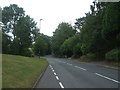
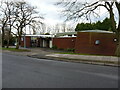
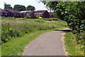
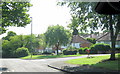
Photos of B31 3DZ
Area Information
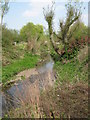
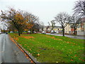
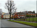
Living in B31 3DZ means being part of a tightly knit residential cluster in south-west Birmingham, where the landscape has evolved from historic heathland to a suburban dormitory. This postcode area, covering 7.7 hectares, is home to 1,648 people, making it one of the most densely populated pockets in the city, with 21,306 people per square kilometre. Its location on the boundary with Worcestershire places it between Kings Norton, Northfield, and Longbridge, offering proximity to both urban and semi-rural settings. The area’s history is rooted in post-war housing developments, with many homes built in the 1940s–1970s to accommodate returning servicemen and families. Today, it serves as a commuter hub for central Birmingham, with residents often working in nearby industrial and commercial zones. The mix of traditional housing and modern infrastructure creates a distinct character, where historic pubs like The Man On The Moon sit alongside contemporary retail outlets. Despite its small size, B31 3DZ offers a range of amenities, from primary schools to rail links, making it a practical choice for those seeking a balance between convenience and community.
- Area Type
- Postcode
- Area Size
- 7.7 hectares
- Population
- 1648
- Population Density
- 4056 people/km²
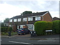
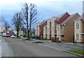
The property market in B31 3DZ is defined by a 36% home ownership rate, indicating that the majority of residents are likely to be renting. This suggests a rental market that may be more prominent than owner-occupation, possibly due to the area’s function as a commuter suburb. The predominant accommodation type is houses, which are typically larger than flats, aligning with the presence of post-war housing stock and semi-detached properties. Given the small area size of 7.7 hectares and high population density, the housing stock is limited, meaning buyers may need to consider nearby areas for more options. The mix of older homes and newer developments could appeal to those seeking character properties or modern living. However, the lack of detailed data on property prices or recent sales means potential buyers should explore the broader Longbridge & West Heath ward for a fuller picture of the market. The area’s proximity to rail links and schools may also make it attractive to families looking for affordable housing with good infrastructure.
House Prices in B31 3DZ
Showing 46 properties
| Address | Type | Beds | Baths | Last Sale Price | Last Sale Date | |
|---|---|---|---|---|---|---|
| 43 Slingfield Road, Birmingham, B31 3DZ | house | - | - | £220,000 | Nov 2025 | |
| 79 Slingfield Road, Birmingham, B31 3DZ | Terraced | 2 | 1 | £200,000 | Mar 2025 | |
| 71 Slingfield Road, Birmingham, B31 3DZ | Detached | 2 | 1 | £200,000 | Dec 2024 | |
| 73 Slingfield Road, Birmingham, B31 3DZ | Terraced | 2 | 1 | £200,000 | Dec 2022 | |
| 57 Slingfield Road, Birmingham, B31 3DZ | house | 2 | 1 | £160,000 | Apr 2022 | |
| 37 Slingfield Road, Birmingham, B31 3DZ | Semi-detached | 3 | 1 | £191,000 | Jan 2021 | |
| 55 Slingfield Road, Birmingham, B31 3DZ | Terraced | 2 | 1 | £165,000 | Oct 2020 | |
| 77 Slingfield Road, Birmingham, B31 3DZ | Semi-detached | 2 | 1 | £168,000 | Aug 2020 | |
| 95 Slingfield Road, Birmingham, B31 3DZ | Semi-detached | 3 | 1 | £164,000 | May 2018 | |
| 39 Slingfield Road, Birmingham, B31 3DZ | Semi-detached | 2 | 1 | £130,000 | Aug 2016 |
Energy Efficiency in B31 3DZ
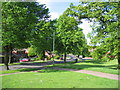
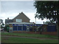
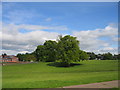
The lifestyle in B31 3DZ is shaped by its proximity to retail, transport, and community hubs. Residents can access five retail outlets, including major chains like Tesco West and Spar, as well as Co-op Longbridge, providing everyday shopping convenience. The area’s rail network connects to Northfield, Kings Norton, and Longbridge stations, facilitating easy travel to Birmingham’s core and surrounding areas. Nearby, the Edgbaston Village and Centenary Square metro stations offer additional transport options, linking to Birmingham’s wider transport system. For leisure, the area includes community centres, pubs like The Man On The Moon, and local parks such as West Heath Park, which are mentioned in historical records. The presence of these amenities fosters a sense of community, with spaces for socialising, relaxation, and recreation. While the data does not specify dining options, the mix of retail and transport links suggests a functional lifestyle, where daily needs are met without requiring long journeys. This balance of convenience and accessibility makes B31 3DZ appealing for those prioritising practicality.
Amenities
Schools
Residents of B31 3DZ have access to three primary schools within walking distance: West Heath Infant School, West Heath Junior School, and West Heath Primary School, which holds a ‘good’ Ofsted rating. These institutions provide a range of educational options for young children, with the latter school’s positive rating indicating a strong foundation in teaching and resources. The presence of multiple primary schools suggests a focus on early education, which is crucial for families with young children. While no secondary schools are listed in the data, the proximity to larger Birmingham districts may offer additional options. The clustering of primary schools in the area supports a family-friendly environment, reducing the need for long commutes to education. For parents, the availability of these schools—especially one with a good rating—could be a significant factor in choosing B31 3DZ as a place to live.
| Rank | School | Type | Entry gender | Ages |
|---|
Explore more schools in this area
Go to Schools tabDemographics
The population of B31 3DZ has a median age of 47, with the majority of residents aged between 30 and 64 years. This suggests a mature community, likely composed of families and professionals settled in the area. Home ownership stands at 36%, indicating a significant proportion of residents rent their homes, possibly due to the area’s role as a commuter suburb. The predominant accommodation type is houses, reflecting a mix of older, permanent homes built in the mid-20th century and newer developments. The predominant ethnic group is White, with no specific data on other demographics provided. The high population density—21,306 people per square kilometre—raises questions about living space per household, though this is typical for urban areas. While the data does not specify deprivation levels, the age profile and housing stock suggest a stable, working-age population with established ties to the local economy. This demographic profile may influence local services and amenities, with a focus on family-oriented infrastructure like schools and healthcare.
Household Size
Accommodation Type
Tenure
Ethnic Group
Religion
Household Composition
Age
Household Deprivation
NS-SEC
Explore more demographic insights in this area
Go to Demographics tabPlanning
Planning Constraints
- Flood RiskPremium
- Ramsar Wetland SitesPremium
- Area of Outstanding Natural BeautyPremium
- Protected Nature ReservePremium
- Protected WoodlandPremium