Area Overview for B31 3DY
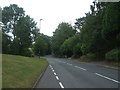
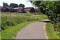
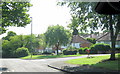
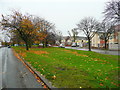
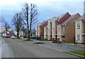
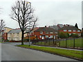
Photos of B31 3DY


Area Information
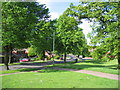
Living in B31 3DY means being part of a compact, residential cluster in south-west Birmingham, England. This postcode covers 1,408 square metres and is home to 1,648 people, creating a densely populated yet small-scale community. Historically a heathland area, it evolved into a suburban ward post-World War II, shaped by prefabricated housing and later permanent estates. The area sits at the boundary of Worcestershire, flanked by Kings Norton, Northfield, and Longbridge. Daily life here balances suburban tranquillity with proximity to Birmingham’s urban centres. Residents benefit from nearby amenities, including schools, rail links, and green spaces like West Heath Park. The community’s character reflects its transition from rural origins to a commuter suburb, with a focus on family homes and local infrastructure. While the population density is high, the area retains a distinct identity, offering a mix of older housing stock and modern developments. For buyers, B31 3DY represents a niche market where proximity to Birmingham’s core is offset by a quieter, residential atmosphere.
- Area Type
- Postcode
- Area Size
- 1408 m²
- Population
- 1648
- Population Density
- 4056 people/km²
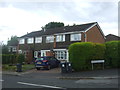
The property market in B31 3DY is characterised by a 36% home ownership rate, suggesting a balance between owner-occupied and rental properties. The accommodation type is predominantly houses, which are typical of suburban areas with family-oriented living. This mix implies a focus on residential stability, though the small area size means housing stock is limited. Buyers should consider nearby zones, as the immediate vicinity may offer more options. The presence of houses indicates a preference for private, spacious living, which could appeal to families or those seeking long-term residency. However, the low home ownership rate may reflect affordability challenges or a reliance on rental markets. For those seeking property, B31 3DY’s compact nature means proximity to Birmingham’s urban amenities is a key draw, though the limited local supply may require flexibility in location.
House Prices in B31 3DY
Showing 8 properties
| Address | Type | Beds | Baths | Last Sale Price | Last Sale Date | |
|---|---|---|---|---|---|---|
| 12 Slingfield Road, Birmingham, B31 3DY | Flat | - | - | £70,000 | Jun 2018 | |
| 8 Slingfield Road, Birmingham, B31 3DY | Flat | - | - | - | - | |
| 4 Slingfield Road, Birmingham, B31 3DY | house | - | - | - | - | |
| 14 Slingfield Road, Birmingham, B31 3DY | Flat | - | - | - | - | |
| 2 Slingfield Road, Birmingham, B31 3DY | Flat | - | - | - | - | |
| 6 Slingfield Road, Birmingham, B31 3DY | Flat | - | - | - | - | |
| 10 Slingfield Road, Birmingham, B31 3DY | Flat | - | - | - | - | |
| 16 Slingfield Road, Birmingham, B31 3DY | Flat | - | - | - | - |
Energy Efficiency in B31 3DY
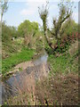
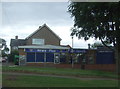
The lifestyle in B31 3DY is shaped by nearby amenities that cater to daily needs. Retail options include Tesco West, Spar, and Co-op Longbridge, providing essential shopping within reach. Residents can access rail stations like Northfield and Longbridge, which connect to Birmingham’s transport network. Parks such as West Heath Park and Cofton Park offer green spaces for recreation, while local landmarks like St. Anne’s Church and The Man On The Moon pub add to the area’s character. The nearby industrial estate on Lightning Way suggests some light commercial activity, though the area remains primarily residential. The mix of shops, transport links, and parks creates a convenient, community-focused environment. While the data does not mention dining options, the presence of pubs and churches indicates a social fabric that supports both practical and cultural needs.
Amenities
Schools
Residents of B31 3DY have access to three primary schools: West Heath Infant School, West Heath Junior School, and West Heath Primary School, which holds a ‘good’ Ofsted rating. These institutions cater to younger children, providing a range of educational options within the area. The presence of multiple primary schools suggests a focus on early education, which is crucial for families with young children. West Heath Primary School’s ‘good’ rating indicates a satisfactory standard of teaching and facilities, though no secondary schools are listed in the data. The concentration of primary schools supports the community’s family-oriented profile, ensuring children have nearby options for schooling. However, parents seeking secondary education may need to look beyond B31 3DY, as the data does not mention local secondary schools.
| Rank | School | Type | Entry gender | Ages |
|---|
Explore more schools in this area
Go to Schools tabDemographics
The population of B31 3DY has a median age of 47, with the majority of residents aged between 30 and 64 years. This suggests a community of established adults, many of whom may be homeowners or long-term residents. Home ownership in the area stands at 36%, indicating a significant proportion of households rent their homes. The predominant accommodation type is houses, reflecting a residential focus rather than high-density living. The predominant ethnic group is White, though specific data on diversity or deprivation is not provided. The age profile implies a mature demographic, potentially influencing local services and amenities. With 1,648 residents in a small area, social interactions and community ties may be more pronounced. The lack of detailed diversity statistics means broader demographic trends remain unexplored, but the data highlights a stable, middle-aged population with a mix of housing needs.
Household Size
Accommodation Type
Tenure
Ethnic Group
Religion
Household Composition
Age
Household Deprivation
NS-SEC
Explore more demographic insights in this area
Go to Demographics tabPlanning
Planning Constraints
- Flood RiskPremium
- Ramsar Wetland SitesPremium
- Area of Outstanding Natural BeautyPremium
- Protected Nature ReservePremium
- Protected WoodlandPremium