Area Overview for B31 3JD
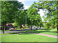
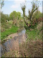
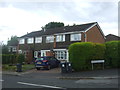
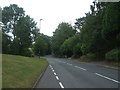
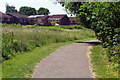
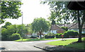
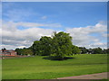
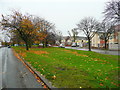
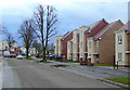
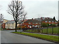
Photos of B31 3JD


Area Information
Living in B31 3JD means being part of a tightly knit residential cluster in south-west Birmingham, England. This small postcode area covers 2,359 square metres and is home to 1,648 people, resulting in a remarkably high population density of 698,486 people per square kilometre. The area’s character stems from its post-war development, with homes built in the 1940s–1970s to accommodate returning servicemen and displaced families. Today, it remains a suburban dormitory for Birmingham commuters, with a median age of 47 and a majority of residents aged 30–64. The community is predominantly White, with homes rather than flats forming the primary accommodation type. Daily life is shaped by proximity to West Heath village, local parks, and nearby transport links. While the area lacks major industrial hubs, its compact size and historical roots in heathland and farmland create a distinct, low-rise residential identity. For buyers, B31 3JD offers a blend of affordability and accessibility, though its small footprint means housing stock is limited to a few hundred properties.
- Area Type
- Postcode
- Area Size
- 2359 m²
- Population
- 1648
- Population Density
- 4056 people/km²
The property market in B31 3JD is defined by a low home ownership rate of 36%, indicating that the majority of residents are renters. The area is predominantly composed of houses rather than flats, which is unusual for a densely populated postcode. This suggests a mix of older, post-war housing stock and more recent developments, though the exact age of properties is not specified. The small size of the area—just 2,359 square metres—means the housing stock is limited, with only a few hundred properties in total. For buyers, this creates a niche market where competition may be fierce, and properties are likely to be in high demand due to their rarity. The focus on houses rather than flats may appeal to those seeking family homes, but the limited supply could make it challenging to find options. The area’s proximity to Birmingham’s transport networks and amenities may offset its small size, making it an attractive, though constrained, option for homebuyers.
House Prices in B31 3JD
Showing 6 properties
| Address | Type | Beds | Baths | Last Sale Price | Last Sale Date | |
|---|---|---|---|---|---|---|
| 41 Aldersmead Road, Birmingham, B31 3JD | house | - | - | - | - | |
| 43 Aldersmead Road, Birmingham, B31 3JD | house | - | - | - | - | |
| 47 Aldersmead Road, Birmingham, B31 3JD | house | - | - | - | - | |
| 45 Aldersmead Road, Birmingham, B31 3JD | house | - | - | - | - | |
| 39 Aldersmead Road, Birmingham, B31 3JD | house | - | - | - | - | |
| 49 Aldersmead Road, Birmingham, B31 3JD | house | - | - | - | - |
Energy Efficiency in B31 3JD
Life in B31 3JD is shaped by its proximity to retail, transport, and green spaces. The area’s retail options include Tesco West, Co-op Longbridge, and Spar, offering essential shopping within walking distance. Nearby rail stations—Northfield, Longbridge, and Kings Norton—provide easy access to Birmingham’s central areas, while metro points like Edgbaston Village and Centenary Square connect to the city’s broader transport network. Parks and recreational spaces such as West Heath Park and Cofton Park are within reach, offering opportunities for walking, cycling, and outdoor activities. The area’s historical character is reflected in sites like St. Anne’s Church and the old railway workers’ cottages on Station Road, adding to its local charm. While B31 3JD lacks large-scale leisure facilities, its compact size ensures amenities are conveniently located. The mix of retail, transport, and green spaces supports a lifestyle that balances suburban tranquillity with urban accessibility, making it suitable for those who value convenience without sacrificing a sense of community.
Amenities
Schools
Residents of B31 3JD have access to three primary schools within walking distance: West Heath Infant School, West Heath Junior School, and West Heath Primary School, which holds an Ofsted rating of ‘good’. These institutions provide a range of educational options for young children, with the latter offering a higher standard of teaching. The presence of multiple primary schools suggests a family-friendly environment, though no secondary schools are listed in the data. For parents, this concentration of primary education reduces the need for long commutes, supporting the area’s role as a commuter suburb. The ‘good’ rating at West Heath Primary indicates a reliable local school, but families requiring secondary education may need to look beyond the immediate postcode. The absence of higher education facilities or specialist schools means the area is best suited for those prioritising primary schooling and proximity to Birmingham’s broader educational network.
| Rank | School | Type | Entry gender | Ages |
|---|
Explore more schools in this area
Go to Schools tabDemographics
The population of B31 3JD is 1,648, with a median age of 47. The most common age range is adults aged 30–64, reflecting a mature, stable community. Only 36% of residents own their homes, indicating a rental-dominated market. The area is characterised by houses rather than flats, suggesting a preference for single-family dwellings. The predominant ethnic group is White, with no specific data on other demographics. This home ownership rate of 36% implies a high proportion of tenants, which may influence the local housing market’s dynamics. The age profile suggests a community with established residents, though younger families may be less represented. The lack of significant deprivation data means the area’s quality of life is not explicitly tied to socioeconomic factors, but the high population density and limited housing stock could affect affordability and availability for new buyers.
Household Size
Accommodation Type
Tenure
Ethnic Group
Religion
Household Composition
Age
Household Deprivation
NS-SEC
Explore more demographic insights in this area
Go to Demographics tabPlanning
Planning Constraints
- Flood RiskPremium
- Ramsar Wetland SitesPremium
- Area of Outstanding Natural BeautyPremium
- Protected Nature ReservePremium
- Protected WoodlandPremium