Area Overview for B31 3DU
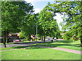
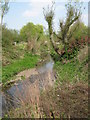
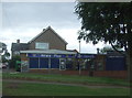
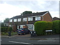
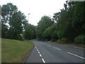
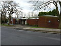
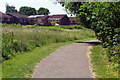
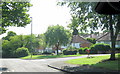
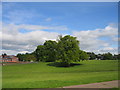
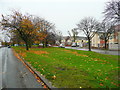
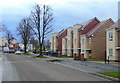
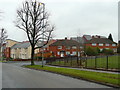
Photos of B31 3DU
Area Information
Living in B31 3DU means residing in a small, densely populated residential cluster within south-west Birmingham. The area spans 5,530 square metres and accommodates 1,648 residents, creating a compact, closely knit community. Historically a heathland, it evolved into a suburban ward post-World War II, shaped by prefabricated housing and later permanent estates. Its location between Kings Norton, Northfield, and Longbridge places it at the southern edge of Birmingham, with proximity to Worcestershire. Daily life here balances suburban tranquillity with easy access to nearby towns and transport hubs. The area’s character reflects its origins as a dormitory suburb, with a mix of older homes and modern developments. Residents benefit from proximity to schools, retail, and public transport, though the high population density means the area feels more like a micro-neighborhood than a sprawling suburb. Its compact size and historical roots make it distinct within Birmingham’s broader urban fabric.
- Area Type
- Postcode
- Area Size
- 5530 m²
- Population
- 1648
- Population Density
- 4056 people/km²
The property market in B31 3DU is characterised by a 36% home ownership rate, meaning the majority of residents live in rented accommodation. The primary accommodation type is houses, which contrasts with areas dominated by flats or apartments. This suggests a more traditional, family-oriented housing stock, likely with larger properties and gardens. The low proportion of owner-occupied homes may indicate a transient population or limited availability of buy-to-let properties. For buyers, this small area’s housing stock is limited to individual houses, which could mean fewer options for first-time buyers or investors. The compact size of the postcode also means the immediate surroundings are critical for property searches. Proximity to nearby towns like Longbridge and Kings Norton may offer additional choices, but within B31 3DU itself, the market is constrained by its small footprint. Buyers should consider the area’s high population density and the potential for competition in the limited housing supply.
House Prices in B31 3DU
Showing 21 properties
| Address | Type | Beds | Baths | Last Sale Price | Last Sale Date | |
|---|---|---|---|---|---|---|
| 90 Slingfield Road, Birmingham, B31 3DU | Semi-detached | 3 | 1 | £221,000 | Nov 2023 | |
| 76 Slingfield Road, Birmingham, B31 3DU | Maisonette | 1 | - | £51,500 | Jul 2016 | |
| 86 Slingfield Road, Birmingham, B31 3DU | Semi-detached | - | - | £76,000 | Jun 2016 | |
| 88 Slingfield Road, Birmingham, B31 3DU | Semi-detached | 3 | 1 | £76,000 | Mar 2016 | |
| 42 Slingfield Road, Birmingham, B31 3DU | Terraced | - | - | - | - | |
| 40 Slingfield Road, Birmingham, B31 3DU | Semi-detached | - | - | - | - | |
| 78 Slingfield Road, Birmingham, B31 3DU | Flat | - | - | - | - | |
| 36 Slingfield Road, Birmingham, B31 3DU | house | - | - | - | - | |
| 44 Slingfield Road, Birmingham, B31 3DU | Terraced | - | - | - | - | |
| 64 Slingfield Road, Birmingham, B31 3DU | Flat | - | - | - | - |
Energy Efficiency in B31 3DU
Residents of B31 3DU enjoy a range of amenities within practical reach. Retail options include Tesco West, Co-op Longbridge, and Spar, offering everyday shopping convenience. The area’s proximity to Longbridge railway station and nearby metro stops like Edgbaston Village ensures easy access to Birmingham’s broader network. Parks such as West Heath Park and Cofton Park provide green spaces for recreation, while local landmarks like The Man On The Moon pub and West Heath Community Centre contribute to the area’s social fabric. Notable sites include St. Anne’s Church, St. John Fisher Church, and the historic Longbridge House. The presence of community-focused venues, combined with nearby schools and transport links, creates a balanced lifestyle. While the area is compact, its mix of retail, leisure, and green spaces supports both daily needs and leisure activities, making it suitable for families and commuters seeking a connected yet manageable environment.
Amenities
Schools
Residents of B31 3DU have access to three primary schools: West Heath Infant School, West Heath Junior School, and West Heath Primary School, which holds an Ofsted rating of 'good'. These schools cater to younger children, with West Heath Primary School offering a consolidated primary education. The presence of multiple primary schools within the area ensures proximity for families, reducing travel time and supporting local community cohesion. However, the data does not mention secondary schools, so families may need to look beyond the immediate postcode for comprehensive education. The 'good' rating at West Heath Primary School indicates a reliable standard of teaching, though parents should verify if this aligns with their specific needs. The concentration of primary schools reflects the area’s focus on family-friendly living, though further research would be required to assess secondary education options.
| Rank | School | Type | Entry gender | Ages |
|---|
Explore more schools in this area
Go to Schools tabDemographics
The population of B31 3DU has a median age of 47, with the majority aged between 30 and 64 years. This suggests a community of established professionals and families, rather than a younger or elderly demographic. Home ownership rates stand at 36%, indicating a significant proportion of residents rent their homes. The accommodation type is predominantly houses, reflecting a lower density of flats or apartments. The predominant ethnic group is White, though the data does not specify further diversity metrics. With a population density of 298,000 people per square kilometre, the area is intensely populated, which may influence local amenities and social dynamics. This density, combined with the age profile, suggests a stable, middle-aged population likely focused on family life and long-term residency. The 36% ownership rate also implies a reliance on rental housing, which could affect property market dynamics and community stability.
Household Size
Accommodation Type
Tenure
Ethnic Group
Religion
Household Composition
Age
Household Deprivation
NS-SEC
Explore more demographic insights in this area
Go to Demographics tabPlanning
Planning Constraints
- Flood RiskPremium
- Ramsar Wetland SitesPremium
- Area of Outstanding Natural BeautyPremium
- Protected Nature ReservePremium
- Protected WoodlandPremium