Area Overview for TN12 7HW
Photos of TN12 7HW
Area Information
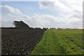
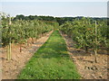
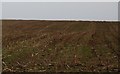
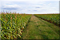
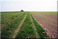
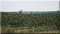
TN12 7HW lies within the rural parish of Brenchley and Matfield, a historic civil parish in Kent’s Borough of Tunbridge Wells. This small residential cluster covers 44.8 hectares, with a population of 1,856 people spread across a low-density settlement of 89 residents per square kilometre. The area is defined by its rural character, surrounded by countryside and parts of an Area of Outstanding Natural Beauty. Its proximity to the A21 and B2162 roads links it to nearby towns like Paddock Wood and Royal Tunbridge Wells, offering a blend of quiet village life and accessible connectivity. The parish’s history dates back to Saxon times, with landmarks like All Saints Church, a Grade 1 listed building from around 1233, and the Old Palace, a 15th-century structure. Daily life here is shaped by its conservation areas, historic woodlands, and a community rooted in agriculture and medieval traditions. The low population density and limited development suggest a tranquil, low-traffic environment, ideal for those seeking a peaceful retreat without sacrificing proximity to amenities.
- Area Type
- Postcode
- Area Size
- 44.8 hectares
- Population
- 1856
- Population Density
- 89 people/km²
TN12 7HW is primarily an owner-occupied area, with 85% of homes owned by residents rather than rented. The accommodation type is exclusively houses, with no flats or apartments reported. This suggests a housing stock tailored to families or individuals seeking larger properties, likely with gardens or outdoor space. Given the small area size of 44.8 hectares and low population density, the number of homes is limited, which could mean a competitive market for buyers. The absence of rental properties indicates a focus on long-term residency, potentially reducing turnover and ensuring stable property values. However, the small scale of the area means buyers should consider proximity to larger towns like Paddock Wood or Tunbridge Wells for additional services. The predominance of houses also aligns with the rural setting, where land availability allows for detached properties.
House Prices in TN12 7HW
Showing 1 properties
| Address | Type | Beds | Baths | Last Sale Price | Last Sale Date | |
|---|---|---|---|---|---|---|
| Orchard House, Cryals Road, Matfield, Tonbridge, TN12 7HW | Detached | 4 | - | - | - |
Energy Efficiency in TN12 7HW
Living in TN12 7HW offers access to a range of nearby amenities within practical reach. Retail options include M&S Blue Boys Tonbridge BP, Tesco Tunbridge, and Morrisons Daily, providing essential shopping and dining choices. The area’s rail network connects to Paddock Wood, Frant, and High Brooms stations, facilitating travel to larger towns for more services. The Tunbridge Wells West metro station adds further transport flexibility. While the area itself is rural, its proximity to the A21 ensures access to cultural and commercial hubs. The presence of historic sites like All Saints Church and the Old Palace, along with conservation areas, contributes to a lifestyle centred on heritage and natural beauty. However, the limited local amenities mean residents may need to travel for specialist services or entertainment, balancing the tranquillity of rural living with the convenience of nearby towns.
Amenities
Schools
| Rank | School | Type | Entry gender | Ages |
|---|
Explore more schools in this area
Go to Schools tabDemographics
The population of TN12 7HW has a median age of 47, with the majority of residents aged 30–64. This suggests a community skewed towards middle-aged adults, likely including families and professionals. Home ownership is high at 85%, indicating a stable, long-term resident base rather than a transient rental market. The area is predominantly composed of houses, with no mention of flats or apartments, reflecting a traditional, family-oriented housing stock. The predominant ethnic group is White, though specific data on diversity is not provided. The low population density of 89 people per square kilometre reinforces the rural, spread-out nature of the settlement. This demographic profile implies a community with strong local ties, fewer young families, and a focus on established homeownership. The absence of detailed deprivation data means quality of life factors like access to services and employment opportunities must be inferred from the area’s amenities and transport links.
Household Size
Accommodation Type
Tenure
Ethnic Group
Religion
Household Composition
Age
Household Deprivation
NS-SEC
Explore more demographic insights in this area
Go to Demographics tabPlanning
Planning Constraints
- Flood RiskPremium
- Ramsar Wetland SitesPremium
- Area of Outstanding Natural BeautyPremium
- Protected Nature ReservePremium
- Protected WoodlandPremium