Area Overview for TN12 7HT
Photos of TN12 7HT

Area Information
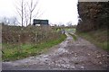
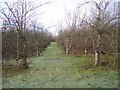
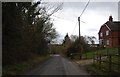
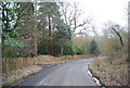
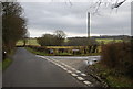
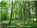
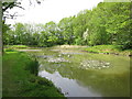
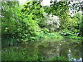
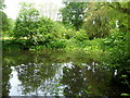
TN12 7HT lies in the rural parish of Brenchley and Matfield, a small cluster of homes nestled within the Borough of Tunbridge Wells, Kent. With a population of 1,856 spread across 63.5 hectares, this area blends historical charm with modern convenience. The village centres are part of conservation areas, surrounded by countryside and medieval woodlands, offering a peaceful, low-density lifestyle. Residents benefit from proximity to nearby towns like Paddock Wood and Royal Tunbridge Wells, both within a short drive. The area’s character is shaped by its Saxon origins, medieval routeways, and historic sites such as All Saints Church, a Grade 1 listed building with a 400-year-old yew avenue. Daily life here is defined by a close-knit community, with access to local amenities and a strong connection to the surrounding natural landscape. The area’s rural setting, combined with practical transport links, makes it appealing to those seeking a balance between tranquillity and accessibility.
- Area Type
- Postcode
- Area Size
- 63.5 hectares
- Population
- 1856
- Population Density
- 89 people/km²
TN12 7HT is primarily an owner-occupied area, with 85% of homes owned by residents rather than rented. The accommodation type is predominantly houses, reflecting the low-density, rural nature of the parish. This suggests a market characterised by family homes and long-term residency, rather than a rental-focused demographic. Given the small population of 1,856 and the area’s size, the housing stock is limited, which may increase competition for properties. Buyers should consider nearby villages within the Brenchley and Matfield civil parish for additional options. The focus on owner-occupation implies a stable market, but the small scale of the area means that property availability is constrained. Prospective buyers should also note the proximity to larger towns like Paddock Wood and Tunbridge Wells, which may offer more extensive housing choices for those seeking alternatives.
House Prices in TN12 7HT
Showing 19 properties
| Address | Type | Beds | Baths | Last Sale Price | Last Sale Date | |
|---|---|---|---|---|---|---|
| Curtis Cottage, Tong Road, Brenchley, Tonbridge, TN12 7HT | house | - | - | £655,000 | Feb 2022 | |
| Hangers Wood, Tong Road, Brenchley, Tonbridge, TN12 7HT | Bungalow | 3 | - | £516,080 | Sep 2021 | |
| Curtis Stables, Tong Road, Brenchley, Tonbridge, TN12 7HT | Bungalow | 3 | 2 | £282,000 | May 2021 | |
| 1, Tong Farm Cottages, Tong Road, Brenchley, Tonbridge, TN12 7HT | Semi-detached | 5 | 2 | £701,000 | Mar 2019 | |
| 2, Tong Farm Cottages, Tong Road, Brenchley, Tonbridge, TN12 7HT | house | - | - | £833,000 | Feb 2018 | |
| The Old Dutch Barn, Tong Road, Brenchley, Tonbridge, TN12 7HT | Detached | - | - | £950,000 | Aug 2017 | |
| East Lynn, Tong Road, Brenchley, Tonbridge, TN12 7HT | Bungalow | - | - | £895,000 | Nov 2014 | |
| Ashendene, Tong Road, Brenchley, Tonbridge, TN12 7HT | house | - | - | £407,800 | May 2009 | |
| The Old Tong Barn, Tong Road, Brenchley, Tonbridge, TN12 7HT | Detached | 4 | 2 | £800,000 | Aug 2007 | |
| Curtis Villa, Tong Road, Brenchley, Tonbridge, TN12 7HT | Detached | 3 | 2 | £84,000 | Aug 1996 |
Energy Efficiency in TN12 7HT
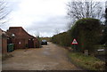
Living in TN12 7HT offers access to a range of local amenities within practical reach. Retail options include M&S Blue Boys Tonbridge BP, Spar, and Tesco Paddock, providing everyday shopping needs. The area’s proximity to Paddock Wood and Tunbridge Wells ensures access to larger retail and dining hubs. For transport, the nearby rail stations—Paddock Wood, Frant, and Beltring—connect residents to broader networks, while Tunbridge Wells West metro station offers regional links. The rural character of the area is complemented by its historic sites, such as All Saints Church and the Old Palace, which contribute to a distinct cultural atmosphere. Parks and open spaces, though not explicitly named in the data, are implied by the parish’s designation as an Area of Outstanding Natural Beauty. This blend of practical amenities and natural surroundings supports a lifestyle that balances convenience with a connection to the countryside.
Amenities
Schools
| Rank | School | Type | Entry gender | Ages |
|---|
Explore more schools in this area
Go to Schools tabDemographics
The population of TN12 7HT is 1,856, with a median age of 47 and the majority of residents aged 30–64. This suggests a mature, stable community with a focus on established households. Home ownership is high at 85%, indicating a strong local presence and long-term residency. The area is predominantly occupied by houses, reflecting a low-density, suburban character. The predominant ethnic group is White, aligning with broader trends in rural Kent. With a population density of 89 people per square kilometre, the area maintains a quiet, spacious feel. The age profile and ownership rates imply a community prioritising stability over transient rental markets, though the small population size means limited diversity in household types. This demographic structure supports a lifestyle centred on local amenities and a slower pace of life, with fewer pressures of urban living.
Household Size
Accommodation Type
Tenure
Ethnic Group
Religion
Household Composition
Age
Household Deprivation
NS-SEC
Explore more demographic insights in this area
Go to Demographics tabPlanning
Planning Constraints
- Flood RiskPremium
- Ramsar Wetland SitesPremium
- Area of Outstanding Natural BeautyPremium
- Protected Nature ReservePremium
- Protected WoodlandPremium