Area Overview for TN12 7HS
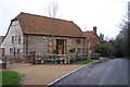
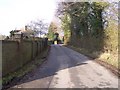
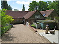
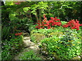
Photos of TN12 7HS
Area Information
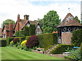
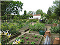
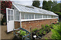
TN12 7HS lies within the civil parish of Brenchley and Matfield, a rural area in Kent’s Borough of Tunbridge Wells. This small postcode covers 78.8 hectares, housing 1,856 residents at a density of 89 people per square kilometre. The area is defined by its historic character, with medieval woodlands, medieval routeways, and post-medieval agricultural landscapes shaping its rural charm. Villages like Brenchley and Matfield, along with hamlets such as Castle Hill and Petteridge, form a close-knit community just 8 miles east of Royal Tunbridge Wells and 3 miles north of Paddock Wood. The area’s proximity to the A21 and B2162 roads offers easy access to nearby towns, while its low population density ensures a quiet, countryside lifestyle. With a median age of 47 and a majority of residents aged 30–64, the community is stable and family-oriented, reflected in the high home ownership rate of 85%. This makes TN12 7HS a place where traditional architecture and historic sites, such as All Saints Church and the Old Palace, coexist with modern living.
- Area Type
- Postcode
- Area Size
- 78.8 hectares
- Population
- 1856
- Population Density
- 89 people/km²
TN12 7HS is primarily an owner-occupied area, with 85% of homes owned by residents rather than rented. This high rate of home ownership is typical of rural regions and suggests a community of long-term residents who value stability and investment in property. The accommodation type is predominantly houses, which aligns with the area’s rural setting and the availability of larger properties. This contrasts with urban areas where flats and apartments dominate. For buyers, this means the housing stock is likely to consist of detached or semi-detached homes, offering space and privacy. However, the small size of the postcode (78.8 hectares) means the number of available properties may be limited, requiring buyers to consider nearby areas such as Paddock Wood or Royal Tunbridge Wells for additional options. The high home ownership rate also indicates strong local demand, which could influence property values and the competitive nature of the market.
House Prices in TN12 7HS
Showing 15 properties
| Address | Type | Beds | Baths | Last Sale Price | Last Sale Date | |
|---|---|---|---|---|---|---|
| 2, Hopgarden Cottage, Marle Place Road, Brenchley, Tonbridge, TN12 7HS | house | - | - | £400,000 | May 2025 | |
| Flightshott House, Marle Place Road, Brenchley, Tonbridge, TN12 7HS | Detached | 6 | 4 | £1,950,000 | Nov 2012 | |
| High Tong Lodge, Marle Place Road, Brenchley, Tonbridge, TN12 7HS | house | - | - | £750,000 | Nov 2003 | |
| High Tong, Marle Place Road, Brenchley, Tonbridge, TN12 7HS | Detached | 8 | - | - | - | |
| Marle Place Farm, Marle Place Road, Brenchley, Tonbridge, TN12 7HS | Detached | - | - | - | - | |
| Boundary Farm, Marle Place Road, Brenchley, Tonbridge, TN12 7HS | Detached | - | - | - | - | |
| Honeycomb Cottage, Marle Place Road, Brenchley, Tonbridge, TN12 7HS | Detached | 3 | 3 | - | - | |
| Cavepits House, Marle Place Road, Brenchley, Tonbridge, TN12 7HS | house | - | - | - | - | |
| 1, Hopgarden Cottage, Marle Place Road, Brenchley, Tonbridge, TN12 7HS | Semi-detached | - | - | - | - | |
| Lordships House, Marle Place Road, Brenchley, Tonbridge, TN12 7HS | house | - | - | - | - |
Energy Efficiency in TN12 7HS
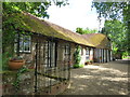
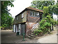
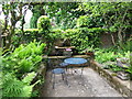
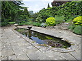
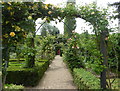
Living in TN12 7HS offers a blend of historic charm and practical amenities. The area’s retail options include notable stores such as M&S Blue Boys Tonbridge BP, Spar, and Tesco Paddock, providing everyday shopping needs within reach. Rail access to Paddock Wood, Marden, and Beltring stations enhances mobility, connecting residents to nearby towns for additional services and leisure. The area’s rural character is complemented by its historic sites, including All Saints Church, a Grade 1 listed building with a 400-year-old yew avenue, and the Old Palace, a half-timbered structure linked to local history. The Brenchley & Matfield C of E primary school serves the community, ensuring educational needs are met. While the area lacks large-scale leisure facilities, its proximity to the countryside and historic landscapes offers opportunities for walking, cycling, and outdoor activities. The combination of local amenities and historic surroundings creates a lifestyle that balances convenience with rural tranquillity.
Amenities
Schools
| Rank | School | Type | Entry gender | Ages |
|---|
Explore more schools in this area
Go to Schools tabDemographics
The population of TN12 7HS is 1,856, with a median age of 47 and the majority of residents falling within the 30–64 age range. This suggests a community dominated by working-age adults and families, likely contributing to a stable local economy. Home ownership is high at 85%, indicating a strong presence of long-term residents and a focus on property as an investment. The accommodation type is predominantly houses, which aligns with the rural character of the area and the preference for larger, more private dwellings. The predominant ethnic group is White, reflecting the broader demographic trends in rural Kent. While no specific data on deprivation is provided, the high home ownership and low population density suggest a relatively affluent and self-sufficient community. The absence of detailed diversity metrics means the area’s cultural makeup remains largely unexplored in the data, but the historic and rural context implies a homogeneous population.
Household Size
Accommodation Type
Tenure
Ethnic Group
Religion
Household Composition
Age
Household Deprivation
NS-SEC
Explore more demographic insights in this area
Go to Demographics tabPlanning
Planning Constraints
- Flood RiskPremium
- Ramsar Wetland SitesPremium
- Area of Outstanding Natural BeautyPremium
- Protected Nature ReservePremium
- Protected WoodlandPremium