Area Overview for TN12 7HU
Photos of TN12 7HU
Area Information
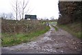
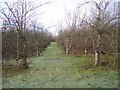
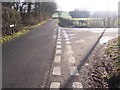
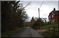
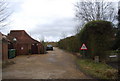
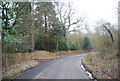
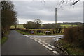
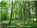
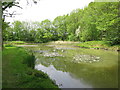
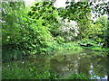
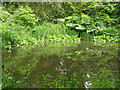
TN12 7HU is a small residential postcode area nestled in the rural parish of Brenchley and Matfield, Kent. Covering 21.5 hectares, it is home to 1,856 residents, translating to a low population density of 89 people per square kilometre. This area, part of the Borough of Tunbridge Wells, lies just 3 miles south of Paddock Wood and 8 miles east of Royal Tunbridge Wells, offering a quiet, countryside-oriented lifestyle. The village centres of Brenchley and Matfield, along with hamlets like Castle Hill and Petteridge, form a historic landscape marked by medieval woodlands and post-medieval agricultural roots. Daily life here is shaped by proximity to nature, with the surrounding Area of Outstanding Natural Beauty providing scenic walks and a sense of tranquillity. The area’s character blends rural charm with practical connectivity, including nearby rail stations and modest retail options. This is a place for those seeking a slower pace, with a community rooted in tradition and a low population density that ensures a sense of space and privacy.
- Area Type
- Postcode
- Area Size
- 21.5 hectares
- Population
- 1856
- Population Density
- 89 people/km²
TN12 7HU is predominantly an owner-occupied area, with 85% of homes owned by residents rather than rented. The accommodation type is primarily houses, which is typical for a rural postcode with low population density. This suggests a housing stock that includes larger properties, potentially appealing to families or those seeking space. The small area size of 21.5 hectares means the housing market is limited, with few properties available. Buyers should consider the surrounding villages, as the immediate area may have minimal new developments. The high home ownership rate indicates a stable market, but competition for existing properties could be fierce. The presence of historic buildings, such as the 14th-century Old Vicarage, may also influence property values and character. For buyers, this area offers a chance to own a home in a rural setting, though the limited supply means careful consideration of nearby areas is essential.
House Prices in TN12 7HU
Showing 2 properties
| Address | Type | Beds | Baths | Last Sale Price | Last Sale Date | |
|---|---|---|---|---|---|---|
| 1 Fir Tree Cottage, Green Lane, Brenchley, Tonbridge, TN12 7HU | Detached | 3 | 2 | £850,000 | Aug 2016 | |
| Owl Cottage, Green Lane, Brenchley, Tonbridge, TN12 7HU | Semi-detached | 4 | 2 | £605,000 | Apr 2009 |
Energy Efficiency in TN12 7HU
Living in TN12 7HU offers a blend of rural simplicity and practical amenities. Nearby retail options include M&S Blue Boys Tonbridge BP, Spar, and Tesco Paddock, providing essential shopping within reach. The area’s proximity to Paddock Wood Railway Station and other nearby stations ensures access to public transport, facilitating travel to larger towns. The surrounding countryside, part of an Area of Outstanding Natural Beauty, offers walking and cycling opportunities, while historic sites like All Saints Church and the Old Vicarage add cultural depth. The Brenchley & Matfield C of E primary school is a key local institution, supporting families with children. The low population density and rural setting contribute to a peaceful lifestyle, though amenities are modest compared to urban areas. For those prioritising nature and a slower pace, this area provides a self-contained environment with access to nearby services.
Amenities
Schools
| Rank | School | Type | Entry gender | Ages |
|---|
Explore more schools in this area
Go to Schools tabDemographics
The population of TN12 7HU skews towards middle-aged and older residents, with a median age of 47 and the most common age range being adults aged 30–64. Home ownership is high at 85%, reflecting a stable, long-term community. The predominant accommodation type is houses, which aligns with the area’s rural, low-density character. The population density of 89 people per square kilometre suggests a spread-out settlement pattern, contributing to a less crowded environment. The predominant ethnic group is White, though specific data on other demographics is not provided. The age profile indicates a community with a strong presence of families and retirees, likely supporting local schools and amenities. The high home ownership rate and older demographic may influence the local economy, with fewer rental properties and a focus on long-term residency.
Household Size
Accommodation Type
Tenure
Ethnic Group
Religion
Household Composition
Age
Household Deprivation
NS-SEC
Explore more demographic insights in this area
Go to Demographics tabPlanning
Planning Constraints
- Flood RiskPremium
- Ramsar Wetland SitesPremium
- Area of Outstanding Natural BeautyPremium
- Protected Nature ReservePremium
- Protected WoodlandPremium