Area Overview for TN12 7AH
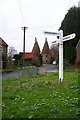
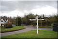
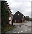
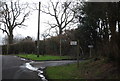
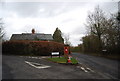
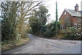
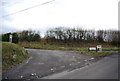
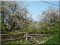
Photos of TN12 7AH

Area Information
TN12 7AH lies within the rural parish of Brenchley and Matfield, nestled in Kent’s rolling countryside. This small postcode area covers 29.2 hectares, housing 1,856 residents in a low-density, house-dominated settlement. Its proximity to the A21 and B2162 roads links it to nearby villages like Paddock Wood and Royal Tunbridge Wells, just 3 miles away. The area’s character is defined by its historic roots, including medieval woodlands and 14th-century buildings like the Old Vicarage, alongside modern field layouts. With a median age of 47, the community leans heavily on adults aged 30–64, reflecting a stable, family-oriented demographic. Daily life here balances rural tranquillity with access to nearby amenities, from rail stations to retail hubs. The area’s low crime risk and lack of major environmental constraints make it appealing for those seeking a peaceful yet connected lifestyle. Its compact size means residents are close to nature, historic sites, and the convenience of nearby towns, blending tradition with practicality.
- Area Type
- Postcode
- Area Size
- 29.2 hectares
- Population
- 1856
- Population Density
- 89 people/km²
TN12 7AH is primarily an owner-occupied area, with 85% of homes owned by residents rather than rented. The accommodation type is predominantly houses, reflecting a rural, low-density settlement. This contrasts with urban areas where flats or apartments dominate, and instead suggests a market focused on family homes or larger properties. The small area size means the housing stock is limited, with properties likely to be older, given the median age of residents. Buyers should consider the area’s compact nature, which may limit availability but also preserve character. Proximity to Paddock Wood and Tunbridge Wells offers additional options for those seeking larger or varied housing. The high home ownership rate indicates stability, but the small population means the market is niche, appealing to those prioritising rural living over urban convenience.
House Prices in TN12 7AH
Showing 17 properties
| Address | Type | Beds | Baths | Last Sale Price | Last Sale Date | |
|---|---|---|---|---|---|---|
| Kingdom Cottage, Tibbs Court Lane, Brenchley, Tonbridge, TN12 7AH | house | - | - | £635,000 | Nov 2021 | |
| Holly Cottage, Tibbs Court Lane, Brenchley, Tonbridge, TN12 7AH | Semi-detached | - | - | £292,000 | Apr 2009 | |
| Little Chill Mill House, Tibbs Court Lane, Brenchley, Tonbridge, TN12 7AH | Retail | 5 | 5 | £495,000 | Oct 2002 | |
| Little Chill Mill Bungalow, Tibbs Court Lane, Brenchley, Tonbridge, TN12 7AH | Bungalow | - | - | £279,500 | May 2001 | |
| The Farmhouse, Tibbs Court Farm, Tibbs Court Lane, Brenchley, Tonbridge, TN12 7AH | Detached | 5 | 3 | - | - | |
| The Barn, Tibbs Court Farm, Tibbs Court Lane, Brenchley, Tonbridge, TN12 7AH | Retail | 5 | 5 | - | - | |
| 9, Tibbs Court Farm, Tibbs Court Lane, Brenchley, Tonbridge, TN12 7AH | Retail | 2 | 2 | - | - | |
| The Hollies, Tibbs Court Lane, Brenchley, Tonbridge, TN12 7AH | Retail | 3 | 2 | - | - | |
| Lyndene, Tibbs Court Lane, Brenchley, Tonbridge, TN12 7AH | Retail | 4 | 3 | - | - | |
| Gallery 88 Ltd, 2, Tibbs Court Farm, Tibbs Court Lane, Brenchley, Tonbridge, TN12 7AH | office_workshop | - | - | - | - |
Energy Efficiency in TN12 7AH
Living in TN12 7AH offers a mix of rural charm and practical amenities. Retail options include M&S Blue Boys Tonbridge BP, Tesco Paddock, and Waitrose Paddock, all within a short drive. The area’s rail links to Paddock Wood, Beltring, and Frant provide easy access to nearby towns, while the Tunbridge Wells West metro station connects to broader transport networks. Historic sites like All Saints Church, a Grade 1 listed building with a 400-year-old yew avenue, add cultural depth. The surrounding countryside, part of an Area of Outstanding Natural Beauty, supports walking, cycling, and outdoor pursuits. Daily life balances quiet village living with proximity to shops, schools, and transport, making it suitable for those seeking a slower pace without complete isolation.
Amenities
Schools
| Rank | School | Type | Entry gender | Ages |
|---|
Explore more schools in this area
Go to Schools tabDemographics
TN12 7AH’s population of 1,856 is spread across 29.2 hectares, resulting in a density of 89 people per square kilometre. The median age of 47 indicates a mature community, with the majority of residents aged 30–64. Home ownership is high at 85%, suggesting a stable, long-term resident base. The area is predominantly composed of houses, reflecting a residential character rather than high-density housing. The predominant ethnic group is White, aligning with broader regional patterns. This demographic profile shapes a community focused on established living, with fewer young families or transient populations. The low population density also means fewer pressures on local services, though it limits the scale of amenities. For buyers, this suggests a market driven by owner-occupation and long-term residency, with properties likely to retain value in a low-risk, low-traffic environment.
Household Size
Accommodation Type
Tenure
Ethnic Group
Religion
Household Composition
Age
Household Deprivation
NS-SEC
Explore more demographic insights in this area
Go to Demographics tabPlanning
Planning Constraints
- Flood RiskPremium
- Ramsar Wetland SitesPremium
- Area of Outstanding Natural BeautyPremium
- Protected Nature ReservePremium
- Protected WoodlandPremium