Area Overview for TN12 7LN
Photos of TN12 7LN


Area Information
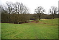
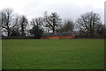
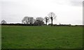
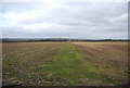
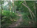
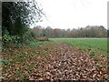
TN12 7LN lies in the heart of Brenchley and Matfield, a rural parish in the Borough of Tunbridge Wells, Kent. This small postcode area covers 57.4 hectares and is home to 1,733 residents, with a population density of 167 people per square kilometre. The area is defined by its proximity to the A21 and B2162 roads, situating it 8 miles east of Royal Tunbridge Wells and 3 miles south of Paddock Wood. Daily life here is shaped by its historic character, with villages like Brenchley and Matfield surrounded by countryside and conservation areas. The parish retains medieval routes and woodlands, while modern field amalgamation has altered the landscape. Residents benefit from a mix of historic sites, such as All Saints Church (Grade 1 listed) and the Old Palace, alongside contemporary amenities. The area’s low crime risk and absence of major flood or planning constraints make it appealing for those seeking a quiet, stable environment.
- Area Type
- Postcode
- Area Size
- 57.4 hectares
- Population
- 1733
- Population Density
- 167 people/km²
The property market in TN12 7LN is characterised by high home ownership (76%) and a focus on houses rather than flats or apartments. This suggests a residential area with a traditional, low-density layout, typical of rural Kent. The small size of the postcode area means the housing stock is likely limited, with properties concentrated in the villages of Brenchley and Matfield. For buyers, this implies a market where demand may outstrip supply, particularly for owner-occupied homes. The area’s proximity to Paddock Wood and Tunbridge Wells could also make it attractive to those seeking a balance between rural living and access to larger towns. However, the limited number of properties means buyers should consider nearby areas for broader options.
House Prices in TN12 7LN
Showing 11 properties
| Address | Type | Beds | Baths | Last Sale Price | Last Sale Date | |
|---|---|---|---|---|---|---|
| Oak Lodge, Cryals Road, Matfield, Tonbridge, TN12 7LN | house | - | - | £1,100,000 | Nov 2018 | |
| Beechwood, Cryals Road, Matfield, Tonbridge, TN12 7LN | Detached | 4 | 2 | £696,000 | Nov 2012 | |
| The Beeches, Cryals Road, Matfield, Tonbridge, TN12 7LN | Detached | - | - | £418,400 | May 2001 | |
| Highwood, Cryals Road, Matfield, Tonbridge, TN12 7LN | Detached | - | - | £860,000 | Jan 2001 | |
| Sunnyside, Cryals Road, Matfield, Tonbridge, TN12 7LN | Detached | 4 | 2 | - | - | |
| Westwoods, Cryals Road, Matfield, Tonbridge, TN12 7LN | Semi-detached | 4 | 2 | - | - | |
| Woodlands, Cryals Road, Matfield, Tonbridge, TN12 7LN | Bungalow | 3 | - | - | - | |
| 1, Cryals Place, Cryals Road, Matfield, Tonbridge, TN12 7LN | Semi-detached | 2 | 1 | - | - | |
| 2, Cryals Place, Cryals Road, Matfield, Tonbridge, TN12 7LN | Terraced | 3 | 2 | - | - | |
| 3, Cryals Place, Cryals Road, Matfield, Tonbridge, TN12 7LN | Semi-detached | 3 | 2 | - | - |
Energy Efficiency in TN12 7LN
Living in TN12 7LN offers a blend of rural tranquillity and accessible amenities. Within practical reach are five retail outlets, including M&S Blue Boys Tonbridge BP, Tesco Tunbridge, and Morrisons Daily, providing everyday shopping needs. The area is served by five railway stations, including Paddock Wood and Frant, and the Tunbridge Wells West metro station, facilitating travel to nearby towns. The presence of protected woodland, while a planning constraint, also adds to the natural appeal of the area. Residents can enjoy a low-crime environment and a historic landscape, with sites like All Saints Church and the Old Palace adding cultural value. The mix of shops, transport links, and green spaces supports a lifestyle that balances convenience with rural charm.
Amenities
Schools
Residents of TN12 7LN have access to two primary schools: Brenchley and Matfield Church of England Voluntary Aided Primary School and Brenchley and Matfield Church of England Primary School. Both are primary institutions, though no Ofsted ratings are provided in the data. The presence of two schools in the area suggests a focus on early education, which is crucial for families with young children. The schools’ names indicate a connection to the local church, reflecting the area’s historic and community-oriented character. While the data does not specify academic performance or facilities, the availability of two primary schools within a small postcode area likely reduces travel time for students and supports a sense of local cohesion.
| Rank | School | Type | Entry gender | Ages |
|---|
Explore more schools in this area
Go to Schools tabDemographics
The community in TN12 7LN is predominantly composed of adults aged 30–64, with a median age of 47. This suggests a mature, established population, likely with long-term ties to the area. Home ownership is high, with 76% of properties occupied by their owners, reflecting a stable housing market. The accommodation type is primarily houses, indicating a low-density, residential character. The predominant ethnic group is White, which aligns with the broader demographic patterns of rural Kent. With a population of 1,733, the area is small enough to foster a close-knit community but large enough to support essential services. The absence of specific deprivation data means the area’s quality of life is likely tied to its rural setting, low crime rates, and access to nearby towns.
Household Size
Accommodation Type
Tenure
Ethnic Group
Religion
Household Composition
Age
Household Deprivation
NS-SEC
Explore more demographic insights in this area
Go to Demographics tabPlanning
Planning Constraints
- Flood RiskPremium
- Ramsar Wetland SitesPremium
- Area of Outstanding Natural BeautyPremium
- Protected Nature ReservePremium
- Protected WoodlandPremium