Area Overview for TN12 7HN
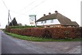
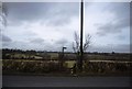
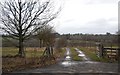
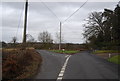
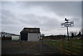
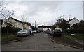
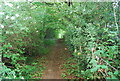
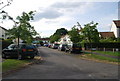
Photos of TN12 7HN
Area Information
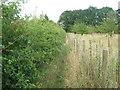
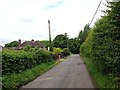
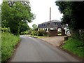
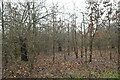
TN12 7HN is a small, tightly knit residential cluster in the heart of Brenchley and Matfield, a civil parish in Kent’s Tunbridge Wells Borough. Covering just 12.9 hectares, this area is home to 1,856 people, creating a low-density, rural feel with a population density of 89 people per square kilometre. The village lies off the A21, nestled between Horsmonden and Matfield, 8 miles east of Royal Tunbridge Wells. Its character is shaped by historic woodlands, medieval routeways, and conservation areas, with a mix of traditional and modern housing. The area is surrounded by countryside, much of it falling within an Area of Outstanding Natural Beauty. Daily life here is defined by proximity to nature, with walking and cycling routes abundant. The village centres, including Castle Hill and Petteridge, retain a historic charm, while amenities like All Saints Church and the Old Palace offer glimpses into the past. This is a place where rural tranquillity meets practical connectivity, with nearby rail links and retail hubs within reach.
- Area Type
- Postcode
- Area Size
- 12.9 hectares
- Population
- 1856
- Population Density
- 89 people/km²
TN12 7HN is a predominantly owner-occupied area, with 85% of homes owned by residents rather than rented. The accommodation is almost exclusively houses, reflecting the rural, low-density nature of the parish. This contrasts with urban areas where flats or apartments dominate. The small area size (12.9 hectares) and limited housing stock suggest a constrained market, with properties likely to be in demand due to their rarity. Buyers should consider the proximity to nearby towns like Paddock Wood and Royal Tunbridge Wells, where additional amenities and services are available. The focus on owner-occupied homes indicates a community of long-term residents, which may influence property values and market stability. For buyers, the challenge lies in balancing the appeal of rural living with the practicality of access to transport and retail hubs.
House Prices in TN12 7HN
Showing 11 properties
| Address | Type | Beds | Baths | Last Sale Price | Last Sale Date | |
|---|---|---|---|---|---|---|
| The Annexe, Parkwood Farmhouse, Cryals Road, Matfield, Tonbridge, TN12 7HN | Detached | 6 | 3 | - | - | |
| Parkwood Farmhouse, Cryals Road, Matfield, Tonbridge, TN12 7HN | Detached | 6 | 3 | - | - | |
| Cryals Lodge, Cryals Road, Matfield, Tonbridge, TN12 7HN | house | 4 | 6 | - | - | |
| 2, Old Cryals Cottages, Cryals Road, Matfield, Tonbridge, TN12 7HN | Semi-detached | 3 | 1 | - | - | |
| The Old Forge, Cryals Road, Matfield, Tonbridge, TN12 7HN | Semi-detached | - | - | - | - | |
| 2, New Cottages, Cryals Road, Matfield, Tonbridge, TN12 7HN | Semi-detached | 3 | 1 | - | - | |
| 1, New Cottages, Cryals Road, Matfield, Tonbridge, TN12 7HN | Semi-detached | 3 | 1 | - | - | |
| Cryals Farm, Cryals Road, Matfield, Tonbridge, TN12 7HN | storage_distribution | - | - | - | - | |
| Old Cryals, Cryals Road, Matfield, Tonbridge, TN12 7HN | Semi-detached | 3 | 1 | - | - | |
| 1, Old Cottages, Cryals Road, Matfield, Tonbridge, TN12 7HN | Semi-detached | 3 | 1 | - | - |
Energy Efficiency in TN12 7HN
Living in TN12 7HN offers a blend of rural tranquillity and accessible amenities. Within practical reach are retail outlets such as M&S Blue Boys Tonbridge BP, Morrisons Daily, and Tesco Tunbridge, providing everyday shopping needs. The area’s proximity to rail stations like Paddock Wood and Frant ensures easy access to public transport, while Tunbridge Wells West metro station connects to broader networks. Historically rich, the parish features landmarks like All Saints Church, a Grade 1 listed building with a 400-year-old yew avenue, and the Old Palace, linked to Nell Gwynne’s son. The landscape is dominated by countryside, with conservation areas preserving its natural beauty. Daily life here is shaped by walks through woodlands, visits to historic sites, and the convenience of nearby towns for dining and leisure. The balance of heritage and practicality makes it appealing for those seeking a peaceful yet connected lifestyle.
Amenities
Schools
| Rank | School | Type | Entry gender | Ages |
|---|
Explore more schools in this area
Go to Schools tabDemographics
The community in TN12 7HN is predominantly middle-aged and older, with a median age of 47 and 85% of residents aged between 30 and 64. Home ownership is high at 85%, reflecting a stable, long-term population. The area is largely composed of houses rather than flats, aligning with its rural character. The predominant ethnic group is White, though no specific data on diversity or deprivation is provided. With a population density of 89 people per square kilometre, the area maintains a low-key, unpressured atmosphere. The age profile suggests a community focused on established living, with fewer young families or students. This demographic profile supports a quiet, mature neighbourhood where services and amenities cater to the needs of older residents. The lack of significant deprivation indicators implies a baseline quality of life, though specific data on income or social mobility is absent.
Household Size
Accommodation Type
Tenure
Ethnic Group
Religion
Household Composition
Age
Household Deprivation
NS-SEC
Explore more demographic insights in this area
Go to Demographics tabPlanning
Planning Constraints
- Flood RiskPremium
- Ramsar Wetland SitesPremium
- Area of Outstanding Natural BeautyPremium
- Protected Nature ReservePremium
- Protected WoodlandPremium