Area Overview for TN12 7HP
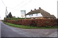
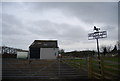
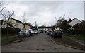
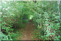
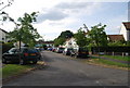
Photos of TN12 7HP
Area Information
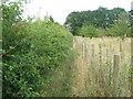
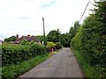
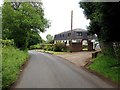
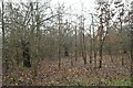
TN12 7HP lies within the rural parish of Brenchley and Matfield, a small cluster of homes nestled in the Borough of Tunbridge Wells, Kent. With a population of 1,856 spread across 3.6 hectares, this area retains a quiet, village-like character, surrounded by countryside and historic landscapes. The postcode sits off the A21, accessible via the B2162, placing it 8 miles east of Royal Tunbridge Wells and 3 miles north of Paddock Wood. The area’s charm stems from its medieval roots, including All Saints Church, a Grade 1 listed building with a 400-year-old yew avenue, and the Old Palace, linked to historical figures like Nell Gwynne’s son. Daily life here balances rural tranquillity with practical connectivity, with nearby railway stations offering links to London and the south-east. The community is predominantly middle-aged, with a strong sense of local identity, reflected in its conservation areas and historic woodlands. For those seeking a peaceful, low-density lifestyle with access to small-town amenities, TN12 7HP offers a distinctive blend of heritage and modern convenience.
- Area Type
- Postcode
- Area Size
- 3.6 hectares
- Population
- 1856
- Population Density
- 89 people/km²
TN12 7HP is predominantly an owner-occupied area, with 85% of homes owned by residents rather than rented. The accommodation type is primarily houses, reflecting a low-density, rural setting with limited high-rise or apartment blocks. This suggests a market focused on family homes, detached or semi-detached properties, and older, characterful residences. Given the area’s small size—just 3.6 hectares—there is little scope for new housing developments, making the property market tightly held and potentially competitive for buyers. The emphasis on owner-occupation indicates long-term residency, with properties likely retaining value due to their historical and scenic appeal. For buyers, this means fewer options but potentially higher quality homes, though proximity to larger towns like Tunbridge Wells or Paddock Wood may be necessary for more diverse property choices.
House Prices in TN12 7HP
Showing 6 properties
| Address | Type | Beds | Baths | Last Sale Price | Last Sale Date | |
|---|---|---|---|---|---|---|
| 5, Cryals Court, Cryals Road, Matfield, Tonbridge, TN12 7HP | Maisonette | - | - | £385,000 | Jun 2017 | |
| 3, Cryals Court, Cryals Road, Matfield, Tonbridge, TN12 7HP | Maisonette | 2 | 1 | £520,000 | Jul 2016 | |
| 4, Cryals Court, Cryals Road, Matfield, Tonbridge, TN12 7HP | Flat | - | - | £213,000 | May 2016 | |
| 2, Cryals Court, Cryals Road, Matfield, Tonbridge, TN12 7HP | Flat | - | - | £510,000 | May 2016 | |
| 6, Cryals Court, Cryals Road, Matfield, Tonbridge, TN12 7HP | Semi-detached | 2 | 1 | £420,000 | Feb 2016 | |
| 1, Cryals Court, Cryals Road, Matfield, Tonbridge, TN12 7HP | Flat | - | - | £295,000 | Mar 2005 |
Energy Efficiency in TN12 7HP
Living in TN12 7HP offers a mix of small-town amenities and rural charm. Within practical reach are retail options such as M&S Blue Boys Tonbridge BP, Morrisons Daily, and Tesco Tunbridge, providing everyday shopping needs. The area’s proximity to Paddock Wood Railway Station and Tunbridge Wells West metro station ensures easy access to transport networks. Historic sites like All Saints Church and the Old Palace add cultural depth, while the surrounding countryside offers walking and cycling opportunities. The Brenchley & Matfield C of E primary school serves local families, and nearby villages provide additional services. The low population density and conservation areas contribute to a peaceful lifestyle, with daily life shaped by community ties, historic landmarks, and the convenience of nearby towns.
Amenities
Schools
| Rank | School | Type | Entry gender | Ages |
|---|
Explore more schools in this area
Go to Schools tabDemographics
The population of TN12 7HP is 1,856, with a median age of 47, indicating a mature community. The most common age range is adults aged 30–64, suggesting a stable, family-oriented demographic. Home ownership is high at 85%, with houses being the predominant accommodation type. This reflects a settled, long-term resident base rather than a transient rental market. The predominant ethnic group is White, aligning with the broader demographic profile of rural Kent. The low population density of 89 people per square kilometre reinforces the area’s low-key, uncluttered character. While no specific deprivation data is provided, the high home ownership and age profile suggest a community with established economic stability. This demographic profile shapes a lifestyle centred on local traditions, historic sites, and proximity to nature, with limited pressure from urbanisation or gentrification.
Household Size
Accommodation Type
Tenure
Ethnic Group
Religion
Household Composition
Age
Household Deprivation
NS-SEC
Explore more demographic insights in this area
Go to Demographics tabPlanning
Planning Constraints
- Flood RiskPremium
- Ramsar Wetland SitesPremium
- Area of Outstanding Natural BeautyPremium
- Protected Nature ReservePremium
- Protected WoodlandPremium