Area Overview for TN12 7LG
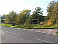
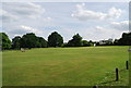
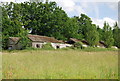
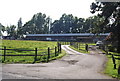
Photos of TN12 7LG
Area Information
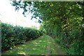
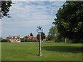
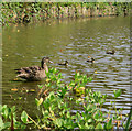
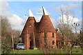
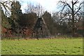
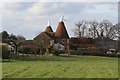
TN12 7LG is a small, rural postcode area nestled in the Borough of Tunbridge Wells, Kent. Covering 33.8 hectares, it is home to around 1,733 residents, with a population density of 167 people per square kilometre, reflecting its low-key, countryside character. The area is part of the civil parish of Brenchley and Matfield, encompassing villages and hamlets like Castle Hill and Petteridge. Historically rooted, it features medieval woodlands, historic routes, and conservation areas, with landmarks such as All Saints Church, a Grade 1 listed building dating to the 13th century. Daily life here is defined by proximity to nature, with a mix of rural tranquillity and practical connectivity. Residents benefit from nearby rail links and essential retail services, while the area’s low population density ensures a sense of space. Living in TN12 7LG means embracing a slower pace of life, with a focus on community, heritage, and access to the surrounding Kent countryside.
- Area Type
- Postcode
- Area Size
- 33.8 hectares
- Population
- 1733
- Population Density
- 167 people/km²
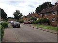
TN12 7LG is primarily an owner-occupied area, with 76% of homes owned by residents rather than rented. The accommodation type is predominantly houses, which is typical for rural and semi-rural regions. This suggests a housing stock that caters to families and long-term residents, with limited rental availability. The small area size—33.8 hectares—means the property market is constrained, with fewer options for buyers. However, this also implies that properties may retain value due to their scarcity. The focus on houses rather than flats or apartments aligns with the area’s character, which prioritises private, spacious living. Buyers should consider the limited number of properties available and the potential for competition, particularly from those seeking a stable, low-density environment. The market’s stability may appeal to investors looking for long-term capital growth in a historically preserved setting.
House Prices in TN12 7LG
Showing 12 properties
| Address | Type | Beds | Baths | Last Sale Price | Last Sale Date | |
|---|---|---|---|---|---|---|
| Friars Oast, Maidstone Road, Matfield, Tonbridge, TN12 7LG | house | 6 | - | £923,000 | Aug 2011 | |
| Friars Grange, Maidstone Road, Matfield, Tonbridge, TN12 7LG | Detached | - | - | £350,000 | Aug 2006 | |
| The Park House, Maidstone Road, Matfield, Tonbridge, TN12 7LG | house | - | - | £825,000 | Jun 1999 | |
| The Friars House, Maidstone Road, Matfield, Tonbridge, TN12 7LG | Semi-detached | - | - | £360,000 | Jan 1999 | |
| Lime Tree Cottage, Maidstone Road, Matfield, Tonbridge, TN12 7LG | Detached | 2 | 1 | - | - | |
| Friars Farm, Maidstone Road, Matfield, Tonbridge, TN12 7LG | Semi-detached | 4 | 3 | - | - | |
| Friars Mill, Maidstone Road, Matfield, Tonbridge, TN12 7LG | house | 4 | 3 | - | - | |
| Lavender House, Maidstone Road, Matfield, Tonbridge, TN12 7LG | house | 4 | - | - | - | |
| Tudor House, Maidstone Road, Matfield, Tonbridge, TN12 7LG | Semi-detached | - | - | - | - | |
| Orchard View, Maidstone Road, Matfield, Tonbridge, TN12 7LG | house | - | - | - | - |
Energy Efficiency in TN12 7LG
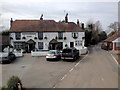
Living in TN12 7LG offers access to a range of practical amenities within reach. The area is served by five retail outlets, including M&S Blue Boys Tonbridge BP, Morrisons Daily, and Tesco Tunbridge, providing everyday shopping needs. Nearby rail stations such as Paddock Wood and Beltring connect residents to broader transport networks, while the Tunbridge Wells West metro station offers additional commuting options. The rural character of the area is complemented by its proximity to natural landscapes, with historic woodlands and conservation areas contributing to a scenic environment. The presence of notable sites like All Saints Church and the Old Palace adds cultural and historical interest. While the area lacks large leisure facilities, its small-scale amenities and countryside setting create a balanced lifestyle, blending practicality with a connection to nature and heritage.
Amenities
Schools
The schools nearest to TN12 7LG include Brenchley and Matfield Church of England Voluntary Aided Primary School and Brenchley and Matfield Church of England Primary School. Both are primary schools, serving the needs of younger children in the area. While no Ofsted ratings are provided in the data, the presence of two primary schools indicates a focus on local education for families with young children. However, the absence of secondary schools in the immediate vicinity means that students may need to travel to nearby towns like Tunbridge Wells or Paddock Wood for secondary education. This mix of school types is typical for smaller rural communities, where primary education is locally available but secondary options require broader travel. For families prioritising a comprehensive local school network, it may be necessary to assess the accessibility of secondary schools in surrounding areas.
| Rank | School | Type | Entry gender | Ages |
|---|
Explore more schools in this area
Go to Schools tabDemographics
The community in TN12 7LG is predominantly composed of adults aged 30–64, with a median age of 47. This suggests a stable population with strong ties to the area, reflected in the high home ownership rate of 76%. The majority of residents live in houses, a feature common in rural parishes. The predominant ethnic group is White, aligning with the broader demographic profile of the region. With a population of 1,733, the area maintains a low population density, contributing to a less crowded, more spread-out living environment. This demographic structure indicates a community focused on long-term residency rather than transient populations. The age profile suggests a mature, established population, with fewer young families compared to urban areas. For prospective buyers, this profile may appeal to those seeking a quiet, settled environment with minimal pressure from high turnover or rental markets.
Household Size
Accommodation Type
Tenure
Ethnic Group
Religion
Household Composition
Age
Household Deprivation
NS-SEC
Explore more demographic insights in this area
Go to Demographics tabPlanning
Planning Constraints
- Flood RiskPremium
- Ramsar Wetland SitesPremium
- Area of Outstanding Natural BeautyPremium
- Protected Nature ReservePremium
- Protected WoodlandPremium