Area Overview for DE11 0TY
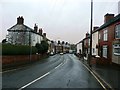
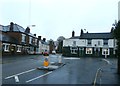
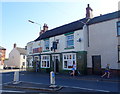
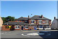
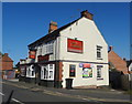
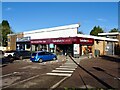
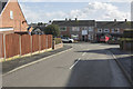
Photos of DE11 0TY


Area Information
Living in DE11 0TY means being part of a small, tightly knit residential cluster in the South Derbyshire district of Derbyshire. The area covers 5,302 square metres and is home to 1,642 people, creating a community where neighbours are likely to know one another. Situated between Swadlincote and Burton upon Trent, it is served by key roads like the A444 and A511, with proximity to the M42 motorway. Historically shaped by 18th-century industrial activity, the area retains a rural charm despite its modern infrastructure. The ward, known as Newhall and Stanton, includes the villages of Newhall and Stanton, with a population that grew from 6,214 in 2001 to 6,963 in the 2001 census. Daily life here balances small-town convenience with easy access to regional amenities, making it appealing for those seeking a quieter lifestyle without sacrificing connectivity. The area’s low crime rates and absence of environmental constraints further enhance its appeal for families and professionals.
- Area Type
- Postcode
- Area Size
- 5302 m²
- Population
- 1642
- Population Density
- 343 people/km²
DE11 0TY is predominantly an owner-occupied area, with 76% of homes owned by residents rather than rented. The accommodation type is largely houses, which contrasts with areas dominated by flats or apartments. This suggests a housing stock that caters to families and individuals seeking more space and privacy. The small size of the area—just 5,302 square metres—means the property market is limited in scale, with fewer options available compared to larger towns. However, the high home ownership rate indicates a stable market where properties are likely to retain value. For buyers, this means competition may be lower, but the range of properties could be narrower. Proximity to nearby towns like Swadlincote and Burton upon Trent offers additional options for those seeking more variety, though the immediate area remains focused on single-family homes.
House Prices in DE11 0TY
Showing 16 properties
| Address | Type | Beds | Baths | Last Sale Price | Last Sale Date | |
|---|---|---|---|---|---|---|
| 5 The Leys, Newhall, Swadlincote, DE11 0TY | Semi-detached | 3 | 1 | £220,000 | May 2024 | |
| 2 The Leys, Newhall, Swadlincote, DE11 0TY | house | - | - | £172,500 | Nov 2021 | |
| 25 The Leys, Newhall, Swadlincote, DE11 0TY | Semi-detached | 3 | 1 | £102,000 | Aug 2017 | |
| 17 The Leys, Newhall, Swadlincote, DE11 0TY | Semi-detached | 3 | 1 | £130,000 | Aug 2016 | |
| 1 The Leys, Newhall, Swadlincote, DE11 0TY | Semi-detached | 3 | - | £120,000 | Sep 2014 | |
| 19 The Leys, Newhall, Swadlincote, DE11 0TY | Semi-detached | - | - | £59,995 | Sep 2001 | |
| 15 The Leys, Newhall, Swadlincote, DE11 0TY | Semi-detached | - | - | £46,000 | Feb 2000 | |
| 21 The Leys, Newhall, Swadlincote, DE11 0TY | Semi-detached | - | - | £38,500 | Feb 1996 | |
| 4 The Leys, Newhall, Swadlincote, DE11 0TY | Semi-detached | - | - | - | - | |
| 7 The Leys, Newhall, Swadlincote, DE11 0TY | Semi-detached | - | - | - | - |
Energy Efficiency in DE11 0TY
Residents of DE11 0TY benefit from nearby retail amenities, including Sainsburys Newhall, Sainsburys Swadlincote, and Tesco Swadlincote, ensuring convenient access to shopping and daily essentials. The area’s proximity to the A444 and A511 roads also connects it to broader regional networks. While the data does not specify parks or leisure facilities, the presence of St John’s Anglican Church and Stanton Methodist Church suggests a community-centred lifestyle. The nearby Newhall Park hosts a composite war memorial, adding historical interest to the area. The mix of retail options and transport links supports a practical, low-stress lifestyle, ideal for those who value convenience without the hustle of larger cities.
Amenities
Schools
Residents of DE11 0TY have access to a range of primary schools, including Newhall Community Junior School and Stanton Primary School, both of which are traditional state-funded institutions. Stanton Primary School holds a ‘good’ Ofsted rating, reflecting its quality of education and facilities. Newhall Junior School is an academy, offering a different governance model that may appeal to parents seeking alternative educational approaches. The mix of school types provides families with options to suit their preferences, whether they prioritise a traditional curriculum or the autonomy of an academy. With no secondary schools listed in the data, parents may need to consider nearby towns like Swadlincote or Burton upon Trent for secondary education. The presence of multiple primary schools within practical reach suggests a well-supported environment for young families.
| Rank | School | Type | Entry gender | Ages |
|---|
Explore more schools in this area
Go to Schools tabDemographics
The population of DE11 0TY is predominantly adults aged 30–64, with a median age of 47. This suggests a community of established residents, many of whom are likely to be homeowners, as 76% of properties are owner-occupied. The accommodation type is primarily houses, reflecting a more traditional housing stock compared to flats or apartments. The predominant ethnic group is White, indicating a relatively homogeneous demographic. With a population density of 343 people per square kilometre, the area maintains a low-density feel, avoiding the congestion of larger urban centres. This profile suggests a stable, family-oriented community where residents are likely to have long-term ties to the area. The absence of specific data on deprivation means the quality of life is inferred from factors like low crime rates and access to amenities, which appear favourable for those prioritising safety and a slower pace of life.
Household Size
Accommodation Type
Tenure
Ethnic Group
Religion
Household Composition
Age
Household Deprivation
NS-SEC
Explore more demographic insights in this area
Go to Demographics tabPlanning
Planning Constraints
- Flood RiskPremium
- Ramsar Wetland SitesPremium
- Area of Outstanding Natural BeautyPremium
- Protected Nature ReservePremium
- Protected WoodlandPremium