Area Overview for DE11 0TU
Photos of DE11 0TU

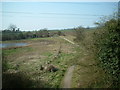


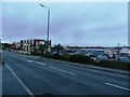

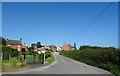
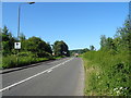
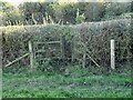
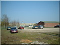
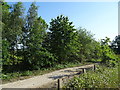
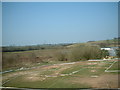
15 photos from this area
Area Information
Key information about the DE11 0TU including its size, population, and administrative classification.
- Area Type
- Postcode
- Area Size
- 10.3 hectares
- Population
- 1642
- Population Density
- 343 people/km²
House Prices in DE11 0TU
33
Properties
£201,528
Average Sold Price
£48,000
Lowest Price
£375,000
Highest Price
Showing 33 properties
| Address | Type | Beds | Baths | Last Sale Price | Last Sale Date | |
|---|---|---|---|---|---|---|
| 65 Park Road, Newhall, Swadlincote, DE11 0TU | Detached | 4 | 2 | £365,000 | Sep 2024 | |
| 39 Park Road, Newhall, Swadlincote, DE11 0TU | Detached | 4 | 2 | £375,000 | Feb 2024 | |
| 64 Park Road, Newhall, Swadlincote, DE11 0TU | Retail | 3 | 1 | £185,000 | Nov 2020 | |
| Tower View, 64A Park Road, Newhall, Swadlincote, DE11 0TU | Bungalow | - | - | £225,000 | May 2019 | |
| 37 Park Road, Newhall, Swadlincote, DE11 0TU | Detached | 4 | 2 | £279,950 | Nov 2018 | |
| 47 Park Road, Newhall, Swadlincote, DE11 0TU | Bungalow | 2 | 1 | £230,000 | Aug 2018 | |
| 43 Park Road, Newhall, Swadlincote, DE11 0TU | Semi-detached | 3 | 1 | £136,000 | Sep 2017 | |
| 53 Park Road, Newhall, Swadlincote, DE11 0TU | Detached | 2 | 1 | £136,500 | Apr 2016 | |
| Oakdale, 62 Park Road, Newhall, Swadlincote, DE11 0TU | Semi-detached | 3 | 1 | £181,000 | Mar 2016 | |
| 63 Park Road, Newhall, Swadlincote, DE11 0TU | Bungalow | 3 | 1 | £185,000 | Apr 2015 |
Page 1 of 4
Energy Efficiency in DE11 0TU
Amenities
Schools
| Rank | School | Type | Entry gender | Ages |
|---|
Explore more schools in this area
Go to Schools tabDemographics
Household Size
Two person
most common
Accommodation Type
Houses
most common
Tenure
76
majority
Ethnic Group
White
most common
Religion
N/A
most common
Household Composition
N/A
most common
Age
47
median
Adults (30-64 years)
most common
Household Deprivation
N/A
with no deprivation
NS-SEC
22
in Lower managerial occupations
Explore more demographic insights in this area
Go to Demographics tabPlanning
Planning Constraints
- Flood RiskPremium
- Ramsar Wetland SitesPremium
- Area of Outstanding Natural BeautyPremium
- Protected Nature ReservePremium
- Protected WoodlandPremium