Area Overview for DE11 0TZ
Photos of DE11 0TZ


Area Information
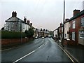
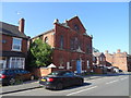
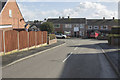
DE11 0TZ is a small, tightly knit residential postcode in South Derbyshire, England, encompassing parts of the villages of Newhall and Stanton. With a population of 1,642 spread across 1.4 hectares, it is a compact area characterised by a mix of historical and modern living. Situated between Swadlincote and Burton upon Trent, it lies near key roads such as the A444 and A511, offering proximity to regional transport networks. The area’s roots trace back to 18th-century industrialisation, when coal and clay extraction shaped its development. Today, it retains a quiet, rural charm, with listed buildings, a war memorial, and churches like St John’s Anglican Church adding to its heritage. Daily life here balances small-town convenience with access to nearby towns, making it appealing for those seeking a peaceful yet connected lifestyle. The low population density of 343 people per square kilometre ensures a sense of space, while the area’s history as a former industrial hub hints at a community with a strong sense of place and continuity.
- Area Type
- Postcode
- Area Size
- 1.4 hectares
- Population
- 1642
- Population Density
- 343 people/km²
DE11 0TZ is a predominantly owner-occupied area, with 76% of homes owned by residents rather than rented. The accommodation type is primarily houses, which contrasts with areas where flats or apartments dominate. This suggests a housing stock that caters to families and individuals seeking more space and privacy. Given the small size of the postcode area—just 1.4 hectares—the number of properties is limited, meaning the market is likely to be tight and competitive. Buyers should consider the proximity to nearby towns such as Swadlincote and Midway, which may offer additional housing options. The high home ownership rate also indicates a stable market with fewer rental properties, which could be advantageous for those seeking long-term investment or a place to settle. However, the limited scale of the area means that property choices are constrained, requiring buyers to look beyond the immediate postcode for more options.
House Prices in DE11 0TZ
Showing 42 properties
| Address | Type | Beds | Baths | Last Sale Price | Last Sale Date | |
|---|---|---|---|---|---|---|
| 8 The Leys, Newhall, Swadlincote, DE11 0TZ | Semi-detached | 3 | 2 | £220,000 | Feb 2024 | |
| 22 The Leys, Newhall, Swadlincote, DE11 0TZ | Semi-detached | 3 | 2 | £157,500 | Dec 2020 | |
| 31 The Leys, Newhall, Swadlincote, DE11 0TZ | Detached | 4 | 2 | £65,000 | Oct 2018 | |
| 38 The Leys, Newhall, Swadlincote, DE11 0TZ | Semi-detached | 3 | 1 | £138,000 | Sep 2018 | |
| 35 The Leys, Newhall, Swadlincote, DE11 0TZ | Semi-detached | 3 | 1 | £158,000 | Jul 2018 | |
| 14 The Leys, Newhall, Swadlincote, DE11 0TZ | house | 3 | 1 | £138,000 | Jul 2018 | |
| 51 The Leys, Newhall, Swadlincote, DE11 0TZ | Detached | 3 | 1 | £160,000 | May 2018 | |
| 24 The Leys, Newhall, Swadlincote, DE11 0TZ | Semi-detached | 3 | 1 | £128,000 | Feb 2018 | |
| 10 The Leys, Newhall, Swadlincote, DE11 0TZ | house | 3 | 1 | £129,000 | Oct 2017 | |
| 49 The Leys, Newhall, Swadlincote, DE11 0TZ | Semi-detached | 3 | 1 | £131,000 | Apr 2017 |
Energy Efficiency in DE11 0TZ
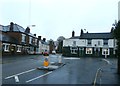
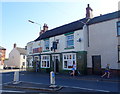
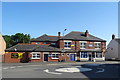
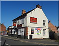
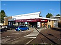
The lifestyle in DE11 0TZ is shaped by its small-town character and proximity to nearby towns. Retail options include Sainsburys Newhall, Tesco Swadlincote, and Sainsburys Swadlincote, providing essential shopping within easy reach. The area’s historical significance is reflected in landmarks such as St John’s Anglican Church, Stanton Methodist Church, and Newhall Park’s war memorial, which add cultural and historical depth to daily life. Parks and open spaces, while not explicitly detailed in the data, are likely present given the rural setting. The presence of listed buildings and traditional features, such as a bottle-shaped kiln in Swadlincote, suggests a community that values heritage. For leisure, nearby towns offer more extensive facilities, but within DE11 0TZ, the focus is on local convenience, with a quiet, low-traffic environment that supports a relaxed pace of life.
Amenities
Schools
Residents of DE11 0TZ have access to a range of primary schools, including Newhall Community Junior School and Stanton Primary School, which holds a ‘good’ Ofsted rating. The latter’s positive assessment suggests a school that delivers consistent educational standards, which is reassuring for families. Newhall Junior School, an academy, offers an alternative educational model, often characterised by autonomy in curriculum design and governance. The mix of school types provides parents with choices, whether they prioritise traditional state education or the flexibility of an academy. For primary education, these schools are within practical reach, reducing the need for long commutes. However, the absence of secondary schools in the immediate area means families may need to look to nearby towns like Burton upon Trent or Swadlincote for secondary education. This dynamic reflects a community where local schooling is strong but not comprehensive, necessitating regional planning for older children.
| Rank | School | Type | Entry gender | Ages |
|---|
Explore more schools in this area
Go to Schools tabDemographics
The population of DE11 0TZ is predominantly middle-aged, with a median age of 47 and the most common age range being adults aged 30–64. This suggests a community with a significant proportion of families and working-age individuals. Home ownership is high, at 76%, reflecting a stable, long-term resident base. The area is primarily composed of houses rather than flats or apartments, indicating a preference for traditional, family-friendly housing. The predominant ethnic group is White, which aligns with broader trends in the region. The population density of 343 people per square kilometre is moderate, suggesting a balance between residential space and community interaction. This demographic profile implies a neighbourhood where local amenities and services are likely to be well-matched to the needs of residents, with a focus on family-oriented living and established community networks.
Household Size
Accommodation Type
Tenure
Ethnic Group
Religion
Household Composition
Age
Household Deprivation
NS-SEC
Explore more demographic insights in this area
Go to Demographics tabPlanning
Planning Constraints
- Flood RiskPremium
- Ramsar Wetland SitesPremium
- Area of Outstanding Natural BeautyPremium
- Protected Nature ReservePremium
- Protected WoodlandPremium