Area Overview for DE11 0SR
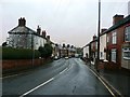
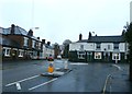
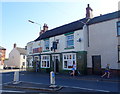
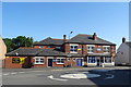
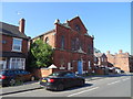
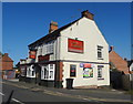
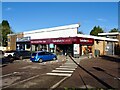
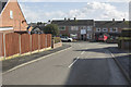
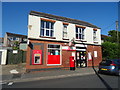
Photos of DE11 0SR


Area Information
DE11 0SR is a small residential postcode area nestled in the South Derbyshire district, encompassing parts of the villages of Newhall and Stanton. With a population of 1,361 spread across just 1.4 hectares, it is a compact, tightly knit community. The area lies between Swadlincote to the south and Burton upon Trent to the west, near key roads such as the A444 and A511. Historically, Newhall was the calculated centre of population for Great Britain in 1971, reflecting its long-standing role as a local hub. Today, the area retains a mix of rural charm and practical connectivity, with nearby towns and motorways offering easy access to larger cities. Residents benefit from proximity to the A444 and A511, which link to the M42 and A38, facilitating travel to Nottingham, Birmingham, and Derby. The ward’s population density of 96,473 people per square kilometre highlights its small, closely spaced nature, ideal for those seeking a quiet, community-focused lifestyle without sacrificing accessibility.
- Area Type
- Postcode
- Area Size
- 1.4 hectares
- Population
- 1361
- Population Density
- 1863 people/km²
The property market in DE11 0SR is characterised by a high rate of home ownership (65%) and a focus on houses as the primary accommodation type. This suggests a predominantly owner-occupied area with a mix of family homes and smaller residences. Given the postcode’s small size—just 1.4 hectares—the housing stock is limited, meaning buyers may need to consider nearby areas for more options. The presence of houses rather than flats or apartments indicates a preference for private, standalone properties, which may appeal to those seeking space and privacy. However, the compact nature of the area means property availability is constrained, potentially driving competition among buyers. For those prioritising proximity to local amenities and transport links, DE11 0SR offers a blend of residential comfort and practicality, though expansion beyond the immediate vicinity may be necessary for larger property searches.
House Prices in DE11 0SR
Showing 46 properties
| Address | Type | Beds | Baths | Last Sale Price | Last Sale Date | |
|---|---|---|---|---|---|---|
| 68 John Street, Newhall, Swadlincote, DE11 0SR | Semi-detached | 2 | 1 | £174,950 | Oct 2022 | |
| 32 John Street, Newhall, Swadlincote, DE11 0SR | Retail | 3 | 1 | £177,500 | Oct 2022 | |
| 15 John Street, Newhall, Swadlincote, DE11 0SR | Terraced | 2 | 1 | £102,000 | Jun 2022 | |
| 54 John Street, Newhall, Swadlincote, DE11 0SR | Terraced | 2 | 1 | £109,000 | Jun 2022 | |
| 52 John Street, Newhall, Swadlincote, DE11 0SR | Retail | 2 | 1 | £121,000 | Dec 2021 | |
| 22 John Street, Newhall, Swadlincote, DE11 0SR | Semi-detached | 2 | 1 | £125,000 | Aug 2020 | |
| 34 John Street, Newhall, Swadlincote, DE11 0SR | Semi-detached | 3 | 1 | £159,950 | Aug 2020 | |
| 44 John Street, Newhall, Swadlincote, DE11 0SR | Maisonette | - | - | £110,000 | Sep 2019 | |
| 62 John Street, Newhall, Swadlincote, DE11 0SR | Terraced | 2 | 1 | £105,000 | Feb 2019 | |
| 36 John Street, Newhall, Swadlincote, DE11 0SR | Semi-detached | 3 | 1 | £145,000 | Jan 2018 |
Energy Efficiency in DE11 0SR
Daily life in DE11 0SR is shaped by its proximity to essential amenities and a small-town character. Within practical reach are five retail outlets, including Sainsburys Newhall, Sainsburys Swadlincote, and Tesco Swadlincote, providing access to groceries, household goods, and other necessities. The area’s rail links to Burton upon Trent and Willington stations offer connections to nearby towns and cities, while the A444 and A511 roads facilitate travel to larger centres. Local landmarks include St John’s Anglican Church and Stanton Methodist Church, contributing to the area’s community identity. The compact size of the postcode means amenities are closely clustered, fostering a convenient, walkable environment. However, the absence of detailed data on dining or leisure options leaves some aspects of the lifestyle unexplored.
Amenities
Schools
The nearest school to DE11 0SR is Fairmeadows Foundation Primary School, which serves the area with a good Ofsted rating. This primary school is a key local institution, providing education for younger children. However, the absence of secondary schools in the immediate vicinity means families may need to look further afield for secondary education. The presence of a single primary school with a strong rating suggests a focus on early education, but parents should consider the availability of secondary options when planning long-term. The school’s good rating indicates a reliable standard of teaching, though the lack of data on other educational institutions leaves gaps in understanding the full range of schooling opportunities.
| Rank | School | Type | Entry gender | Ages |
|---|
Explore more schools in this area
Go to Schools tabDemographics
The community in DE11 0SR is predominantly composed of adults aged 30–64, with a median age of 47. This suggests a mature population, likely with established careers and families. Home ownership is high, with 65% of residents owning their homes, and the primary accommodation type is houses, indicating a mix of family homes and smaller residences. The predominant ethnic group is White, reflecting the area’s historical and cultural continuity. While specific data on deprivation is not provided, the high home ownership rate and stable age profile suggest a relatively stable economic environment. However, the absence of detailed diversity metrics means the community’s full demographic complexity remains unexplored. The age range also implies a potential need for local services tailored to middle-aged residents, such as healthcare and retirement planning.
Household Size
Accommodation Type
Tenure
Ethnic Group
Religion
Household Composition
Age
Household Deprivation
NS-SEC
Explore more demographic insights in this area
Go to Demographics tabPlanning
Planning Constraints
- Flood RiskPremium
- Ramsar Wetland SitesPremium
- Area of Outstanding Natural BeautyPremium
- Protected Nature ReservePremium
- Protected WoodlandPremium