Area Overview for DE11 0SN
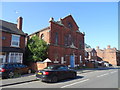
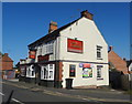
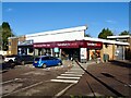
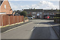
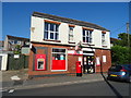
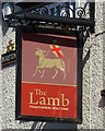
Photos of DE11 0SN


Area Information
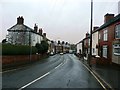
Living in DE11 0SN means being part of a tightly knit residential cluster in the heart of Newhall and Stanton, a village in South Derbyshire. The area covers just 1.4 hectares, housing 1,361 people in a population density of 93,918 per square kilometre, reflecting its small, compact nature. Situated between Swadlincote and Burton upon Trent, it lies near key roads like the A444 and A511, with easy access to the M42 motorway. The community here is predominantly middle-aged, with a median age of 47, and 65% of residents owning their homes. The area’s history is rooted in 18th-century industrial activity, but today it offers a quiet, village-centric lifestyle. Residents benefit from nearby amenities, including retail outlets, rail links, and a primary school with a good Ofsted rating. While the population is small, the area’s connectivity to larger towns ensures access to services and employment opportunities. For those seeking a balance between rural charm and urban convenience, DE11 0SN provides a distinct microcosm of Derbyshire’s character.
- Area Type
- Postcode
- Area Size
- 1.4 hectares
- Population
- 1361
- Population Density
- 1863 people/km²
The property market in DE11 0SN is characterised by a high rate of home ownership (65%) and a predominance of houses. This suggests a community of established residents rather than a rental-focused area. The small size of the postcode (1.4 hectares) means the housing stock is limited, likely concentrated in the village core. Buyers should consider the surrounding areas, such as Swadlincote and Burton upon Trent, for more extensive property options. The high home ownership rate indicates strong local attachment, but the small area size may limit availability. For those seeking a house in DE11 0SN, the market is likely competitive, with properties reflecting the village’s character. However, the absence of data on property prices or recent transactions means buyers must rely on local agents for up-to-date insights.
House Prices in DE11 0SN
Showing 52 properties
| Address | Type | Beds | Baths | Last Sale Price | Last Sale Date | |
|---|---|---|---|---|---|---|
| 167 Oversetts Road, Newhall, Swadlincote, DE11 0SN | Terraced | 2 | 3 | £70,500 | Jul 2024 | |
| 154 Oversetts Road, Newhall, Swadlincote, DE11 0SN | Bungalow | 2 | 2 | £180,000 | Jun 2024 | |
| 113 Oversetts Road, Newhall, Swadlincote, DE11 0SN | Terraced | 2 | 1 | £100,000 | Jun 2024 | |
| 132 Oversetts Road, Newhall, Swadlincote, DE11 0SN | Terraced | 2 | 1 | £117,500 | Oct 2023 | |
| 117 Oversetts Road, Newhall, Swadlincote, DE11 0SN | Terraced | 2 | 1 | £73,000 | Aug 2023 | |
| 128 Oversetts Road, Newhall, Swadlincote, DE11 0SN | Terraced | 2 | 1 | £104,000 | Apr 2023 | |
| 169 Oversetts Road, Newhall, Swadlincote, DE11 0SN | Terraced | 2 | 1 | £100,000 | Sep 2022 | |
| 129 Oversetts Road, Newhall, Swadlincote, DE11 0SN | Detached | 2 | 2 | £200,000 | Aug 2022 | |
| 121 Oversetts Road, Newhall, Swadlincote, DE11 0SN | house | 2 | 1 | £86,000 | Jan 2022 | |
| 131 Oversetts Road, Newhall, Swadlincote, DE11 0SN | house | - | - | £205,000 | Nov 2021 |
Energy Efficiency in DE11 0SN
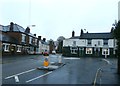
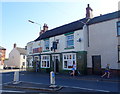
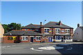
Residents of DE11 0SN have access to a modest but functional range of amenities within practical reach. Five retail outlets, including Sainsburys Newhall and Tesco Swadlincote, provide essential shopping options, while two railway stations—Burton and Willington—offer links to nearby towns. The area’s small village character is complemented by nearby attractions such as St John’s Anglican Church and Newhall Park, which features a composite war memorial. Although the postcode itself lacks large-scale leisure facilities, its proximity to Burton upon Trent and Swadlincote opens up opportunities for dining, entertainment, and cultural activities. The combination of local shops, transport links, and historical sites creates a lifestyle that blends rural tranquillity with urban accessibility, ideal for those seeking convenience without sacrificing community charm.
Amenities
Schools
The nearest school to DE11 0SN is Fairmeadows Foundation Primary School, which holds a ‘good’ Ofsted rating. This school serves the primary education needs of the area, though no secondary schools are listed in the data. Families with children will need to consider commuting to nearby towns like Swadlincote or Burton upon Trent for secondary education. The presence of a well-rated primary school is a positive factor for buyers prioritising family-friendly amenities. However, the limited range of schools within the postcode means parents should investigate further for secondary options. The single school in the area reflects the small scale of the community, which may appeal to those seeking a close-knit environment but requires planning for broader educational needs.
| Rank | School | Type | Entry gender | Ages |
|---|
Explore more schools in this area
Go to Schools tabDemographics
The community in DE11 0SN is predominantly composed of adults aged 30–64, with a median age of 47. This suggests a stable population with a strong presence of middle-aged residents, likely including families and professionals. Home ownership is high at 65%, indicating a community of long-term residents rather than a transient rental market. The area is primarily composed of houses, which aligns with the demographic profile of established households. The predominant ethnic group is White, with no specific data on other ethnicities provided. The age distribution and home ownership rates imply a mature, settled community with limited generational turnover. However, the lack of data on deprivation or younger age groups means the area’s diversity and vibrancy are not fully quantified. For buyers, this suggests a focus on stability and long-term residency rather than rapid change or investment in rental properties.
Household Size
Accommodation Type
Tenure
Ethnic Group
Religion
Household Composition
Age
Household Deprivation
NS-SEC
Explore more demographic insights in this area
Go to Demographics tabPlanning
Planning Constraints
- Flood RiskPremium
- Ramsar Wetland SitesPremium
- Area of Outstanding Natural BeautyPremium
- Protected Nature ReservePremium
- Protected WoodlandPremium