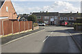
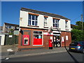
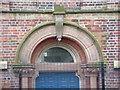
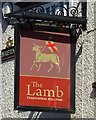
Area Overview for DE11 0RY
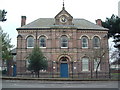
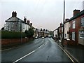
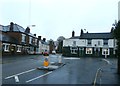
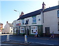
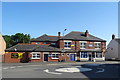
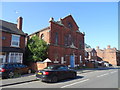
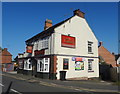
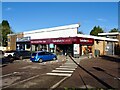
Photos of DE11 0RY
Area Information
Living in DE11 0RY means being part of a tightly knit, small-scale residential cluster in South Derbyshire. The area covers just 1.7 hectares, housing 1,258 people in a densely populated setting. This postcode lies between Swadlincote to the south and Burton upon Trent to the west, with the A444 and A511 roads forming its boundaries. Historically, the region was shaped by 18th-century coal and clay industries, though today it retains a quiet, rural character with pockets of industrial heritage. The ward of Newhall and Stanton, which includes this postcode, has a population of around 6,963, according to the 2001 census, though the precise figure for DE11 0RY is smaller. Residents benefit from proximity to nearby towns, with Burton upon Trent’s railway station about 5 miles away. The area’s compact size means amenities and services are within practical reach, though its small footprint also means it is a distinct, self-contained community.
- Area Type
- Postcode
- Area Size
- 1.7 hectares
- Population
- 1258
- Population Density
- 3562 people/km²
The property market in DE11 0RY is dominated by owner-occupied homes, with 76% of properties in private hands. This high home ownership rate suggests a stable, long-term resident base rather than a transient rental market. The accommodation type is primarily houses, which is unusual for a small postcode area but aligns with the broader ward of Newhall and Stanton, where residential development is focused on single-family homes. Given the area’s compact size and high population density, property availability is likely limited, with most homes being established rather than newly built. Buyers should consider that the small footprint of DE11 0RY means the housing stock is concentrated, and proximity to nearby towns like Swadlincote and Burton upon Trent may be key for those seeking more space or alternative amenities. The mix of historical and modern housing, combined with the area’s connectivity to major roads, makes it appealing to those prioritising convenience and a settled lifestyle.
House Prices in DE11 0RY
Showing 43 properties
| Address | Type | Beds | Baths | Last Sale Price | Last Sale Date | |
|---|---|---|---|---|---|---|
| 13 Renshaw Drive, Newhall, Swadlincote, DE11 0RY | Semi-detached | 3 | 1 | £200,000 | Jun 2025 | |
| 28 Renshaw Drive, Newhall, Swadlincote, DE11 0RY | Semi-detached | 3 | 1 | £190,000 | Feb 2025 | |
| 27 Renshaw Drive, Newhall, Swadlincote, DE11 0RY | Semi-detached | 3 | 1 | £167,500 | Jul 2024 | |
| 7 Renshaw Drive, Newhall, Swadlincote, DE11 0RY | Bungalow | 2 | 1 | £197,500 | Aug 2023 | |
| 12 Renshaw Drive, Newhall, Swadlincote, DE11 0RY | Bungalow | 2 | 2 | £200,000 | Jun 2022 | |
| 21 Renshaw Drive, Newhall, Swadlincote, DE11 0RY | Semi-detached | 3 | 1 | £170,000 | May 2022 | |
| 18A Renshaw Drive, Newhall, Swadlincote, DE11 0RY | Detached | 6 | 4 | £350,000 | Mar 2021 | |
| 14 Renshaw Drive, Newhall, Swadlincote, DE11 0RY | Terraced | 3 | 1 | £145,000 | Aug 2020 | |
| 19 Renshaw Drive, Newhall, Swadlincote, DE11 0RY | house | - | - | £70,000 | May 2019 | |
| 22 Renshaw Drive, Newhall, Swadlincote, DE11 0RY | Terraced | 3 | 1 | £127,500 | Feb 2018 |
Energy Efficiency in DE11 0RY
Residents of DE11 0RY have access to a range of nearby amenities within practical reach. Retail options include Sainsburys Newhall, Sainsburys Swadlincote, and Tesco Swadlincote, providing essential shopping and grocery needs. The area’s proximity to the A444 and A511 roads ensures easy access to larger towns, where more diverse amenities can be found. For transport, Burton upon Trent’s railway station is about 5 miles away, offering connections to regional destinations. The area also benefits from historical and cultural sites, such as St John’s Anglican Church and the composite war memorial in Newhall Park, which add to its local character. While the data does not mention parks or leisure facilities directly, the compact nature of the postcode suggests that daily life is centred around nearby towns and the immediate vicinity, with a balance of practicality and small-community charm.
Amenities
Schools
| Rank | School | Type | Entry gender | Ages |
|---|
Explore more schools in this area
Go to Schools tabDemographics
The population of DE11 0RY is predominantly adults aged 30–64, with a median age of 47. This suggests a mature, settled community, likely with families and professionals. Home ownership is high at 76%, indicating a strong presence of long-term residents. The accommodation type is primarily houses, which aligns with the area’s residential character. The predominant ethnic group is White, reflecting the broader demographic trends in South Derbyshire. The high population density—75,651 people per square kilometre—suggests a compact, closely packed living environment. While no specific deprivation data is provided, the high home ownership rate and stable age profile imply a relatively secure economic base. However, the medium crime risk score of 56 (out of 100) indicates that residents should maintain standard security precautions. This demographic profile paints a picture of a community that values stability, with a focus on family-oriented living and long-term residency.
Household Size
Accommodation Type
Tenure
Ethnic Group
Religion
Household Composition
Age
Household Deprivation
NS-SEC
Explore more demographic insights in this area
Go to Demographics tabPlanning
Planning Constraints
- Flood RiskPremium
- Ramsar Wetland SitesPremium
- Area of Outstanding Natural BeautyPremium
- Protected Nature ReservePremium
- Protected WoodlandPremium