Area Overview for DE11 0YB
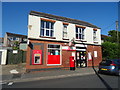
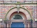
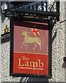
Photos of DE11 0YB
Area Information
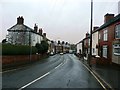
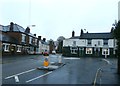
Living in DE11 0YB means inhabiting a small, defined postcode area in South Derbyshire, England, where residential life is shaped by its compact size and proximity to nearby towns. The area covers 1,080 square metres and is home to 1,642 residents, creating a tight-knit community feel. Situated between Swadlincote to the south and Burton upon Trent to the west, it is served by key roads like the A444 and A511, linking it to regional transport networks. Historically, the area was rural until 18th-century industrialisation brought collieries and brickworks, though today it is a quiet residential cluster. The ward’s population grew slightly after 2001, reflecting its enduring appeal. Residents benefit from a mix of local amenities, including schools, retail outlets, and rail connections, while the area’s low crime rate and minimal environmental constraints make it a practical choice for those seeking a balanced lifestyle.
- Area Type
- Postcode
- Area Size
- 1080 m²
- Population
- 1642
- Population Density
- 343 people/km²
The property market in DE11 0YB is characterised by high home ownership (76%) and a focus on houses rather than flats, indicating a market skewed towards owner-occupation rather than rental. This suggests that the area is more likely to appeal to families or individuals seeking long-term stability rather than short-term tenancies. The predominance of houses implies a mix of semi-detached and detached properties, which are typical in smaller rural or semi-urban settings. Given the area’s compact size, the housing stock is limited, which could make it a competitive market for buyers. However, the lack of significant planning constraints, such as protected landscapes or flood risks, may make it an attractive option for those prioritising practicality over scenic or historical features.
House Prices in DE11 0YB
Showing 3 properties
| Address | Type | Beds | Baths | Last Sale Price | Last Sale Date | |
|---|---|---|---|---|---|---|
| 2 Portchester Leys, Newhall, Swadlincote, DE11 0YB | Detached | 3 | 1 | - | - | |
| 3 Portchester Leys, Newhall, Swadlincote, DE11 0YB | Detached | 3 | 1 | - | - | |
| 1 Portchester Leys, Newhall, Swadlincote, DE11 0YB | Detached | 3 | 1 | - | - |
Energy Efficiency in DE11 0YB
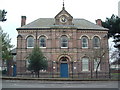
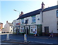
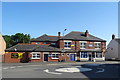
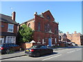
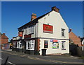
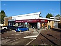
Daily life in DE11 0YB is shaped by its proximity to local amenities and historical features. Residents have access to five retail outlets, including Sainsburys Newhall and Tesco Swadlincote, ensuring convenience for shopping. The area’s rail links, including Burton and Willington stations, provide easy access to nearby towns. Parks and open spaces are present, such as Newhall Park, which hosts a war memorial, offering both recreational value and historical interest. The ward also includes listed buildings and churches, like St John’s Anglican Church, adding to its character. These amenities create a balance between practicality and heritage, supporting a lifestyle that combines modern convenience with a sense of place.
Amenities
Schools
Residents of DE11 0YB have access to a range of educational institutions. Newhall Community Junior School is a primary school serving the area, while Stanton Primary School, also a primary, holds a ‘good’ Ofsted rating, indicating a reliable standard of education. Newhall Junior School is an academy, offering a different governance model that may appeal to parents seeking alternative educational approaches. The mix of school types provides families with choices, from traditional state schools to academies with potentially distinct curricula. These schools are all within practical reach, supporting the area’s reputation as a family-friendly location. The presence of multiple primary schools suggests a well-established educational infrastructure catering to local children.
| Rank | School | Type | Entry gender | Ages |
|---|
Explore more schools in this area
Go to Schools tabDemographics
The population of DE11 0YB has a median age of 47, with the majority of residents falling in the 30-64 age range. This suggests a mature, established community, likely with a strong presence of families and long-term residents. Home ownership is high, at 76%, indicating a stable housing market and a preference for owning property. The area is predominantly composed of houses rather than flats, reflecting a suburban or semi-rural character. The predominant ethnic group is White, which aligns with broader trends in the region. With a population density of 343 people per square kilometre, the area balances residential density with space, offering a quieter alternative to larger towns. The demographic profile suggests a community focused on stability, with fewer transient populations compared to urban areas.
Household Size
Accommodation Type
Tenure
Ethnic Group
Religion
Household Composition
Age
Household Deprivation
NS-SEC
Explore more demographic insights in this area
Go to Demographics tabPlanning
Planning Constraints
- Flood RiskPremium
- Ramsar Wetland SitesPremium
- Area of Outstanding Natural BeautyPremium
- Protected Nature ReservePremium
- Protected WoodlandPremium