Area Overview for DE11 0TP
Photos of DE11 0TP

Area Information
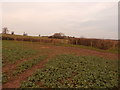
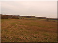
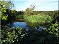
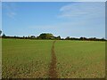
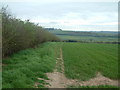
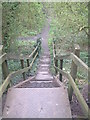
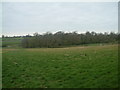
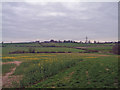
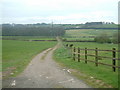
Living in DE11 0TP means being part of a small, tightly knit residential cluster in the heart of Newhall and Stanton, a ward in South Derbyshire. This postcode covers 35.7 hectares, home to 1,642 people, creating a close-knit community with a distinct character. Historically shaped by 18th-century coal and clay industries, the area has evolved into a quiet residential hub between Swadlincote and Burton upon Trent. The median age of 47 reflects a mature population, with many residents in their 30s to 60s, suggesting a stable, established community. The area’s proximity to major roads like the A444 and A511, along with connections to the M42 and A38, ensures easy access to nearby towns. With 76% of homes owned by residents, DE11 0TP is a place where people live long-term, often in traditional houses. The village of Newhall, with its historic war memorial and listed buildings, adds a layer of heritage to daily life, while local amenities and transport links provide practical convenience for residents.
- Area Type
- Postcode
- Area Size
- 35.7 hectares
- Population
- 1642
- Population Density
- 343 people/km²
DE11 0TP is predominantly an owner-occupied area, with 76% of homes owned by residents rather than rented. The accommodation type is primarily houses, reflecting a residential cluster that prioritises family homes over flats or apartments. This suggests a market where properties are likely to be long-term investments, with limited turnover. The small size of the area—35.7 hectares—means the housing stock is concentrated, creating a tight local market. Buyers should consider that the area’s character is defined by its traditional housing, which may appeal to those seeking a quieter, established community. While there is no explicit data on property prices or rental demand, the high home ownership rate implies a stable market with fewer rental options. Prospective buyers should also note the proximity to major roads and transport links, which may influence property value and desirability.
House Prices in DE11 0TP
Showing 21 properties
| Address | Type | Beds | Baths | Last Sale Price | Last Sale Date | |
|---|---|---|---|---|---|---|
| 63 Main Street, Newhall, Swadlincote, DE11 0TP | Terraced | 2 | 1 | £86,000 | May 2025 | |
| 65 Main Street, Newhall, Swadlincote, DE11 0TP | Terraced | 2 | - | £132,500 | Jul 2022 | |
| 89 Main Street, Newhall, Swadlincote, DE11 0TP | house | - | - | £119,000 | Mar 2021 | |
| 91 Main Street, Newhall, Swadlincote, DE11 0TP | Semi-detached | 4 | 2 | £166,500 | Dec 2020 | |
| 73 Main Street, Newhall, Swadlincote, DE11 0TP | Detached | 4 | 1 | £190,000 | Jan 2019 | |
| 75 Main Street, Newhall, Swadlincote, DE11 0TP | Detached | 3 | 1 | £150,000 | May 2017 | |
| 84 Main Street, Newhall, Swadlincote, DE11 0TP | Semi-detached | 3 | 1 | £120,000 | May 2017 | |
| 81 Main Street, Newhall, Swadlincote, DE11 0TP | house | - | - | £200,000 | Apr 2016 | |
| Lyndhurst, Main Street, Newhall, Swadlincote, DE11 0TP | house | - | - | £85,000 | Jul 2011 | |
| 67 Main Street, Newhall, Swadlincote, DE11 0TP | Terraced | 2 | 1 | £105,000 | Dec 2007 |
Energy Efficiency in DE11 0TP
Daily life in DE11 0TP is supported by nearby amenities, including five retail venues such as Sainsburys Newhall, Tesco Stapenhill, and Spar Platinum. These shops provide essentials, reducing the need for long trips to larger towns. The area’s proximity to the A444 and A511 roads, along with connections to the M42, ensures easy access to Burton upon Trent and Swadlincote for additional shopping, dining, and leisure. Local landmarks like St John’s Anglican Church and Newhall Park add character, while the ward’s listed buildings and war memorial reflect its history. The blend of practical retail options and historical sites creates a lifestyle that balances convenience with a sense of place. For those who enjoy a mix of rural charm and accessible services, DE11 0TP offers a compact, well-connected environment.
Amenities
Schools
The schools near DE11 0TP include Newhall Community Junior School and Stanton Primary School, both offering primary education. Stanton Primary School holds an Ofsted rating of ‘good’, indicating a reliable standard of teaching and facilities. Newhall Junior School is an academy, which may offer specialised curricula or governance structures. The presence of two primary schools provides families with options for early education, though no secondary schools are listed in the data. This mix of school types suggests a focus on foundational education, with academies potentially offering distinct approaches. Families with children may need to consider nearby towns for secondary schooling, but the local primary options are sufficient for younger children. The ‘good’ rating at Stanton Primary adds reassurance for parents seeking quality education within the area.
| Rank | School | Type | Entry gender | Ages |
|---|
Explore more schools in this area
Go to Schools tabDemographics
The population of DE11 0TP is 1,642 people, with a median age of 47, indicating a mature demographic. Over 70% of residents are adults aged 30–64, suggesting a stable, working-age population. Home ownership is high at 76%, with the majority of properties being houses rather than flats or apartments. The predominant ethnic group is White, reflecting the area’s historical roots and limited recent demographic shifts. This composition points to a community with strong local ties, where many residents have lived for years. The absence of specific deprivation data means the area’s quality of life is likely tied to its established infrastructure and services. With no mention of significant social or economic challenges in the data, DE11 0TP appears to be a place where residents value stability and long-term residency.
Household Size
Accommodation Type
Tenure
Ethnic Group
Religion
Household Composition
Age
Household Deprivation
NS-SEC
Explore more demographic insights in this area
Go to Demographics tabPlanning
Planning Constraints
- Flood RiskPremium
- Ramsar Wetland SitesPremium
- Area of Outstanding Natural BeautyPremium
- Protected Nature ReservePremium
- Protected WoodlandPremium