Area Overview for NP19 7AU
Photos of NP19 7AU


Area Information
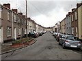
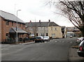
Living in NP19 7AU defines a life within a very specific and compact postcode cluster situated in Wales. This area covers 4929 square metres and supports a population of 1853 people. The result is a highly concentrated residential environment where neighbours are inevitably close. Residents navigate a small footprint with high population density, creating an immediate sense of local belonging. When you explore homes in NP19 7AU, you enter a neighbourhood where the scale of daily commutes is measured in short distances rather than long travels. The character of this postcode is shaped by its residents rather than grand infrastructure. It is a place where the community interacts daily because the physical boundaries are naturally tight. Buyers considering this location should understand that they are purchasing a stake in a defined pocket of the wider Newport region. The area does not offer the sprawling landscapes found elsewhere but provides a focused living experience. Every household shares the same local parks and footpaths because the space is simply limited. Daily life revolves around this core cluster, making even the nearest shops feel exceptionally close.
- Area Type
- Postcode
- Area Size
- 4929 m²
- Population
- 1853
- Population Density
- 4504 people/km²
Homes in NP19 7AU are primarily houses due to the specific nature of the accommodation type recorded in the data. With a 56% home ownership rate, the market is firmly established rather than driven by short-term rentals. This statistic implies that most properties have been owned by families or individuals for extended periods. Buyers looking at this small area can expect to encounter single-family homes rather than apartments or converted flats. The housing stock reflects the preferences of the area's core demographic, which skews towards younger adults and mature professionals. When you view a property in NP19 7AU, you are likely seeing a standing house with a settled history. The lack of flat listings aligns with the high percentage of people who buy into the area rather than rent. This creates a consistent market where fences and driveways define property boundaries. There is little churn in terms of residential types, ensuring that the streets retain their original character. Investment buyers might find stability here because the market does not fluctuate wildly between rentals and sales. The focus remains on owner-occupied homes within the immediate surroundings.
House Prices in NP19 7AU
Showing 24 properties
| Address | Type | Beds | Baths | Last Sale Price | Last Sale Date | |
|---|---|---|---|---|---|---|
| 6 Clayton Street, Newport, NP19 7AU | house | - | - | £143,000 | Sep 2021 | |
| 4 Clayton Street, Newport, NP19 7AU | Terraced | - | - | £84,000 | Nov 2018 | |
| 9 Clayton Street, Newport, NP19 7AU | Terraced | 2 | 1 | £94,000 | Aug 2017 | |
| 16 CLAYTON STREET, Newport, NP19 7AU | Detached | - | - | £75,000 | Jun 2016 | |
| 11 Clayton Street, Newport, NP19 7AU | Terraced | 2 | 1 | £99,500 | Feb 2016 | |
| 10 Clayton Street, Newport, NP19 7AU | Terraced | 2 | 1 | £102,000 | Oct 2015 | |
| 5 Clayton Street, Newport, NP19 7AU | Terraced | 2 | 1 | £87,500 | Mar 2012 | |
| 14 Clayton Street, Newport, NP19 7AU | house | - | - | £90,000 | Mar 2010 | |
| 21 Clayton Street, Newport, NP19 7AU | Terraced | - | - | £45,000 | Jul 2001 | |
| 3 Clayton Street, Newport, NP19 7AU | house | - | - | £40,000 | Apr 2001 |
Energy Efficiency in NP19 7AU
Residents of NP19 7AU enjoy convenient access to a variety of retail outlets and transport hubs within practical reach. You can shop at Tesco Caerleon, Asda Casnewydd, or Spar for weekly groceries and daily essentials. These supermarkets are located near the boundary of the postcode, ensuring that shopping trips do not disrupt your morning routine. Transport links are equally accessible via key railway stations including Newport Railway Station, Pye Corner Railway Station, and Rogerstone Railway Station. Commuters can travel to London or other major cities relatively quickly due to these nearby stops. A ferry option exists through the Newport Ferry Terminal, offering holiday travel or access to the Severn Boatmen routes. Dining and leisure activities are supported by the proximity of these large retail parks and commercial zones. The landscape is flat and open, creating short walks between home and destination. You can combine a walk to the shop with a train to work in a single journey. The area balances domestic quiet with the convenience of major commercial infrastructure.
Amenities
Schools
Families living in NP19 7AU have access to Newport Nursery School, which falls under the 'other' category for school types. This establishment offers early years education for local children before they join primary schools elsewhere on the Newport Road network. While the data does not list secondary schools or standard primary institutions immediately within the immediate boarder, Newport Nursery School serves as the primary educational reference point for young families. The presence of a nursery indicates that local support structures exist for the youngest members of the household. Parents in NP19 7AU will utilise this facility for care needs while preparing older children for the wider catchment area. The mix of school types is simple because the immediate vicinity focuses on foundational care rather than formal schooling. You should plan your commute to nearby mainstream schools that lie just beyond the 4929 square metre boundary. The area provides a base for early development, with the nursery acting as the first educational stop.
| Rank | School | Type | Entry gender | Ages |
|---|
Explore more schools in this area
Go to Schools tabDemographics
The community within NP19 7AU reflects a mature demographic profile dominated by adults aged between 30 and 64 years. The median age for residents is 47 years, indicating a settled family structure or older professionals. House ownership stands at a solid 56% in this postcode, suggesting stability for the majority of households. Most residents live in houses rather than flats, fitting the older age profile of the area. The predominant ethnic group is White, which mirrors the broader local landscape. This demographic mix supports a steady demand for family-sized homes and single occupancy dwellings. Children likely play on the local grasshedges because the age group active in the community includes many young families. Older residents utilise local healthcare and leisure facilities without leaving the immediate vicinity. The area attracts people who value established routes and known neighbours over new arrivals. The high home ownership rate means second-hand houses in NP19 7AU dominate the market rather than rental properties. You will find listings that cater to owners who wish to stay or sell to like-minded buyers.
Household Size
Accommodation Type
Tenure
Ethnic Group
Religion
Household Composition
Age
Household Deprivation
NS-SEC
Explore more demographic insights in this area
Go to Demographics tabPlanning
Planning Constraints
- Flood RiskPremium
- Ramsar Wetland SitesPremium
- Area of Outstanding Natural BeautyPremium
- Protected Nature ReservePremium
- Protected WoodlandPremium
- Crime RiskPremium