Area Overview for Wales
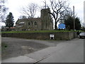
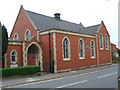
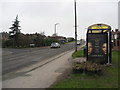
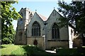
Photos of Wales


Area Information
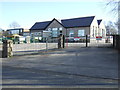
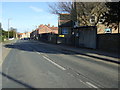
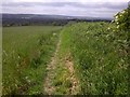
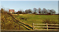
Living in Wales offers a settled lifestyle within a very small civil parish covering just 10.3 square kilometres. The area is defined by its compact size and established character, making it easy to navigate on foot or by car for daily necessities. You will find a community where stability is the norm, anchored by a high rate of long-term residency rather than transient populations. The proximity of everything matters less here because boundaries are close and distances are short. This scale suits those who prefer a quiet, manageable environment over sprawling urban landscapes. Residents benefit from a neighbourhood where local knowledge of the streets is common and the atmosphere remains consistent year round. The small footprint means that essential services are often within a brief drive, reducing the need for lengthy commutes to the wider region. For anyone considering Wales, the combination of limited space and deep community roots creates a distinct living experience that prioritises peace over pace.
- Area Type
- Parish
- Area Size
- 10.3 km²
- Population
- Not available
- Population Density
- Not available
Demographics
The community profile in Wales is unmistakably mature, with a median age of seventy years. This demographic skew indicates a population where retirees and older residents form the heart of the neighbourhood. Consequently, the daily rhythm of the area reflects the needs and habits of these age groups more than young families or recent graduates would. Across the board, there is a significant degree of stability in household composition, suggesting families and long-term couples remain settled in their abodes. Home ownership stands at seventy-one per cent, which is notably high and points to a neighbourhood where most residents own their properties outright or with a mortgage rather than renting. This high ownership rate often correlates with quieter streets and lower transient rates, as owners tend to stay put. The accommodation stock mirrors this stability, with existing homes remaining in use rather than being frequently exchanged. While specific details on ethnic diversity and religious affiliation are not detailed in available records, the overall picture is one of an older, property-owning community with deeply rooted local ties.
Household Size
Accommodation Type
Tenure
Ethnic Group
Religion
Household Composition
Age
Household Deprivation
NS-SEC
Explore more demographic insights in this area
Go to Demographics tabPlanning
Planning Constraints
- Flood RiskPremium
- Ramsar Wetland SitesPremium
- Area of Outstanding Natural BeautyPremium
- Protected Nature ReservePremium
- Crime RiskPremium