Area Overview for NP19 7AW
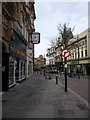
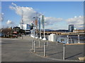
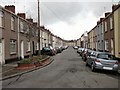
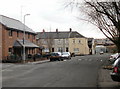
Photos of NP19 7AW


Area Information
Living in NP19 7AW offers a residential experience defined by high density within a compact footprint. This specific postcode covers a small residential cluster spanning just 5282 square metres. You will find 1853 people situated in this space, creating one of the most densely populated environments in the UK, with a figure of 350793 people per square kilometre. Although the land area is minimal, the concentration of residents suggests a tightly knit neighbourhood character. Daily life here revolves around proximity; neighbours are unavoidable, which can foster strong community bonds or generate noise concerns for those requiring quiet. The area sits in Wales, distinct from the surrounding English countryside. You benefit from immediate access to major transport hubs because the cluster is near Newport Railway Station and the ferry terminal. This location suits individuals who prioritise urban convenience over sprawling gardens. While the building volume is high, the physical environment is constrained by its tiny geographical boundary.
- Area Type
- Postcode
- Area Size
- 5282 m²
- Population
- 1853
- Population Density
- 4504 people/km²
The property market in NP19 7AW operates within a tightly bounded geographic space where homes in this postcode face different dynamics than suburban zones. The housing stock accommodates 1853 people on just 5282 square metres, indicating a predominance of flats, maisonettes, or terraced houses rather than detached homes. This density creates a competitive market where purchasing power is significant, driven by the scarcity of land. Property values here reflect the convenience of being near major rail stations and the ferry terminal. Because the area is designated as a specific postcode covering a small residential cluster, individual property boundaries are closely packed. You will find that homes in NP19 7AW lack external gardens compared to the wider Caerleon area. The market is dominated by multi-unit dwellings designed for the high population density of 350793 people per square kilometre. Buyers looking for space must look beyond this specific cluster to the surrounding neighbourhoods. The concentration of residents means maintenance costs and noise levels are inherently higher due to the proximity of neighbours.
House Prices in NP19 7AW
Showing 17 properties
| Address | Type | Beds | Baths | Last Sale Price | Last Sale Date | |
|---|---|---|---|---|---|---|
| 1 Courtney Street, Newport, NP19 7AW | Detached | 3 | 3 | £285,000 | Feb 2025 | |
| 12 Courtney Street, Newport, NP19 7AW | house | 4 | 2 | £225,000 | Oct 2023 | |
| 4 Courtney Street, Newport, NP19 7AW | Terraced | 3 | 1 | £133,500 | Aug 2023 | |
| 2 Courtney Street, Newport, NP19 7AW | Terraced | 3 | 2 | £163,000 | Jul 2023 | |
| 16 Courtney Street, Newport, NP19 7AW | Terraced | 3 | 1 | £84,950 | Jun 2015 | |
| 14 Courtney Street, Newport, NP19 7AW | house | - | - | £124,995 | Oct 2010 | |
| 7 Courtney Street, Newport, NP19 7AW | house | - | - | £97,000 | Aug 2005 | |
| 3 Courtney Street, Newport, NP19 7AW | Terraced | 4 | 2 | £85,000 | May 2002 | |
| 6 Courtney Street, Newport, NP19 7AW | Terraced | - | - | £32,000 | Jul 2000 | |
| 13 Courtney Street, Newport, NP19 7AW | house | - | - | £44,000 | Nov 1999 |
Energy Efficiency in NP19 7AW
Residents enjoy a lifestyle centred on immediate access to major commercial and transit hubs. Five retail outlets are within practical reach, including Tesco Caerleon, Asda Casnewydd, and a Spar, ensuring your daily shopping needs are met without a long drive. The presence of Asda Casnewydd and Newport Railway Station means you do not need a car for essential trips. Cultural and leisure options are anchored by the vibrant Newport Railway Station and Pye Corner Railway Station, which serve as focal points for the local economy. You can access the Newport Ferry Terminal for holiday trips or necessary crossings across the Severn Estuary. The area is technically a small residential cluster, but its amenities are substantial. Five rail stations nearby provide unparalleled flexibility for weekend travel or daily commuting. Your lifestyle includes easy access to Spar for convenience food and Tesca for weekly groceries. Despite the high population density, the existence of these major retailers means the area avoids the isolation typical of small postcode clusters. Living in NP19 7AW means your world extends as far as the train lines allow.
Amenities
Schools
For families considering this postcode, education options are the primary logistical constraint. You have access to Newport Nursery School, which serves the early years needs of young children in NP19 7AW. This institution is located nearby and supports the growing number of families residing in the dense cluster. While this school covers the younger demographic, older children require travel to other institutions not listed among the immediate amenities provided. The school type listed is "other", suggesting a non-standard classification or a specific local designation rather than a primary or secondary academy. Families must plan commutes extensively because this specific cluster offers very limited secondary education options. The single listed school indicates that most residents send their children to facilities in other postcodes. When researching schools near NP19 7AW, you must look outside the immediate 5282 square metre boundary. The availability of just one nursery facility highlights a demand for early education support in this high-population area.
| Rank | School | Type | Entry gender | Ages |
|---|
Explore more schools in this area
Go to Schools tabDemographics
Understanding the community in NP19 7AW requires looking at the specific population figures available. There are 1853 residents calling this postcode home. The household composition and ownership levels define the daily rhythm of life here. Because the area is a small residential cluster, household sizes may vary, but the sheer population density implies a high degree of social interaction. The demographic profile suggests a mix of short-term renters and long-term residents due to the limited street space. Without specific age breakdowns in the current records, the population's age profile remains undefined, though the density often attracts younger professionals or students. The accommodation stock supports this large population, indicating significant shared living spaces or high-rise developments within these few thousand square metres. You should expect a lively atmosphere where people commute to local stations rather than a quiet, rural retirement setting. The community feel is intense simply because so many people live in such a small area.
Household Size
Accommodation Type
Tenure
Ethnic Group
Religion
Household Composition
Age
Household Deprivation
NS-SEC
Explore more demographic insights in this area
Go to Demographics tabPlanning
Planning Constraints
- Flood RiskPremium
- Ramsar Wetland SitesPremium
- Area of Outstanding Natural BeautyPremium
- Protected Nature ReservePremium
- Protected WoodlandPremium
- Crime RiskPremium