Area Overview for NP19 7AY
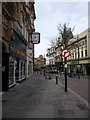
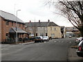
Photos of NP19 7AY


Area Information
Living in NP19 7AY defines a compact residential experience centred on a specific postcode covering a small cluster. This location encompasses just 2.5 hectares, creating an intimate setting for the 1,853 residents who call it home. You will find yourself in a densely populated spot with 73,291 people per square kilometre, a figure that is exceptionally high for Wales. The character of the area stems from its limited footprint, which concentrates the local population into a defined community hub. Daily life here involves navigating a tight-knit environment where proximity defines convenience and neighbourly interaction. While the area lacks the sprawling skyline of larger cities, its concentrated nature means services are within reach without extensive travel. Residents experience a neighbourhood scale that prioritises local connection over anonymity. The small size of the land area limits typical suburban expansion, ensuring that the layout remains consistent and familiar. You are stepping into a defined zone where every street is part of a manageable whole. This postcode represents a place where the built environment is closely tied to the high density of its inhabitants. ### The community in NP19 7AY reflects a mature demographic profile with a median age of 47 years. The most common age range consists of adults between 30 and 64 years, indicating a workforce and family population rather than young singles or seniors. Home ownership stands at 56%, meaning over half of the households own their property outright or with a mortgage. The remaining residents likely rent, though the high ownership rate suggests stability and long-term settlement. Most accommodation within this cluster consists of houses, offering a traditional residential structure suitable for families or individuals seeking space. The predominant ethnic group is White, which aligns with the broader demographic trends of the region. With 1,853 people living in such a small 2.5-hectare area, the social fabric is tightly woven. You will encounter a population that has largely grown up together or moved with clear intentions to stay. The age skew towards middle adulthood means local shops and services cater to practical needs and family life rather than nightlife or youth trends. This demographic stability supports the character of the housing stock described nearby. ### You are looking at a property market in NP19 7AY that is defined by its housing stock type and ownership structure. The area predominantly features houses, which provides a specific character distinct from apartments or terraced flats common in urban centres. With 56% home ownership, the market is heavily weighted towards owner-occupiers rather than landlords or investors. This high percentage of owners typically means a slower turnover rate compared to high-rental areas, resulting in more stable street scenes. Buyers considering homes in NP19 7AY should expect to find properties suited to the needs of adults and families, given the local age profile. The land size of just 2.5 hectares for the entire cluster means that supply is naturally limited, which can influence value and availability. You are not viewing a speculative development site but an established residential pocket. The accommodation type of houses suggests gardens and driveways are standard features, differentiating this from high-density city blocks. When assessing the property market here, factor in the implications of a stable, owner-led community on price consistency and sale velocity. ### Families seeking schools near NP19 7AY have a specific, limited option immediately to their north. Newport Nursery School is the only educational institution listed in the proximity data for this postcode. Classified under the category of 'other', it serves the early years of primary education. Because there is no data provided on secondary or older primary schools within the immediate vicinity, parents will likely need to look beyond this single facility for older children. The presence of a nursery indicates that some families reside here with young children, aligning with the adult-heavy age demographic of the area. You must plan ahead if you have school-age children, as the nearest listed education provision stops at the nursery level. The mix of school types is minimal in this specific postcode, relying heavily on Newport Nursery School for the youngest residents. For older students, the local education map extends further into the wider Newport and Caerleon areas, outside the strict bounds of this 2.5-hectare zone. ### Digital connectivity in NP19 7AY is robust, making it suitable for remote work and modern digital lifestyles. You can expect excellent quality for fixed broadband, which scores 97 out of 100 on quality indices. This performance level supports high-speed internet needs such as video conferencing, large file transfers, and multiple connected devices without interruption. Mobile coverage scores 85 out of 100, translating to good signal strength for daily use while walking, working outside, or travelling within the locality. These scores ensure that residents stay connected reliably. For a working professional living in this area, the digital infrastructure supports a seamless blend of home life and professional tasks. The high scores indicate that you do not need to worry about poor internet service affecting your routine. The combination of reliable fibre and strong mobile networks provides a solid foundation for households where digital tools are essential. This connectivity level matches the expectation for a modern residential area where isolation from the internet is not an option. ### Life in NP19 7AY offers practical convenience through a range of nearby amenities within walking or short driving distance. For your daily shopping requirements, five retail outlets are available, including major supermarkets like Tesco Caerleon and Asda Casnewydd, alongside a local Spar for quick essentials. These specific venues provide a comprehensive shopping experience without needing to travel deep into the city centre. Transport links are equally accessible, with five major rail stations nearby, including Newport Railway Station, Pye Corner Railway Station, and Rogerstone Railway Station. You can reach these stations easily to commute to Cardiff or other parts of South Wales. A ferry service is also available via the one Newport Ferry Terminal, providing alternatives for travel to Pembroke Dock or other coastal destinations. This mix of retail and transport creates a lifestyle where everyday needs are met without significant delay. You will find that the area functions well as a base for a balanced life, combining local shopping with regional transport options. The presence of these named facilities grounds the lifestyle in tangible, usable resources. ### Safety and environmental factors in NP19 7AY present a reassuring picture for potential residents. The flood risk assessment passes with a low score of 3.58 out of 100, indicating minimal threat from water events. This low level means you do not need to worry about property damage from flooding. There are no planning constraints regarding wetlands, nature reserves, or protected woodlands, as the scores for Ramsar sites, Areas of Outstanding Natural Beauty, and protected areas are all zero. This absence of designated protected land means fewer restrictions on certain development activities compared to sensitive zones. The area also avoids the constraints of protected nature reserves, ensuring a standard regulatory environment for housing. Regarding crime risk, specific data is currently not available for this location in Wales, so you must rely on broader regional trends for context. The environmental and flood safety metrics suggest a low-risk residential setting where physical safety and environmental stability are not primary concerns. ### Who typically lives in NP19 7AY?The area has a median age of 47, with the most common residents being adults aged 30 to 64 years. Over half of the population, specifically 56%, own their homes. The community is predominantly White, and the housing stock consists mainly of houses rather than flats or apartments. What kind of schools are available near NP19 7AY?There is one school listed in the immediate proximity, Newport Nursery School. It falls under the 'other' category and serves young children. Parents with older children will need to look to schools in the wider Newport or Caerleon areas, as no secondary institutions are listed for this specific postcode. How is the internet and phone coverage in this area?Digital connectivity is excellent for residents. Fixed broadband scores 97 out of 100, providing top-tier speeds for working from home or leisure. Mobile coverage is rated at 85 out of 100, offering good signal strength throughout the neighbourhood for all daily communication needs. Is NP19 7AY a safe place to live regarding environment and safety?The area passes safety assessments with flying colours. Flood risk is very low with a score of 3.58. There are no protected nature reserves, woodlands, or Areas of Outstanding Natural Beauty that would impose planning constraints. Crime risk data is not currently available specifically for this Welsh postcode, but environmental risks are minimal. What shops and transport links can I use as a resident?You have access to five retail outlets nearby, including Tesco Caerleon, Asda Casnewydd, and a Spar. Transport is well served by five railway stations such as Newport and Pye Corner, plus a ferry terminal. These amenities allow for easy shopping and commuting without the need for long-distance travel.
- Area Type
- Postcode
- Area Size
- 2.5 hectares
- Population
- 1853
- Population Density
- 4504 people/km²
You are looking at a property market in NP19 7AY that is defined by its housing stock type and ownership structure. The area predominantly features houses, which provides a specific character distinct from apartments or terraced flats common in urban centres. With 56% home ownership, the market is heavily weighted towards owner-occupiers rather than landlords or investors. This high percentage of owners typically means a slower turnover rate compared to high-rental areas, resulting in more stable street scenes. Buyers considering homes in NP19 7AY should expect to find properties suited to the needs of adults and families, given the local age profile. The land size of just 2.5 hectares for the entire cluster means that supply is naturally limited, which can influence value and availability. You are not viewing a speculative development site but an established residential pocket. The accommodation type of houses suggests gardens and driveways are standard features, differentiating this from high-density city blocks. When assessing the property market here, factor in the implications of a stable, owner-led community on price consistency and sale velocity. ### Families seeking schools near NP19 7AY have a specific, limited option immediately to their north. Newport Nursery School is the only educational institution listed in the proximity data for this postcode. Classified under the category of 'other', it serves the early years of primary education. Because there is no data provided on secondary or older primary schools within the immediate vicinity, parents will likely need to look beyond this single facility for older children. The presence of a nursery indicates that some families reside here with young children, aligning with the adult-heavy age demographic of the area. You must plan ahead if you have school-age children, as the nearest listed education provision stops at the nursery level. The mix of school types is minimal in this specific postcode, relying heavily on Newport Nursery School for the youngest residents. For older students, the local education map extends further into the wider Newport and Caerleon areas, outside the strict bounds of this 2.5-hectare zone. ### Digital connectivity in NP19 7AY is robust, making it suitable for remote work and modern digital lifestyles. You can expect excellent quality for fixed broadband, which scores 97 out of 100 on quality indices. This performance level supports high-speed internet needs such as video conferencing, large file transfers, and multiple connected devices without interruption. Mobile coverage scores 85 out of 100, translating to good signal strength for daily use while walking, working outside, or travelling within the locality. These scores ensure that residents stay connected reliably. For a working professional living in this area, the digital infrastructure supports a seamless blend of home life and professional tasks. The high scores indicate that you do not need to worry about poor internet service affecting your routine. The combination of reliable fibre and strong mobile networks provides a solid foundation for households where digital tools are essential. This connectivity level matches the expectation for a modern residential area where isolation from the internet is not an option. ### Life in NP19 7AY offers practical convenience through a range of nearby amenities within walking or short driving distance. For your daily shopping requirements, five retail outlets are available, including major supermarkets like Tesco Caerleon and Asda Casnewydd, alongside a local Spar for quick essentials. These specific venues provide a comprehensive shopping experience without needing to travel deep into the city centre. Transport links are equally accessible, with five major rail stations nearby, including Newport Railway Station, Pye Corner Railway Station, and Rogerstone Railway Station. You can reach these stations easily to commute to Cardiff or other parts of South Wales. A ferry service is also available via the one Newport Ferry Terminal, providing alternatives for travel to Pembroke Dock or other coastal destinations. This mix of retail and transport creates a lifestyle where everyday needs are met without significant delay. You will find that the area functions well as a base for a balanced life, combining local shopping with regional transport options. The presence of these named facilities grounds the lifestyle in tangible, usable resources. ### Safety and environmental factors in NP19 7AY present a reassuring picture for potential residents. The flood risk assessment passes with a low score of 3.58 out of 100, indicating minimal threat from water events. This low level means you do not need to worry about property damage from flooding. There are no planning constraints regarding wetlands, nature reserves, or protected woodlands, as the scores for Ramsar sites, Areas of Outstanding Natural Beauty, and protected areas are all zero. This absence of designated protected land means fewer restrictions on certain development activities compared to sensitive zones. The area also avoids the constraints of protected nature reserves, ensuring a standard regulatory environment for housing. Regarding crime risk, specific data is currently not available for this location in Wales, so you must rely on broader regional trends for context. The environmental and flood safety metrics suggest a low-risk residential setting where physical safety and environmental stability are not primary concerns. ### Who typically lives in NP19 7AY?The area has a median age of 47, with the most common residents being adults aged 30 to 64 years. Over half of the population, specifically 56%, own their homes. The community is predominantly White, and the housing stock consists mainly of houses rather than flats or apartments. What kind of schools are available near NP19 7AY?There is one school listed in the immediate proximity, Newport Nursery School. It falls under the 'other' category and serves young children. Parents with older children will need to look to schools in the wider Newport or Caerleon areas, as no secondary institutions are listed for this specific postcode. How is the internet and phone coverage in this area?Digital connectivity is excellent for residents. Fixed broadband scores 97 out of 100, providing top-tier speeds for working from home or leisure. Mobile coverage is rated at 85 out of 100, offering good signal strength throughout the neighbourhood for all daily communication needs. Is NP19 7AY a safe place to live regarding environment and safety?The area passes safety assessments with flying colours. Flood risk is very low with a score of 3.58. There are no protected nature reserves, woodlands, or Areas of Outstanding Natural Beauty that would impose planning constraints. Crime risk data is not currently available specifically for this Welsh postcode, but environmental risks are minimal. What shops and transport links can I use as a resident?You have access to five retail outlets nearby, including Tesco Caerleon, Asda Casnewydd, and a Spar. Transport is well served by five railway stations such as Newport and Pye Corner, plus a ferry terminal. These amenities allow for easy shopping and commuting without the need for long-distance travel.
House Prices in NP19 7AY
Showing 24 properties
| Address | Type | Beds | Baths | Last Sale Price | Last Sale Date | |
|---|---|---|---|---|---|---|
| 42 Crawford Street, Newport, NP19 7AY | Terraced | 3 | - | £105,000 | Oct 2024 | |
| 4 Crawford Street, Newport, NP19 7AY | Semi-detached | 2 | - | £167,500 | Jun 2022 | |
| 2 Crawford Street, Newport, NP19 7AY | Terraced | 3 | 1 | £158,000 | Dec 2021 | |
| 7 Crawford Street, Newport, NP19 7AY | house | - | - | £135,000 | Jan 2019 | |
| 34 Crawford Street, Newport, NP19 7AY | house | - | - | £110,000 | Jun 2016 | |
| 48 Crawford Street, Newport, NP19 7AY | house | - | - | £90,000 | Mar 2016 | |
| 11 Crawford Street, Newport, NP19 7AY | house | - | - | £87,500 | Aug 2013 | |
| 3 Crawford Street, Newport, NP19 7AY | Terraced | 3 | - | £100,000 | Sep 2007 | |
| 15 Crawford Street, Newport, NP19 7AY | Terraced | 3 | 1 | £148,000 | Sep 2006 | |
| 5 Crawford Street, Newport, NP19 7AY | Terraced | - | - | £88,950 | Dec 2003 |
Energy Efficiency in NP19 7AY
Life in NP19 7AY offers practical convenience through a range of nearby amenities within walking or short driving distance. For your daily shopping requirements, five retail outlets are available, including major supermarkets like Tesco Caerleon and Asda Casnewydd, alongside a local Spar for quick essentials. These specific venues provide a comprehensive shopping experience without needing to travel deep into the city centre. Transport links are equally accessible, with five major rail stations nearby, including Newport Railway Station, Pye Corner Railway Station, and Rogerstone Railway Station. You can reach these stations easily to commute to Cardiff or other parts of South Wales. A ferry service is also available via the one Newport Ferry Terminal, providing alternatives for travel to Pembroke Dock or other coastal destinations. This mix of retail and transport creates a lifestyle where everyday needs are met without significant delay. You will find that the area functions well as a base for a balanced life, combining local shopping with regional transport options. The presence of these named facilities grounds the lifestyle in tangible, usable resources. ### Safety and environmental factors in NP19 7AY present a reassuring picture for potential residents. The flood risk assessment passes with a low score of 3.58 out of 100, indicating minimal threat from water events. This low level means you do not need to worry about property damage from flooding. There are no planning constraints regarding wetlands, nature reserves, or protected woodlands, as the scores for Ramsar sites, Areas of Outstanding Natural Beauty, and protected areas are all zero. This absence of designated protected land means fewer restrictions on certain development activities compared to sensitive zones. The area also avoids the constraints of protected nature reserves, ensuring a standard regulatory environment for housing. Regarding crime risk, specific data is currently not available for this location in Wales, so you must rely on broader regional trends for context. The environmental and flood safety metrics suggest a low-risk residential setting where physical safety and environmental stability are not primary concerns. ### Who typically lives in NP19 7AY?The area has a median age of 47, with the most common residents being adults aged 30 to 64 years. Over half of the population, specifically 56%, own their homes. The community is predominantly White, and the housing stock consists mainly of houses rather than flats or apartments. What kind of schools are available near NP19 7AY?There is one school listed in the immediate proximity, Newport Nursery School. It falls under the 'other' category and serves young children. Parents with older children will need to look to schools in the wider Newport or Caerleon areas, as no secondary institutions are listed for this specific postcode. How is the internet and phone coverage in this area?Digital connectivity is excellent for residents. Fixed broadband scores 97 out of 100, providing top-tier speeds for working from home or leisure. Mobile coverage is rated at 85 out of 100, offering good signal strength throughout the neighbourhood for all daily communication needs. Is NP19 7AY a safe place to live regarding environment and safety?The area passes safety assessments with flying colours. Flood risk is very low with a score of 3.58. There are no protected nature reserves, woodlands, or Areas of Outstanding Natural Beauty that would impose planning constraints. Crime risk data is not currently available specifically for this Welsh postcode, but environmental risks are minimal. What shops and transport links can I use as a resident?You have access to five retail outlets nearby, including Tesco Caerleon, Asda Casnewydd, and a Spar. Transport is well served by five railway stations such as Newport and Pye Corner, plus a ferry terminal. These amenities allow for easy shopping and commuting without the need for long-distance travel.
Amenities
Schools
Families seeking schools near NP19 7AY have a specific, limited option immediately to their north. Newport Nursery School is the only educational institution listed in the proximity data for this postcode. Classified under the category of 'other', it serves the early years of primary education. Because there is no data provided on secondary or older primary schools within the immediate vicinity, parents will likely need to look beyond this single facility for older children. The presence of a nursery indicates that some families reside here with young children, aligning with the adult-heavy age demographic of the area. You must plan ahead if you have school-age children, as the nearest listed education provision stops at the nursery level. The mix of school types is minimal in this specific postcode, relying heavily on Newport Nursery School for the youngest residents. For older students, the local education map extends further into the wider Newport and Caerleon areas, outside the strict bounds of this 2.5-hectare zone. ### Digital connectivity in NP19 7AY is robust, making it suitable for remote work and modern digital lifestyles. You can expect excellent quality for fixed broadband, which scores 97 out of 100 on quality indices. This performance level supports high-speed internet needs such as video conferencing, large file transfers, and multiple connected devices without interruption. Mobile coverage scores 85 out of 100, translating to good signal strength for daily use while walking, working outside, or travelling within the locality. These scores ensure that residents stay connected reliably. For a working professional living in this area, the digital infrastructure supports a seamless blend of home life and professional tasks. The high scores indicate that you do not need to worry about poor internet service affecting your routine. The combination of reliable fibre and strong mobile networks provides a solid foundation for households where digital tools are essential. This connectivity level matches the expectation for a modern residential area where isolation from the internet is not an option. ### Life in NP19 7AY offers practical convenience through a range of nearby amenities within walking or short driving distance. For your daily shopping requirements, five retail outlets are available, including major supermarkets like Tesco Caerleon and Asda Casnewydd, alongside a local Spar for quick essentials. These specific venues provide a comprehensive shopping experience without needing to travel deep into the city centre. Transport links are equally accessible, with five major rail stations nearby, including Newport Railway Station, Pye Corner Railway Station, and Rogerstone Railway Station. You can reach these stations easily to commute to Cardiff or other parts of South Wales. A ferry service is also available via the one Newport Ferry Terminal, providing alternatives for travel to Pembroke Dock or other coastal destinations. This mix of retail and transport creates a lifestyle where everyday needs are met without significant delay. You will find that the area functions well as a base for a balanced life, combining local shopping with regional transport options. The presence of these named facilities grounds the lifestyle in tangible, usable resources. ### Safety and environmental factors in NP19 7AY present a reassuring picture for potential residents. The flood risk assessment passes with a low score of 3.58 out of 100, indicating minimal threat from water events. This low level means you do not need to worry about property damage from flooding. There are no planning constraints regarding wetlands, nature reserves, or protected woodlands, as the scores for Ramsar sites, Areas of Outstanding Natural Beauty, and protected areas are all zero. This absence of designated protected land means fewer restrictions on certain development activities compared to sensitive zones. The area also avoids the constraints of protected nature reserves, ensuring a standard regulatory environment for housing. Regarding crime risk, specific data is currently not available for this location in Wales, so you must rely on broader regional trends for context. The environmental and flood safety metrics suggest a low-risk residential setting where physical safety and environmental stability are not primary concerns. ### Who typically lives in NP19 7AY?The area has a median age of 47, with the most common residents being adults aged 30 to 64 years. Over half of the population, specifically 56%, own their homes. The community is predominantly White, and the housing stock consists mainly of houses rather than flats or apartments. What kind of schools are available near NP19 7AY?There is one school listed in the immediate proximity, Newport Nursery School. It falls under the 'other' category and serves young children. Parents with older children will need to look to schools in the wider Newport or Caerleon areas, as no secondary institutions are listed for this specific postcode. How is the internet and phone coverage in this area?Digital connectivity is excellent for residents. Fixed broadband scores 97 out of 100, providing top-tier speeds for working from home or leisure. Mobile coverage is rated at 85 out of 100, offering good signal strength throughout the neighbourhood for all daily communication needs. Is NP19 7AY a safe place to live regarding environment and safety?The area passes safety assessments with flying colours. Flood risk is very low with a score of 3.58. There are no protected nature reserves, woodlands, or Areas of Outstanding Natural Beauty that would impose planning constraints. Crime risk data is not currently available specifically for this Welsh postcode, but environmental risks are minimal. What shops and transport links can I use as a resident?You have access to five retail outlets nearby, including Tesco Caerleon, Asda Casnewydd, and a Spar. Transport is well served by five railway stations such as Newport and Pye Corner, plus a ferry terminal. These amenities allow for easy shopping and commuting without the need for long-distance travel.
| Rank | School | Type | Entry gender | Ages |
|---|
Explore more schools in this area
Go to Schools tabDemographics
The community in NP19 7AY reflects a mature demographic profile with a median age of 47 years. The most common age range consists of adults between 30 and 64 years, indicating a workforce and family population rather than young singles or seniors. Home ownership stands at 56%, meaning over half of the households own their property outright or with a mortgage. The remaining residents likely rent, though the high ownership rate suggests stability and long-term settlement. Most accommodation within this cluster consists of houses, offering a traditional residential structure suitable for families or individuals seeking space. The predominant ethnic group is White, which aligns with the broader demographic trends of the region. With 1,853 people living in such a small 2.5-hectare area, the social fabric is tightly woven. You will encounter a population that has largely grown up together or moved with clear intentions to stay. The age skew towards middle adulthood means local shops and services cater to practical needs and family life rather than nightlife or youth trends. This demographic stability supports the character of the housing stock described nearby. ### You are looking at a property market in NP19 7AY that is defined by its housing stock type and ownership structure. The area predominantly features houses, which provides a specific character distinct from apartments or terraced flats common in urban centres. With 56% home ownership, the market is heavily weighted towards owner-occupiers rather than landlords or investors. This high percentage of owners typically means a slower turnover rate compared to high-rental areas, resulting in more stable street scenes. Buyers considering homes in NP19 7AY should expect to find properties suited to the needs of adults and families, given the local age profile. The land size of just 2.5 hectares for the entire cluster means that supply is naturally limited, which can influence value and availability. You are not viewing a speculative development site but an established residential pocket. The accommodation type of houses suggests gardens and driveways are standard features, differentiating this from high-density city blocks. When assessing the property market here, factor in the implications of a stable, owner-led community on price consistency and sale velocity. ### Families seeking schools near NP19 7AY have a specific, limited option immediately to their north. Newport Nursery School is the only educational institution listed in the proximity data for this postcode. Classified under the category of 'other', it serves the early years of primary education. Because there is no data provided on secondary or older primary schools within the immediate vicinity, parents will likely need to look beyond this single facility for older children. The presence of a nursery indicates that some families reside here with young children, aligning with the adult-heavy age demographic of the area. You must plan ahead if you have school-age children, as the nearest listed education provision stops at the nursery level. The mix of school types is minimal in this specific postcode, relying heavily on Newport Nursery School for the youngest residents. For older students, the local education map extends further into the wider Newport and Caerleon areas, outside the strict bounds of this 2.5-hectare zone. ### Digital connectivity in NP19 7AY is robust, making it suitable for remote work and modern digital lifestyles. You can expect excellent quality for fixed broadband, which scores 97 out of 100 on quality indices. This performance level supports high-speed internet needs such as video conferencing, large file transfers, and multiple connected devices without interruption. Mobile coverage scores 85 out of 100, translating to good signal strength for daily use while walking, working outside, or travelling within the locality. These scores ensure that residents stay connected reliably. For a working professional living in this area, the digital infrastructure supports a seamless blend of home life and professional tasks. The high scores indicate that you do not need to worry about poor internet service affecting your routine. The combination of reliable fibre and strong mobile networks provides a solid foundation for households where digital tools are essential. This connectivity level matches the expectation for a modern residential area where isolation from the internet is not an option. ### Life in NP19 7AY offers practical convenience through a range of nearby amenities within walking or short driving distance. For your daily shopping requirements, five retail outlets are available, including major supermarkets like Tesco Caerleon and Asda Casnewydd, alongside a local Spar for quick essentials. These specific venues provide a comprehensive shopping experience without needing to travel deep into the city centre. Transport links are equally accessible, with five major rail stations nearby, including Newport Railway Station, Pye Corner Railway Station, and Rogerstone Railway Station. You can reach these stations easily to commute to Cardiff or other parts of South Wales. A ferry service is also available via the one Newport Ferry Terminal, providing alternatives for travel to Pembroke Dock or other coastal destinations. This mix of retail and transport creates a lifestyle where everyday needs are met without significant delay. You will find that the area functions well as a base for a balanced life, combining local shopping with regional transport options. The presence of these named facilities grounds the lifestyle in tangible, usable resources. ### Safety and environmental factors in NP19 7AY present a reassuring picture for potential residents. The flood risk assessment passes with a low score of 3.58 out of 100, indicating minimal threat from water events. This low level means you do not need to worry about property damage from flooding. There are no planning constraints regarding wetlands, nature reserves, or protected woodlands, as the scores for Ramsar sites, Areas of Outstanding Natural Beauty, and protected areas are all zero. This absence of designated protected land means fewer restrictions on certain development activities compared to sensitive zones. The area also avoids the constraints of protected nature reserves, ensuring a standard regulatory environment for housing. Regarding crime risk, specific data is currently not available for this location in Wales, so you must rely on broader regional trends for context. The environmental and flood safety metrics suggest a low-risk residential setting where physical safety and environmental stability are not primary concerns. ### Who typically lives in NP19 7AY?The area has a median age of 47, with the most common residents being adults aged 30 to 64 years. Over half of the population, specifically 56%, own their homes. The community is predominantly White, and the housing stock consists mainly of houses rather than flats or apartments. What kind of schools are available near NP19 7AY?There is one school listed in the immediate proximity, Newport Nursery School. It falls under the 'other' category and serves young children. Parents with older children will need to look to schools in the wider Newport or Caerleon areas, as no secondary institutions are listed for this specific postcode. How is the internet and phone coverage in this area?Digital connectivity is excellent for residents. Fixed broadband scores 97 out of 100, providing top-tier speeds for working from home or leisure. Mobile coverage is rated at 85 out of 100, offering good signal strength throughout the neighbourhood for all daily communication needs. Is NP19 7AY a safe place to live regarding environment and safety?The area passes safety assessments with flying colours. Flood risk is very low with a score of 3.58. There are no protected nature reserves, woodlands, or Areas of Outstanding Natural Beauty that would impose planning constraints. Crime risk data is not currently available specifically for this Welsh postcode, but environmental risks are minimal. What shops and transport links can I use as a resident?You have access to five retail outlets nearby, including Tesco Caerleon, Asda Casnewydd, and a Spar. Transport is well served by five railway stations such as Newport and Pye Corner, plus a ferry terminal. These amenities allow for easy shopping and commuting without the need for long-distance travel.
Household Size
Accommodation Type
Tenure
Ethnic Group
Religion
Household Composition
Age
Household Deprivation
NS-SEC
Explore more demographic insights in this area
Go to Demographics tabPlanning
Planning Constraints
- Flood RiskPremium
- Ramsar Wetland SitesPremium
- Area of Outstanding Natural BeautyPremium
- Protected Nature ReservePremium
- Protected WoodlandPremium
- Crime RiskPremium