Area Overview for NP19 4PB
Photos of NP19 4PB


Area Information
NP19 4PB represents a compact residential cluster situated within Wales, covering just 1.3 hectares. This small footprint supports a population of 1645 residents, creating a dense living environment where neighbours are likely to know one another. The high population density suggests a lively atmosphere despite the modest geographical size. Living in NP19 4PB means embracing a neighbourhood character defined by its concentration of homes rather than sprawling suburbs. Residents benefit from proximity to key transport links, including Newport Railway Station and the Newport Ferry Terminal, which are all within practical reach. The area functions as a functional residential hub rather than a tourist destination or historic landmark. Daily life here revolves around easy access to major retail destinations and efficient public transport connections. You will find that the local infrastructure is designed to serve a specific demographic, prioritising convenience and accessibility over expansive green spaces. This density ensures that essential services are never far away, making it a practical choice for those who value connectivity and proximity to amenities. The area skews towards adults, reflecting a community stable enough to support a established local economy.
- Area Type
- Postcode
- Area Size
- 1.3 hectares
- Population
- 1645
- Population Density
- 2204 people/km²
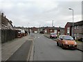
Looking at the property market in NP19 4PB, you will encounter a stock dominated by houses. This dominance aligns with the area's 51% household ownership rate, which places it slightly above the national average for owner-occupation. This statistic suggests that the majority of adults in the postcode have secured their base through purchase rather than rental agreements. Consequently, the housing market here is characterised by a mix of private residences that offer a degree of permanence. The concentration of houses implies a traditional residential layout, likely featuring distinct boundaries and private outdoor space. For buyers, this market profile indicates fewer modern high-rise blocks and more established, architecturally varied properties typical of a Welsh residential cluster. The density of 125,226 people per square kilometre reflects a tighter arrangement of properties, where land use is maximised within a small 1.3-hectare footprint. This environment suits those seeking a house but require proximity to urban amenities rather than those looking for isolation.
House Prices in NP19 4PB
Showing 22 properties
| Address | Type | Beds | Baths | Last Sale Price | Last Sale Date | |
|---|---|---|---|---|---|---|
| 11 Broadcommon Close, Newport, NP19 4PB | Retail | 3 | 1 | £177,500 | Jun 2022 | |
| 24 Broadcommon Close, Newport, NP19 4PB | Retail | 2 | 1 | £160,000 | Mar 2022 | |
| 16 Broadcommon Close, Newport, NP19 4PB | Bungalow | 2 | 1 | £260,000 | Dec 2021 | |
| 6 Broadcommon Close, Newport, NP19 4PB | Semi-detached | 3 | 1 | £193,000 | Nov 2020 | |
| 3 Broadcommon Close, Newport, NP19 4PB | Detached | 3 | 1 | £172,000 | Jan 2020 | |
| 18 Broadcommon Close, Newport, NP19 4PB | Terraced | - | - | £150,000 | Nov 2018 | |
| 28 Broadcommon Close, Newport, NP19 4PB | Bungalow | - | - | £85,000 | Oct 2010 | |
| 26 Broadcommon Close, Newport, NP19 4PB | Terraced | - | - | £120,000 | Jul 2008 | |
| 13 Broadcommon Close, Newport, NP19 4PB | Bungalow | - | - | £96,500 | Apr 2003 | |
| 15 Broadcommon Close, Newport, NP19 4PB | Terraced | - | - | £116,500 | Nov 2002 |
Energy Efficiency in NP19 4PB
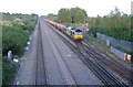
The lifestyle in NP19 4PB is supported by a network of amenities located within practical reach. Your daily shopping needs are met by major retailers including Asda Living, Iceland Newport, and Tesco Newport. These stores provide a wide selection of groceries and household goods without the need for long drives. For travel, the Newport Railway Station serves as a primary rail link, while the Newport Ferry Terminal offers coastal transport options. Four local railway stations, including Pye Corner Railway Station and Rogerstone Railway Station, ensure that rail access is just a short journey away. This density of railheads is unusual for a small postcode but convenient for accessing wider destinations. You will find that essential services cluster around specific commercial hubs that serve the immediate 1645 residents. The presence of a ferry terminal adds a unique element of connectivity, linking the land to the sea. Daily life revolves around accessible retail parks and efficient public transport nodes, creating a self-contained lifestyle where you can run errands locally before switching to rail for longer journeys.
Amenities
Schools
| Rank | School | Type | Entry gender | Ages |
|---|
Explore more schools in this area
Go to Schools tabDemographics
The community in NP19 4PB is defined by a mature population profile with a median age of 47 years. The majority of residents fall into the adult age range of 30 to 64 years, indicating a neighbourhood populated by working families and established individuals. Over half of the households, specifically 51%, are owner-occupied, which signals financial stability and a long-term commitment to the locality. Houses remain the dominant form of accommodation, distinguishing this postcode from areas with larger volumes of flats or terraced properties. The population is predominantly White, reflecting the broader demographic composition of the region. This high rate of home ownership typically correlates with lower levels of transient movement and stronger community bonds. You are more likely to meet long-term residents than short-term renters within the streets of NP19 4PB. The accommodation mix lacks significant variation in building type, focusing entirely on standalone houses which often imply larger plots or distinct garden spaces compared to high-density developments.
Household Size
Accommodation Type
Tenure
Ethnic Group
Religion
Household Composition
Age
Household Deprivation
NS-SEC
Explore more demographic insights in this area
Go to Demographics tabPlanning
Planning Constraints
- Flood RiskPremium
- Ramsar Wetland SitesPremium
- Area of Outstanding Natural BeautyPremium
- Protected Nature ReservePremium
- Protected WoodlandPremium
- Crime RiskPremium