Area Overview for NP19 4PE
Photos of NP19 4PE
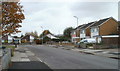
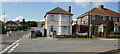

100 photos from this area
Area Information
Key information about the NP19 4PE including its size, population, and administrative classification.
- Area Type
- Postcode
- Area Size
- 1.8 hectares
- Population
- 1645
- Population Density
- 2204 people/km²
House Prices in NP19 4PE
67
Properties
£108,357
Average Sold Price
£35,000
Lowest Price
£155,000
Highest Price
Showing 67 properties
| Address | Type | Beds | Baths | Last Sale Price | Last Sale Date | |
|---|---|---|---|---|---|---|
| 70 Broad Mead Park, Newport, NP19 4PE | Terraced | 3 | 2 | £147,000 | Sep 2025 | |
| 107 Broad Mead Park, Newport, NP19 4PE | house | 3 | 1 | £155,000 | Apr 2022 | |
| 66 Broad Mead Park, Newport, NP19 4PE | Terraced | 3 | 1 | £154,500 | Mar 2022 | |
| 128 Broad Mead Park, Newport, NP19 4PE | Terraced | 3 | 1 | £101,000 | Feb 2018 | |
| 113 Broad Mead Park, Newport, NP19 4PE | Terraced | - | - | £100,000 | Nov 2006 | |
| 88 Broad Mead Park, Newport, NP19 4PE | Flat | - | - | £66,000 | Aug 2005 | |
| 108 Broad Mead Park, Newport, NP19 4PE | Terraced | - | - | £35,000 | Aug 1998 | |
| 111 Broad Mead Park, Newport, NP19 4PE | Terraced | 3 | 1 | - | - | |
| 65 Broad Mead Park, Newport, NP19 4PE | house | 3 | - | - | - | |
| Bsc Llanwern Playing Fields, Spytty Road, Newport, NP19 4PE | Leisure | - | - | - | - |
Page 1 of 7
Energy Efficiency in NP19 4PE
Amenities
Schools
| Rank | School | Type | Entry gender | Ages |
|---|
Explore more schools in this area
Go to Schools tabDemographics
Household Size
Two person
most common
Accommodation Type
Houses
most common
Tenure
51
majority
Ethnic Group
White
most common
Religion
N/A
most common
Household Composition
N/A
most common
Age
47
median
Adults (30-64 years)
most common
Household Deprivation
N/A
with no deprivation
NS-SEC
17
in Lower managerial occupations
Explore more demographic insights in this area
Go to Demographics tabPlanning
Planning Constraints
- Flood RiskPremium
- Ramsar Wetland SitesPremium
- Area of Outstanding Natural BeautyPremium
- Protected Nature ReservePremium
- Protected WoodlandPremium
- Crime RiskPremium