Area Overview for NP19 4PD
Photos of NP19 4PD


Area Information
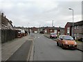
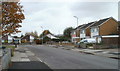
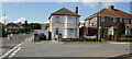
Living in NP19 4PD offers a contained residential experience within a small residential cluster covering just 2.5 hectares. You will find 1,645 residents calling this postcode home, creating a tight-knit environment where neighbours are likely to know one another. The high population density of 66,220 people per square kilometre suggests that buildings may be clustered closely together, defining a distinct urban or semi-urban feel rather than sprawling countryside. This specific area represents a slice of Newport life where daily routines revolve around the immediate vicinity before expanding outward for larger commitments. Residents enjoy the convenience of having their daily needs met locally while knowing their wartime-style footprint limits the scope of the neighbourhood. The area is not speculative or defined by uncertain future plans; it is a existing community with clear boundaries and a defined demographic. You are stepping into a space where the physical footprint is modest, ensuring that the character of the place remains recognizable regardless of minor fluctuations in property values. This community functions as a self-contained unit, offering a practical solution for those seeking a home without the strain of a vast expanse of housing development. The compact size means you will navigate a familiar landscape daily, avoiding long commutes to basic services. Whether you are rising early or venturing out after dark, the scale of NP19 4PD ensures that the area feels manageable and accessible. It is a postcode defined by its precision and its status as a recognised part of the larger Newport housing stock.
- Area Type
- Postcode
- Area Size
- 2.5 hectares
- Population
- 1645
- Population Density
- 2204 people/km²
You will primarily encounter houses in NP19 4PD, as this accommodation type dominates the housing stock entirely. This lack of variety in building style means you know exactly what you are buying before you make an offer. The fabric of the estate consists of residential structures designed for family living rather than single occupancy or student housing. If your goal is to secure a property for a growing family, you will find the housing mix aligns with that requirement. The home ownership level of 51% signals that the market retains a significant owner-occupied share. You will find many sellers who have lived in their properties for years, potentially allowing for smoother transactions compared to high-turnover rental zones. The remaining portion of the market consists of private or social rentals, offering options for those who prefer the flexibility of tenancy. However, with housing prices generally higher in owner-occupied sectors, buyers should prepare for a standard purchase process involving standard mortgage approval. Financial observers note that areas with over half ownership often fluctuate gently rather than experiencing the extreme volatility seen in pure rental markets. This stability benefits those planning long-term stays or children needing local schools. The small size of the postcode does not diversify the housing types, but it ensures that every street reflects the same architectural and functional priorities. When you look for homes in NP19 4PD, you are looking for traditional residential solutions suited to the local climate and lifestyle needs of the region.
House Prices in NP19 4PD
Showing 100 properties
| Address | Type | Beds | Baths | Last Sale Price | Last Sale Date | |
|---|---|---|---|---|---|---|
| 40 Broad Mead Park, Newport, NP19 4PD | Flat | - | - | £76,000 | Apr 2021 | |
| 31 Broad Mead Park, Newport, NP19 4PD | house | - | - | £80,000 | Aug 2011 | |
| 59 Broad Mead Park, Newport, NP19 4PD | house | - | - | £95,000 | Mar 2006 | |
| Plot 5, Land Encompassing Long Meadow Court, Long Meadow Court, Newport, NP19 4PD | undefined | - | - | - | - | |
| 28 Broad Mead Park, Newport, NP19 4PD | Flat | - | - | - | - | |
| 25 Broad Mead Park, Newport, NP19 4PD | Flat | - | - | - | - | |
| 51 Broad Mead Park, Newport, NP19 4PD | Flat | - | - | - | - | |
| 50 Broad Mead Park, Newport, NP19 4PD | Flat | - | - | - | - | |
| 30 Broad Mead Park, Newport, NP19 4PD | Flat | - | - | - | - | |
| 29 Broad Mead Park, Newport, NP19 4PD | Flat | - | - | - | - |
Energy Efficiency in NP19 4PD
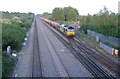
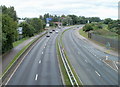
Daily life in NP19 4PD is enhanced by a selection of major retailers and transport hubs within practical reach. You have five key retail outlets nearby, including Asda Living, Iceland Newport, and Tesco Newport. Access to these supermarkets means you can stock a house or find groceries without travelling far. The variety of these shops covers basic needs and occasional treats, reducing the need for a shopping list to stretch for miles. Transport links are equally strong, with four railway stations in the vicinity. Newport Railway Station, Pye Corner Railway Station, and Rogerstone Railway Station provide regular train services. You can access wider city networks quickly, making commuting to Cardiff, Bristol, or Manchester a simple routine rather than a daily struggle. The proximity to these stations adds value to any property you consider buying. Ferry services are also available, with one terminal located nearby. Newport Ferry Terminal allows residents to cross to South Wales islands or other destinations by sea. This option adds a layer of connectivity for tourists or locals wishing to explore the coast. The combination of rail and sea links makes this area highly integrated into the national transport network. You can travel by car, train, boat, or on foot to reach your destination.
Amenities
Schools
| Rank | School | Type | Entry gender | Ages |
|---|
Explore more schools in this area
Go to Schools tabDemographics
The community in NP19 4PD is defined by a mature population structure. Your neighbours average 47 years of age, indicating that this is an area settled by families and professionals rather than recent graduates or young starters. The most common age group comprises adults between 30 and 64 years, suggesting a stable workforce with established careers and varying stages of family life. You will find children, working adults, and retirees living side by side, creating a balanced community without extreme pockets of youth or elderly isolation. Home ownership stands at 51%, meaning slightly more than half the residents own their properties outright or with a mortgage. This figure implies a mixed economy of owners and renters, though the slight edge to ownership points toward stability. If you plan to buy, you are entering a market where established homeowners are the majority, potentially offering a friendlier environment for new entrants. The 49% of residents who do not own their homes likely include tenants looking for local stability or investors. Accommodation types are exclusively houses, which sets a clear expectation for the streetscape. You will see detached, semi-detached, or terraced houses rather than purpose-built apartments or city flats. This homogeneity in building style contributes to a consistent aesthetic throughout the postcode. The population is predominantly White, reflecting the broader national demographic trends common in established Welsh towns. This leans toward a traditionally mixed community familiar with the social norms of suburban Newport.
Household Size
Accommodation Type
Tenure
Ethnic Group
Religion
Household Composition
Age
Household Deprivation
NS-SEC
Explore more demographic insights in this area
Go to Demographics tabPlanning
Planning Constraints
- Flood RiskPremium
- Ramsar Wetland SitesPremium
- Area of Outstanding Natural BeautyPremium
- Protected Nature ReservePremium
- Protected WoodlandPremium
- Crime RiskPremium