Area Overview for NP19 4PA
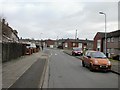
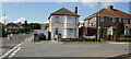
Photos of NP19 4PA


Area Information
The postcode NP19 4PA defines a compact residential cluster within Wales, covering just 1.6 hectares. This small footprint houses 1,645 people, creating a densely populated environment where neighbours are inevitably familiar to one another. It is an established locality rather than a sprawling development, characterised by a concentration of homes in a limited geographical space. Living in NP19 4PA means engaging with a tightly knit community where daily routines intersect frequently due to the high population density. Residents here navigate a setting that prioritises immediate proximity to services over extensive open spaces within the immediate boundary. The area serves as a functional residential hub, situated close to broader transport links and retail centres in Newport. You are purchasing into a defined zone where the built environment is the primary focus. The sheer number of people per square kilometre ensures active streets and community interaction, distinguishing this location from more spread-out suburbs. This dense configuration supports a specific way of life where convenience and community proximity are the defining features of daily existence in this modest but significant postcode.
- Area Type
- Postcode
- Area Size
- 1.6 hectares
- Population
- 1645
- Population Density
- 2204 people/km²
Living in NP19 4PA places you in a market where houses dominate the housing stock. The accommodation type is explicitly listed as houses, meaning you will find more semi-detached, detached, or terraced homes than flats. This architectural preference shapes the local streetscape and influences the character of the neighbourhood. With a home ownership rate of 51%, the area functions as a hybrid zone where owner-occupied homes sit alongside a significant rental sector. This balance indicates a mix of long-term residents and families with a lower stake in the property market. Buying in NP19 4PA means entering an environment where property values are influenced by the scarcity of land. The total area of just 1.6 hectares restricts the total volume of housing, which can drive up valuations for the available stock. You are unlikely to find large new-build estates here; instead, the market relies on existing stock that meets the needs of the 30-64 age demographic. The presence of 1,645 residents within such a small boundary implies intense competition for specific properties. The high density supports a robust market where properties sell quickly, as buyers appreciate the convenience of living in a fully formed village or estate setting.
House Prices in NP19 4PA
Showing 35 properties
| Address | Type | Beds | Baths | Last Sale Price | Last Sale Date | |
|---|---|---|---|---|---|---|
| 11 Fosse Road, Newport, NP19 4PA | Bungalow | 2 | 1 | £241,000 | Jun 2025 | |
| 10 Fosse Road, Newport, NP19 4PA | Bungalow | - | - | £222,500 | May 2025 | |
| 3 Fosse Road, Newport, NP19 4PA | Bungalow | 3 | 1 | £265,000 | Apr 2024 | |
| 6 Fosse Road, Newport, NP19 4PA | Semi-detached | 2 | 1 | £200,000 | Sep 2023 | |
| 13 Fosse Road, Newport, NP19 4PA | Bungalow | 2 | 1 | £245,000 | Jul 2023 | |
| 25 Fosse Road, Newport, NP19 4PA | Detached | 3 | 1 | £190,000 | Mar 2021 | |
| 12 Fosse Road, Newport, NP19 4PA | Bungalow | - | - | £125,000 | Sep 2017 | |
| 17 Fosse Road, Newport, NP19 4PA | Bungalow | 3 | 2 | £178,000 | Aug 2017 | |
| 35 Fosse Road, Newport, NP19 4PA | Semi-detached | 3 | - | £169,950 | Aug 2017 | |
| 18 Fosse Road, Newport, NP19 4PA | Bungalow | 2 | 1 | £160,000 | Jul 2017 |
Energy Efficiency in NP19 4PA
Life in NP19 4PA centres on convenience and access to local services. The immediate vicinity includes a stream of amenities designed for daily practical needs. You will find five notable retail facilities nearby, specifically Tesco Newport, Asda Living, and Iceland Newport. These supermarkets offer full-range groceries and household essentials, meaning you rarely need to travel further than a short drive for shopping. For leisure and travel, ten distinct amenities are within practical reach, including a ferry terminal at Newport Ferry Terminal and multiple rail stations. The presence of Newport Ferry Terminal connects residents to destinations across the Bristol Channel, adding a unique travel dimension to local life. Commuters benefit from four nearby railway stations, providing frequent services to Newport city centre and beyond. This density of transport links means you can easily access schools, workplaces, and leisure venues located near the main railway hubs. The lifestyle here is defined by functional access rather than exclusive luxury. Residents move quickly from home to shops or stations because these destinations are clustered effectively close to the residential return. It is a practical neighbourhood where time spent commuting or running errands is minimised by strategic planning of local infrastructure.
Amenities
Schools
| Rank | School | Type | Entry gender | Ages |
|---|
Explore more schools in this area
Go to Schools tabDemographics
The community within NP19 4PA presents a mature profile, with a median age of 47 years. The majority of residents fall within the 30 to 64 years age range, indicating a population dominated by adults who often balance careers with family life or retirement. Accommodation in this cluster consists primarily of houses, reflecting a preference for detached or semi-detached living over flat living. More than half of the households are owned outright or with a mortgage, with a home ownership rate of 51%. This figure suggests a stable residential base where people have established long-term roots. The predominant ethnic group is White, which aligns with the broader demographic trends of many established residential clusters in the region. There is no indication of significant deprivation metrics in the available records, meaning the area does not face the specific challenges associated with higher deprivation indices. The demographic stability points to a neighbourhood where families and older adults have settled permanently. You are looking at an area where the population has not recently changed drastically, offering consistency for those seeking a settled community. The age profile suggests a quieter environment compared to districts with younger populations, yet still active enough for those in their working years.
Household Size
Accommodation Type
Tenure
Ethnic Group
Religion
Household Composition
Age
Household Deprivation
NS-SEC
Explore more demographic insights in this area
Go to Demographics tabPlanning
Planning Constraints
- Flood RiskPremium
- Ramsar Wetland SitesPremium
- Area of Outstanding Natural BeautyPremium
- Protected Nature ReservePremium
- Protected WoodlandPremium
- Crime RiskPremium