Area Overview for NP10 8RQ
Photos of NP10 8RQ
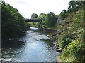
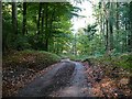
![Alongside the river [3] in NP10 8RQ](https://images.propbar.co.uk/images/geograph/18/16/1816300_120.jpg)
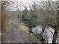
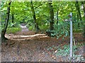
![Alongside the river [4] in NP10 8RQ](https://images.propbar.co.uk/images/geograph/18/16/1816303_120.jpg)
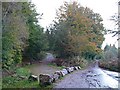
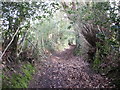
![River bridge [4] in NP10 8RQ](https://images.propbar.co.uk/images/geograph/18/16/1816298_120.jpg)
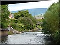
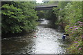
![River bridge [5] in NP10 8RQ](https://images.propbar.co.uk/images/geograph/18/16/1816301_120.jpg)
35 photos from this area
Area Information
Key information about the NP10 8RQ including its size, population, and administrative classification.
- Area Type
- Postcode
- Area Size
- 2.4 km²
- Population
- 1933
- Population Density
- 168 people/km²
House Prices in NP10 8RQ
15
Properties
£299,333
Average Sold Price
£8,000
Lowest Price
£465,000
Highest Price
Showing 15 properties
| Address | Type | Beds | Baths | Last Sale Price | Last Sale Date | |
|---|---|---|---|---|---|---|
| Sunnybank Farm, Caerphilly Road, Newport, NP10 8RQ | Detached | 6 | 2 | £8,000 | Jun 2023 | |
| Llwyn Deri Cottage, Llwyn Deri, Rhiwderin, Newport, NP10 8RQ | house | 1 | - | £425,000 | Nov 2014 | |
| Coed Mawr Cottage, Fox Hill, Rhiwderin, Newport, NP10 8RQ | house | - | - | £465,000 | Aug 2012 | |
| Managers Accomodation, Pentre Tai Farm Bed And Breakfast, Pentre Tai Road, Rhiwderin, Newport, NP10 8RQ | Flat | - | - | - | - | |
| Farm House, Five Lanes Farm, Maypole Lane, Rhiwderin, Newport, NP10 8RQ | Detached | - | - | - | - | |
| Oak Tree Barn, Pump-heol Farm, Maypole Lane, Rhiwderin, Newport, NP10 8RQ | Bungalow | - | - | - | - | |
| Pump-heol Farm, Maypole Lane, Rhiwderin, Newport, NP10 8RQ | Farm | - | - | - | - | |
| Pentre Tai Farm Bed And Breakfast, Pentre Tai Road, Rhiwderin, Newport, NP10 8RQ | house | - | - | - | - | |
| Carpenters, Caerphilly Road, Newport, NP10 8RQ | Detached | - | - | - | - | |
| Twyn Y Cadno, Pentre Tai Road, Rhiwderin, Newport, NP10 8RQ | Detached | - | - | - | - |
Page 1 of 2
Energy Efficiency in NP10 8RQ
Amenities
Schools
| Rank | School | Type | Entry gender | Ages |
|---|
Explore more schools in this area
Go to Schools tabDemographics
Household Size
Family (3-5 people)
most common
Accommodation Type
Houses
most common
Tenure
87
majority
Ethnic Group
White
most common
Religion
N/A
most common
Household Composition
N/A
most common
Age
47
median
Adults (30-64 years)
most common
Household Deprivation
N/A
with no deprivation
NS-SEC
49
in Lower managerial occupations
Explore more demographic insights in this area
Go to Demographics tabPlanning
Planning Constraints
- Flood RiskPremium
- Ramsar Wetland SitesPremium
- Area of Outstanding Natural BeautyPremium
- Protected Nature ReservePremium
- Protected WoodlandPremium
- Crime RiskPremium