Area Overview for NP10 8GY
Photos of NP10 8GY
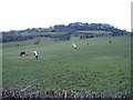
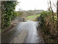
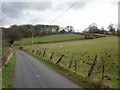

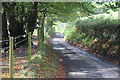


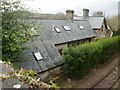
22 photos from this area
Area Information
Key information about the NP10 8GY including its size, population, and administrative classification.
- Area Type
- Postcode
- Area Size
- 2.2 km²
- Population
- 1933
- Population Density
- 168 people/km²
House Prices in NP10 8GY
12
Properties
£795,000
Average Sold Price
£470,000
Lowest Price
£1,120,000
Highest Price
Showing 12 properties
| Address | Type | Beds | Baths | Last Sale Price | Last Sale Date | |
|---|---|---|---|---|---|---|
| Maendy Uchaf, Church Road, Lower Machen, Newport, NP10 8GY | Detached | 4 | 1 | £1,120,000 | Apr 2022 | |
| Meadow Barn, Church Road, Lower Machen, Newport, NP10 8GY | Detached | - | - | £470,000 | Mar 2005 | |
| Lower Barn, Pant-teg Farm, Church Road, Lower Machen, Newport, NP10 8GY | Cottage | 4 | - | - | - | |
| Ty Derym Nos, Church Road, Lower Machen, Newport, NP10 8GY | Detached | - | - | - | - | |
| Farmhouse, Pant-teg Farm, Church Road, Lower Machen, Newport, NP10 8GY | Detached | - | - | - | - | |
| Farm House, Llandanglws Farm, Church Road, Lower Machen, Newport, NP10 8GY | Detached | - | - | - | - | |
| Upper Barn, Pant-teg Farm, Church Road, Lower Machen, Newport, NP10 8GY | Semi-detached | - | - | - | - | |
| Park Farm, Caerphilly Road, Newport, NP10 8GY | Detached | - | - | - | - | |
| Pant-teg Farm, Church Road, Lower Machen, Newport, NP10 8GY | house | - | - | - | - | |
| Llandanglws Farm, Church Road, Lower Machen, Newport, NP10 8GY | Farm | - | - | - | - |
Page 1 of 2
Energy Efficiency in NP10 8GY
Amenities
Schools
| Rank | School | Type | Entry gender | Ages |
|---|
Explore more schools in this area
Go to Schools tabDemographics
Household Size
Family (3-5 people)
most common
Accommodation Type
Houses
most common
Tenure
87
majority
Ethnic Group
White
most common
Religion
N/A
most common
Household Composition
N/A
most common
Age
47
median
Adults (30-64 years)
most common
Household Deprivation
N/A
with no deprivation
NS-SEC
49
in Lower managerial occupations
Explore more demographic insights in this area
Go to Demographics tabPlanning
Planning Constraints
- Flood RiskPremium
- Ramsar Wetland SitesPremium
- Area of Outstanding Natural BeautyPremium
- Protected Nature ReservePremium
- Protected WoodlandPremium
- Crime RiskPremium