Area Overview for WS9 0EL
Photos of WS9 0EL
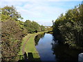
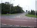
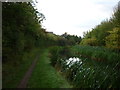
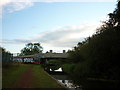
15 photos from this area
Area Information
Key information about the WS9 0EL including its size, population, and administrative classification.
- Area Type
- Postcode
- Area Size
- 1.2 hectares
- Population
- 1571
- Population Density
- 518 people/km²
House Prices in WS9 0EL
22
Properties
£184,671
Average Sold Price
£66,060
Lowest Price
£320,000
Highest Price
Showing 22 properties
| Address | Type | Beds | Baths | Last Sale Price | Last Sale Date | |
|---|---|---|---|---|---|---|
| 43 Berryfields, Aldridge, WS9 0EL | house | - | - | £310,000 | Sep 2024 | |
| 21 Berryfields, Aldridge, WS9 0EL | house | - | - | £320,000 | Aug 2022 | |
| 37 Berryfields, Aldridge, WS9 0EL | house | - | - | £260,000 | Apr 2021 | |
| 41 Berryfields, Aldridge, WS9 0EL | house | - | - | £205,000 | Oct 2016 | |
| 49 Berryfields, Aldridge, WS9 0EL | Semi-detached | 3 | 1 | £216,000 | Sep 2016 | |
| 31 Berryfields, Aldridge, WS9 0EL | house | - | - | £188,000 | Apr 2016 | |
| 29 Berryfields, Aldridge, WS9 0EL | house | - | - | £185,000 | Jun 2015 | |
| 51 Berryfields, Aldridge, WS9 0EL | house | 3 | - | £160,000 | Sep 2013 | |
| 39 Berryfields, Aldridge, WS9 0EL | house | - | - | £166,000 | Feb 2009 | |
| 25 Berryfields, Aldridge, WS9 0EL | Semi-detached | - | - | £182,000 | Apr 2007 |
Page 1 of 3
Energy Efficiency in WS9 0EL
Amenities
Schools
| Rank | School | Type | Entry gender | Ages |
|---|
Explore more schools in this area
Go to Schools tabDemographics
Household Size
Family (3-5 people)
most common
Accommodation Type
Houses
most common
Tenure
88
majority
Ethnic Group
White
most common
Religion
N/A
most common
Household Composition
N/A
most common
Age
47
median
Adults (30-64 years)
most common
Household Deprivation
N/A
with no deprivation
NS-SEC
34
in Lower managerial occupations
Explore more demographic insights in this area
Go to Demographics tabPlanning
Planning Constraints
- Flood RiskPremium
- Ramsar Wetland SitesPremium
- Area of Outstanding Natural BeautyPremium
- Protected Nature ReservePremium
- Protected WoodlandPremium