Area Overview for WS9 0EB
Photos of WS9 0EB
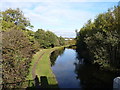
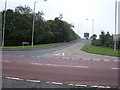
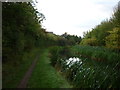
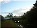
15 photos from this area
Area Information
Key information about the WS9 0EB including its size, population, and administrative classification.
- Area Type
- Postcode
- Area Size
- 9574 m²
- Population
- 1457
- Population Density
- 4706 people/km²
House Prices in WS9 0EB
30
Properties
£139,491
Average Sold Price
£64,950
Lowest Price
£185,000
Highest Price
Showing 30 properties
| Address | Type | Beds | Baths | Last Sale Price | Last Sale Date | |
|---|---|---|---|---|---|---|
| 94 Berryfields, Aldridge, WS9 0EB | house | - | - | £185,000 | Jan 2021 | |
| 70 Berryfields, Aldridge, WS9 0EB | Terraced | 3 | - | £159,000 | Sep 2020 | |
| 48 Berryfields, Aldridge, WS9 0EB | house | 3 | 1 | £176,500 | Aug 2017 | |
| 72 Berryfields, Aldridge, WS9 0EB | Terraced | 3 | - | £144,950 | Mar 2017 | |
| 74 Berryfields, Aldridge, WS9 0EB | Terraced | 3 | 1 | £136,000 | Feb 2017 | |
| 54 Berryfields, Aldridge, WS9 0EB | Semi-detached | 3 | 1 | £142,000 | Jun 2014 | |
| 84 Berryfields, Aldridge, WS9 0EB | house | 3 | - | £104,000 | Jan 2013 | |
| 96 Berryfields, Aldridge, WS9 0EB | Terraced | - | - | £120,000 | Mar 2008 | |
| 46 Berryfields, Aldridge, WS9 0EB | Semi-detached | - | - | £175,000 | Mar 2008 | |
| 100 Berryfields, Aldridge, WS9 0EB | house | - | - | £127,000 | May 2005 |
Page 1 of 3
Energy Efficiency in WS9 0EB
Amenities
Schools
| Rank | School | Type | Entry gender | Ages |
|---|
Explore more schools in this area
Go to Schools tabDemographics
Household Size
Family (3-5 people)
most common
Accommodation Type
Houses
most common
Tenure
50
majority
Ethnic Group
White
most common
Religion
N/A
most common
Household Composition
N/A
most common
Age
47
median
Adults (30-64 years)
most common
Household Deprivation
N/A
with no deprivation
NS-SEC
23
in Lower managerial occupations
Explore more demographic insights in this area
Go to Demographics tabPlanning
Planning Constraints
- Flood RiskPremium
- Ramsar Wetland SitesPremium
- Area of Outstanding Natural BeautyPremium
- Protected Nature ReservePremium
- Protected WoodlandPremium