Area Overview for WS9 0DF
Photos of WS9 0DF
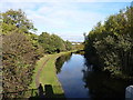
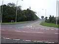
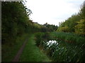
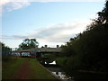
15 photos from this area
Area Information
Key information about the WS9 0DF including its size, population, and administrative classification.
- Area Type
- Postcode
- Area Size
- 1.9 hectares
- Population
- 1571
- Population Density
- 518 people/km²
House Prices in WS9 0DF
44
Properties
£186,790
Average Sold Price
£30,000
Lowest Price
£370,000
Highest Price
Showing 44 properties
| Address | Type | Beds | Baths | Last Sale Price | Last Sale Date | |
|---|---|---|---|---|---|---|
| 153 Redhouse Lane, Aldridge, WS9 0DF | Detached | 3 | 2 | £370,000 | Oct 2025 | |
| 131 Redhouse Lane, Aldridge, WS9 0DF | Semi-detached | 3 | 1 | £255,000 | May 2025 | |
| 95 Redhouse Lane, Aldridge, WS9 0DF | Semi-detached | 3 | 1 | £272,000 | Dec 2024 | |
| 147 Redhouse Lane, Aldridge, WS9 0DF | Semi-detached | 4 | 1 | £350,000 | Aug 2023 | |
| 111 Redhouse Lane, Aldridge, WS9 0DF | house | - | - | £210,000 | Mar 2022 | |
| 133 Redhouse Lane, Aldridge, WS9 0DF | Semi-detached | 3 | - | £290,000 | Mar 2022 | |
| 141 Redhouse Lane, Aldridge, WS9 0DF | house | - | - | £340,000 | Dec 2020 | |
| 155 Redhouse Lane, Aldridge, WS9 0DF | house | - | - | £280,000 | Feb 2020 | |
| 93 Redhouse Lane, Aldridge, WS9 0DF | house | 3 | - | £185,000 | Mar 2019 | |
| 89 Redhouse Lane, Aldridge, WS9 0DF | Semi-detached | 3 | 2 | £193,500 | Sep 2018 |
Page 1 of 5
Energy Efficiency in WS9 0DF
Amenities
Schools
| Rank | School | Type | Entry gender | Ages |
|---|
Explore more schools in this area
Go to Schools tabDemographics
Household Size
Family (3-5 people)
most common
Accommodation Type
Houses
most common
Tenure
88
majority
Ethnic Group
White
most common
Religion
N/A
most common
Household Composition
N/A
most common
Age
47
median
Adults (30-64 years)
most common
Household Deprivation
N/A
with no deprivation
NS-SEC
34
in Lower managerial occupations
Explore more demographic insights in this area
Go to Demographics tabPlanning
Planning Constraints
- Flood RiskPremium
- Ramsar Wetland SitesPremium
- Area of Outstanding Natural BeautyPremium
- Protected Nature ReservePremium
- Protected WoodlandPremium