Area Overview for WS9 0DB
Photos of WS9 0DB
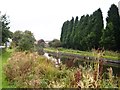
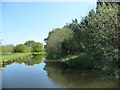
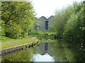
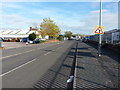
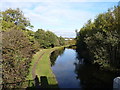
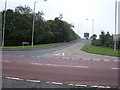
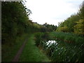
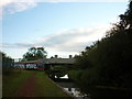
15 photos from this area
Area Information
Key information about the WS9 0DB including its size, population, and administrative classification.
- Area Type
- Postcode
- Area Size
- 2.3 hectares
- Population
- 1571
- Population Density
- 518 people/km²
House Prices in WS9 0DB
51
Properties
£159,815
Average Sold Price
£46,000
Lowest Price
£340,000
Highest Price
Showing 51 properties
| Address | Type | Beds | Baths | Last Sale Price | Last Sale Date | |
|---|---|---|---|---|---|---|
| 86 Redhouse Lane, Aldridge, WS9 0DB | Terraced | 3 | 1 | £231,000 | Sep 2024 | |
| 144 Redhouse Lane, Aldridge, WS9 0DB | Semi-detached | 3 | 1 | £250,000 | Jun 2024 | |
| 172 Redhouse Lane, Aldridge, WS9 0DB | Semi-detached | 3 | 1 | £261,000 | Mar 2024 | |
| 152 Redhouse Lane, Aldridge, WS9 0DB | Semi-detached | 4 | 2 | £340,000 | Dec 2023 | |
| 168 Redhouse Lane, Aldridge, WS9 0DB | Semi-detached | 3 | 1 | £285,000 | Aug 2023 | |
| 170 Redhouse Lane, Aldridge, WS9 0DB | Semi-detached | 5 | 2 | £205,000 | Nov 2022 | |
| 110 Redhouse Lane, Aldridge, WS9 0DB | Semi-detached | 3 | - | £235,500 | Sep 2021 | |
| 150 Redhouse Lane, Aldridge, WS9 0DB | house | - | - | £293,000 | Sep 2021 | |
| 80 Redhouse Lane, Aldridge, WS9 0DB | Semi-detached | 3 | 1 | £220,000 | Jul 2021 | |
| 166 Redhouse Lane, Aldridge, WS9 0DB | Detached | 3 | 2 | £245,000 | Apr 2021 |
Page 1 of 6
Energy Efficiency in WS9 0DB
Amenities
Schools
| Rank | School | Type | Entry gender | Ages |
|---|
Explore more schools in this area
Go to Schools tabDemographics
Household Size
Family (3-5 people)
most common
Accommodation Type
Houses
most common
Tenure
88
majority
Ethnic Group
White
most common
Religion
N/A
most common
Household Composition
N/A
most common
Age
47
median
Adults (30-64 years)
most common
Household Deprivation
N/A
with no deprivation
NS-SEC
34
in Lower managerial occupations
Explore more demographic insights in this area
Go to Demographics tabPlanning
Planning Constraints
- Flood RiskPremium
- Ramsar Wetland SitesPremium
- Area of Outstanding Natural BeautyPremium
- Protected Nature ReservePremium
- Protected WoodlandPremium