Area Overview for DY4 9AR
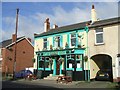
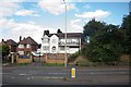
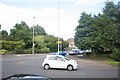
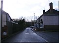
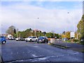
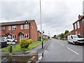
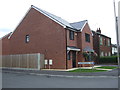
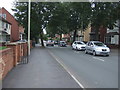
Photos of DY4 9AR


Area Information
Living in DY4 9AR means being part of a small, tightly knit residential cluster in England. The area covers 2,698 square metres and is home to 1,535 residents, making it one of the more densely populated postcode areas in the country, with 568,865 people per square kilometre. This compact community offers a mix of practical living with proximity to essential services. The area’s character is defined by its focus on housing, with the majority of properties being homes rather than flats or apartments. While the population density is high, the small size of the area suggests a close-knit environment where local amenities and transport links are within easy reach. Residents here are likely to value convenience, with nearby schools, rail stations, and retail options all within practical distance. The area’s compact nature means it is ideal for those seeking a balance between urban accessibility and a quieter residential setting, though the density may impact the sense of space for some.
- Area Type
- Postcode
- Area Size
- 2698 m²
- Population
- 1535
- Population Density
- 2665 people/km²
DY4 9AR is primarily an owner-occupied area, with 56% of residents living in homes they own. The accommodation type is predominantly houses, which is unusual for a small postcode area but may reflect a mix of semi-detached or detached properties. This suggests a housing stock that prioritises private ownership over rental units, potentially limiting availability for renters. The compact size of the area means that property choices are likely limited to a small number of homes, though the focus on houses may appeal to buyers seeking space and privacy. For those considering the area, the owner-occupied nature implies a stable market, but the small size of the postcode could mean that buyers need to look beyond the immediate vicinity for more options. The presence of nearby rail and metro stations may also make the area attractive to commuters, though the local housing stock is unlikely to cater to a large rental market.
House Prices in DY4 9AR
Showing 20 properties
| Address | Type | Beds | Baths | Last Sale Price | Last Sale Date | |
|---|---|---|---|---|---|---|
| 108 Hurst Lane, Tipton, DY4 9AR | Flat | 2 | 1 | £115,000 | Oct 2023 | |
| 107 Hurst Lane, Tipton, DY4 9AR | Flat | 2 | 1 | £86,000 | Jan 2017 | |
| 119 Hurst Lane, Tipton, DY4 9AR | Terraced | 3 | - | £130,000 | Nov 2016 | |
| 118 Hurst Lane, Tipton, DY4 9AR | Semi-detached | 3 | 2 | £122,500 | Mar 2015 | |
| 115 Hurst Lane, Tipton, DY4 9AR | Flat | - | - | £75,996 | Feb 2008 | |
| 111 Hurst Lane, Tipton, DY4 9AR | Flat | - | - | £107,000 | May 2006 | |
| 114 Hurst Lane, Tipton, DY4 9AR | Flat | - | - | £99,995 | Mar 2006 | |
| 104 Hurst Lane, Tipton, DY4 9AR | Flat | 2 | 1 | £115,000 | Mar 2006 | |
| 117 Hurst Lane, Tipton, DY4 9AR | Flat | 2 | 1 | - | - | |
| 112 Hurst Lane, Tipton, DY4 9AR | Flat | - | - | - | - |
Energy Efficiency in DY4 9AR
Daily life in DY4 9AR is shaped by its proximity to essential amenities. The area includes five retail outlets, such as Aldi Priory and Co-op Woodsetton, offering groceries and household supplies. Nearby rail stations like Tipton and Dudley Port provide links to broader transport networks, while metro stops at Bradley Lane and Wednesbury Parkway offer additional connectivity. Though the data does not specify parks or leisure facilities, the presence of multiple retail and transport hubs suggests a practical, service-oriented lifestyle. Residents can access schools, shops, and public transport without long commutes, fostering a sense of convenience. The mix of retail and transport options indicates that the area is designed for efficiency, though the lack of detailed information on leisure or recreational spaces means that those prioritising outdoor activities may need to look further afield.
Amenities
Schools
Residents of DY4 9AR have access to a range of educational institutions, including St Paul’s CofE (C) Primary School, which serves younger children, and Midland Oak School, an independent institution offering alternative educational pathways. Bloomfield School, a special school, provides tailored support for students with specific needs, while St Pauls Church of England Academy offers secondary education. The mix of school types suggests a comprehensive educational landscape, catering to both mainstream and specialist requirements. Families with children may find the presence of a primary school particularly valuable for early education, while the independent and special schools offer flexibility for those seeking alternative or specialised learning environments. The proximity of these institutions to the area indicates that DY4 9AR is well-served for educational needs, though the specific quality of each school is not detailed in the data.
| Rank | School | Type | Entry gender | Ages |
|---|
Explore more schools in this area
Go to Schools tabDemographics
The population of DY4 9AR is predominantly adults aged 30–64, with a median age of 47. This suggests a community of established professionals and families, rather than a younger or elderly demographic. Home ownership is strong, with 56% of residents owning their homes, indicating a stable, long-term presence in the area. The accommodation is primarily houses, which aligns with the higher proportion of owner-occupied properties. The predominant ethnic group is White, reflecting the broader regional demographic. While no specific data on deprivation is provided, the high home ownership rate and age profile suggest a relatively stable economic environment. However, the lack of diversity in ethnic composition may impact the range of cultural amenities and services available. The age range of residents implies a community focused on family life and professional stability, with schools and local services playing a central role in daily life.
Household Size
Accommodation Type
Tenure
Ethnic Group
Religion
Household Composition
Age
Household Deprivation
NS-SEC
Explore more demographic insights in this area
Go to Demographics tabPlanning
Planning Constraints
- Flood RiskPremium
- Ramsar Wetland SitesPremium
- Area of Outstanding Natural BeautyPremium
- Protected Nature ReservePremium
- Protected WoodlandPremium