Area Overview for DY4 8DJ
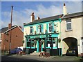
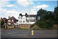
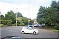
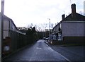
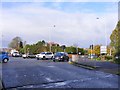
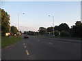
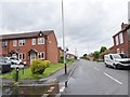
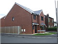
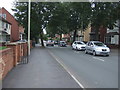
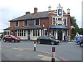
Photos of DY4 8DJ


Area Information
DY4 8DJ is a compact residential postcode in England, covering just 1.6 hectares yet home to 1868 residents. Its high population density of 116,550 people per square kilometre reflects a tightly woven community, where proximity to amenities and transport links is a defining feature. This area is not a sprawling suburb but a small, focused cluster of homes, likely centred around local streets and shared spaces. Daily life here is shaped by its proximity to retail, rail, and metro services, with Aldi Priory and Co-op stores within walking distance. The median age of 47 suggests a mature demographic, with many residents in their 30s to 60s, potentially creating a stable, long-term community. While the area lacks natural reserves or protected landscapes, its safety record and practical connectivity make it appealing for those seeking a balance between urban convenience and residential tranquillity. Living in DY4 8DJ means navigating a densely populated but well-served environment, where the local character is defined by its accessibility to nearby towns and the rhythm of everyday life centred on local shops and transport hubs.
- Area Type
- Postcode
- Area Size
- 1.6 hectares
- Population
- 1868
- Population Density
- 7154 people/km²
The property market in DY4 8DJ is characterised by a 52% home ownership rate, indicating that nearly half of the housing stock is owner-occupied, while the remaining properties are likely rented. The accommodation type is predominantly houses, which suggests a focus on family homes or larger dwellings rather than flats or apartments. This aligns with the area’s compact size and residential nature, where space and privacy may be prioritised. Given the small area size of 1.6 hectares, the housing stock is likely concentrated within a limited geographical footprint, potentially creating a mix of semi-detached or terraced properties. For buyers, this means a market that is not dominated by high-rise developments but rather by traditional housing types. The high population density, however, may mean that properties are closely spaced, with limited scope for expansion. Buyers should consider the area’s proximity to transport links and amenities as key selling points, given the lack of natural constraints or planning restrictions that might limit development.
House Prices in DY4 8DJ
Showing 26 properties
| Address | Type | Beds | Baths | Last Sale Price | Last Sale Date | |
|---|---|---|---|---|---|---|
| 113 Dudley Road, Tipton, DY4 8DJ | house | 3 | 2 | £620,000 | May 2024 | |
| 23 Dudley Road, Tipton, DY4 8DJ | Flat | 2 | 2 | £93,000 | Dec 2022 | |
| 110 Dudley Road, Tipton, DY4 8DJ | house | - | - | £300,000 | May 2022 | |
| 115 Dudley Road, Tipton, DY4 8DJ | Semi-detached | 3 | 1 | £168,000 | Oct 2021 | |
| 22 Dudley Road, Tipton, DY4 8DJ | Flat | - | - | £80,000 | Aug 2019 | |
| 116 Dudley Road, Tipton, DY4 8DJ | Semi-detached | 3 | 1 | £137,000 | Jan 2019 | |
| 26 Dudley Road, Tipton, DY4 8DJ | Flat | - | - | £54,000 | Mar 2016 | |
| 25 Dudley Road, Tipton, DY4 8DJ | Flat | 2 | 2 | £62,000 | Jun 2015 | |
| 24 Dudley Road, Tipton, DY4 8DJ | Flat | 2 | - | £63,000 | Aug 2014 | |
| 21 Dudley Road, Tipton, DY4 8DJ | Flat | 4 | 2 | £132,950 | Mar 2007 |
Energy Efficiency in DY4 8DJ
Living in DY4 8DJ offers a blend of convenience and accessibility, with essential amenities within practical reach. The area is served by five retail outlets, including Aldi Priory and Co-op Woodsetton, providing everyday shopping needs. These stores likely cater to a range of preferences, from budget-friendly options to more general provisions. For transport, the presence of five rail stations—Tipton, Dudley Port, and Coseley—and three metro stops—Bradley Lane, Loxdale, and Wednesbury Parkway—ensures frequent and reliable public transport options. This connectivity supports both daily commutes and leisure travel. While the data does not mention parks or recreational spaces, the absence of protected natural areas suggests that the area’s character is more urban than rural. The combination of retail, transport, and a dense residential layout creates a lifestyle focused on practicality, where residents can access services efficiently without needing to travel far.
Amenities
Schools
| Rank | School | Type | Entry gender | Ages |
|---|
Explore more schools in this area
Go to Schools tabDemographics
The community in DY4 8DJ is predominantly composed of adults aged 30 to 64, with a median age of 47. This suggests a mature population, likely with established careers and families, contributing to a stable and experienced local demographic. Home ownership stands at 52%, indicating a mix of owner-occupied properties and rental units. The accommodation type is primarily houses, which aligns with the area’s residential character and may cater to families or individuals seeking more space. The predominant ethnic group is White, reflecting a homogenous community profile. While no specific data on deprivation is provided, the high population density and prevalence of owner-occupied homes suggest a moderate level of economic stability. The absence of detailed diversity metrics means the area’s social fabric is largely shaped by its core demographic. For residents, this profile implies a community focused on long-term living, with services and amenities tailored to the needs of middle-aged adults and their families.
Household Size
Accommodation Type
Tenure
Ethnic Group
Religion
Household Composition
Age
Household Deprivation
NS-SEC
Explore more demographic insights in this area
Go to Demographics tabPlanning
Planning Constraints
- Flood RiskPremium
- Ramsar Wetland SitesPremium
- Area of Outstanding Natural BeautyPremium
- Protected Nature ReservePremium
- Protected WoodlandPremium