Area Overview for DY4 9SL
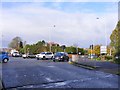
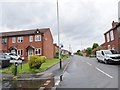
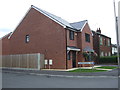
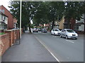
Photos of DY4 9SL


Area Information
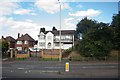
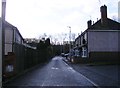
DY4 9SL is a small, densely populated residential cluster in England, covering just 6,067 square metres and home to 1,535 residents. Its compact size means it is a tight-knit community, with a high population density of 253,013 people per square kilometre. This area is characterised by its modest scale, where daily life is shaped by proximity to local amenities and transport links. The demographic profile suggests a mature population, with a median age of 47 and the majority of residents falling within the 30-64 age range. This reflects a community of established adults, many of whom may be in their peak working years or nearing retirement. The area’s small footprint means it is likely surrounded by larger urban or rural zones, offering a balance between local convenience and broader connectivity. Living here implies a focus on practicality, with homes and services closely aligned to meet the needs of a stable, middle-aged population. The presence of multiple schools and transport options within reach further underscores its role as a functional, family-oriented location.
- Area Type
- Postcode
- Area Size
- 6067 m²
- Population
- 1535
- Population Density
- 2665 people/km²
The property market in DY4 9SL is defined by a 56% home ownership rate, with houses being the predominant accommodation type. This suggests a mix of owner-occupied properties and rental units, though the exact proportion of rentals is not specified. Given the area’s small size and high population density, the housing stock is likely limited, with properties concentrated in a compact cluster. The prevalence of houses over flats or apartments indicates a suburban or semi-rural setting, possibly with gardens or larger living spaces. For buyers, this means competition may be fierce due to the limited number of available homes. The area’s proximity to transport and amenities could make it attractive to those seeking a balance between urban access and residential comfort. However, the small size of DY4 9SL means that buyers should consider nearby areas for more options, as the immediate vicinity may have limited scope for expansion.
House Prices in DY4 9SL
Showing 35 properties
| Address | Type | Beds | Baths | Last Sale Price | Last Sale Date | |
|---|---|---|---|---|---|---|
| 44 Thunderbolt Way, Tipton, DY4 9SL | Semi-detached | 3 | 2 | £210,000 | Jan 2025 | |
| 26 Thunderbolt Way, Tipton, DY4 9SL | Flat | - | - | £100,000 | Oct 2024 | |
| 10 Thunderbolt Way, Tipton, DY4 9SL | Flat | - | - | £110,000 | Apr 2024 | |
| 58 Thunderbolt Way, Tipton, DY4 9SL | Semi-detached | 4 | 2 | £255,000 | Mar 2024 | |
| 30 Thunderbolt Way, Tipton, DY4 9SL | Flat | 1 | - | £90,000 | Nov 2023 | |
| 40 Thunderbolt Way, Tipton, DY4 9SL | Semi-detached | 3 | 1 | £240,000 | Oct 2023 | |
| 34 Thunderbolt Way, Tipton, DY4 9SL | Flat | 1 | 1 | £80,000 | Feb 2023 | |
| 28 Thunderbolt Way, Tipton, DY4 9SL | Flat | - | - | £86,500 | Oct 2022 | |
| 14 Thunderbolt Way, Tipton, DY4 9SL | Flat | - | - | £130,000 | Jul 2022 | |
| 6 Thunderbolt Way, Tipton, DY4 9SL | Flat | 2 | 1 | £111,000 | May 2022 |
Energy Efficiency in DY4 9SL
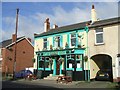
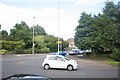
Residents of DY4 9SL have access to a range of local amenities, including retail outlets such as Aldi Priory, Co-op Woodsetton, and Farmfoods Tipton, which cater to everyday shopping needs. The proximity to rail and metro stations enhances the area’s connectivity, allowing easy access to larger urban centres for leisure, dining, or employment. While specific parks or leisure facilities are not listed in the data, the presence of multiple transport links suggests that nearby green spaces or recreational areas are likely within reach. The combination of retail options and transport infrastructure contributes to a practical, convenient lifestyle, where daily essentials are readily available, and broader opportunities are accessible via public transport.
Amenities
Schools
Residents of DY4 9SL have access to a range of educational institutions, including St Paul’s CofE (C) Primary School, a state-funded primary school, and St Pauls Church of England Academy, which operates as an academy. Midland Oak School is an independent institution, offering a private education option, while Bloomfield School specialises in supporting students with specific needs. This mix of school types provides families with flexibility, whether they prefer state, independent, or special education. The presence of multiple schools within reach suggests that DY4 9SL is a family-friendly area, with options catering to different educational preferences and requirements. For parents, the availability of both mainstream and specialist schools may reduce the need to relocate for schooling, reinforcing the area’s appeal to households with children.
| Rank | School | Type | Entry gender | Ages |
|---|
Explore more schools in this area
Go to Schools tabDemographics
The community in DY4 9SL is predominantly composed of adults aged 30-64, with a median age of 47. This suggests a population largely in their prime working years, with fewer children or elderly residents compared to other areas. Home ownership is relatively high at 56%, indicating a stable residential base with long-term residents. The majority of properties are houses, which aligns with the area’s small size and likely suburban or semi-rural character. The predominant ethnic group is White, though no further diversity data is provided. The age profile and ownership figures imply a community that is economically established, with a focus on long-term residency rather than transient populations. The absence of specific data on deprivation or income levels means the quality of life is inferred from the available metrics, such as the presence of schools and transport links.
Household Size
Accommodation Type
Tenure
Ethnic Group
Religion
Household Composition
Age
Household Deprivation
NS-SEC
Explore more demographic insights in this area
Go to Demographics tabPlanning
Planning Constraints
- Flood RiskPremium
- Ramsar Wetland SitesPremium
- Area of Outstanding Natural BeautyPremium
- Protected Nature ReservePremium
- Protected WoodlandPremium