Area Overview for DY4 9AB
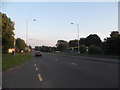
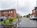
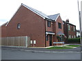
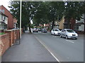
Photos of DY4 9AB


Area Information
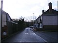
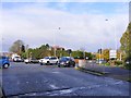
DY4 9AB is a compact residential postcode area in England, covering just 1.7 hectares and home to 1,772 residents. Its population density of 106,246 people per square kilometre highlights its small, tightly knit character, typical of a focused housing cluster. The area’s proximity to rail and metro networks suggests it is well integrated into regional transport systems, making it accessible for commuters. Daily life here is shaped by its modest size and the presence of nearby amenities, from retail outlets to public transport hubs. While the area lacks natural or protected landscapes, its practical layout and connectivity make it a viable option for those prioritising convenience over rural scenery. The demographic profile—predominantly adults aged 30–64—hints at a stable, established community, with a balance of homeowners and renters. For buyers, DY4 9AB offers a snapshot of suburban living, where proximity to services and transport is key.
- Area Type
- Postcode
- Area Size
- 1.7 hectares
- Population
- 1772
- Population Density
- 3610 people/km²
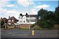
DY4 9AB is characterised by a 54% home ownership rate, with houses forming the primary type of accommodation. This suggests a market skewed towards owner-occupied properties rather than rental units, though the area’s small size may mean limited housing stock. The dominance of houses implies a focus on family homes, potentially appealing to buyers seeking traditional living spaces. However, the compact nature of the postcode—just 1.7 hectares—means the immediate surroundings are likely to be similarly constrained, with limited scope for expansion or new developments. For buyers, this translates to a niche market where properties are likely to be in high demand, given the area’s connectivity to transport networks and proximity to retail and public services. Those considering the area should prioritise location over size, as the housing stock is likely to be limited and competitive.
House Prices in DY4 9AB
Showing 5 properties
| Address | Type | Beds | Baths | Last Sale Price | Last Sale Date | |
|---|---|---|---|---|---|---|
| Bilbo Baggins, Residential Moorings At Malthouse Stables, Hurst Lane, Tipton, DY4 9AB | Houseboat | - | - | - | - | |
| Double Vision, Residential Moorings At Malthouse Stables, Hurst Lane, Tipton, DY4 9AB | Houseboat | - | - | - | - | |
| Duck Em All, Residential Moorings At Malthouse Stables, Hurst Lane, Tipton, DY4 9AB | Houseboat | - | - | - | - | |
| The Busker, Residential Moorings At Malthouse Stables, Hurst Lane, Tipton, DY4 9AB | Houseboat | - | - | - | - | |
| Thats It, Residential Moorings At Malthouse Stables, Hurst Lane, Tipton, DY4 9AB | Houseboat | - | - | - | - |
Energy Efficiency in DY4 9AB
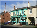
Living in DY4 9AB offers access to a range of nearby amenities within practical reach. Retail options include Aldi Priory, Co-op Woodsetton, and Farmfoods Tipton, providing essential shopping and grocery needs. The area’s rail and metro stations—such as Tipton, Coseley, and Bradley Lane—offer convenient links to broader networks, facilitating travel to work, leisure, or social events. While the postcode itself is small, the surrounding area likely includes parks and open spaces, though specific names are not provided in the data. The presence of multiple retail and transport hubs suggests a lifestyle focused on accessibility and practicality, ideal for those prioritising ease of movement and proximity to services. However, the compact nature of the area may limit the variety of leisure or cultural options, requiring residents to venture slightly further for more specialised amenities.
Amenities
Schools
| Rank | School | Type | Entry gender | Ages |
|---|
Explore more schools in this area
Go to Schools tabDemographics
The population of DY4 9AB is 1,772, with a median age of 47. The majority of residents fall within the 30–64 age range, indicating a mature, stable community. Home ownership stands at 54%, with houses being the predominant type of accommodation. This suggests a mix of long-term residents and families, though the area’s compact size limits the diversity of household types. The predominant ethnic group is White, reflecting broader regional patterns. The high population density—over 100,000 people per square kilometre—points to a tightly packed residential cluster, which may influence the availability of private outdoor space. While no specific data on deprivation is provided, the age profile and home ownership rate suggest a community with established economic foundations, though the area’s small size may limit access to broader social or cultural amenities.
Household Size
Accommodation Type
Tenure
Ethnic Group
Religion
Household Composition
Age
Household Deprivation
NS-SEC
Explore more demographic insights in this area
Go to Demographics tabPlanning
Planning Constraints
- Flood RiskPremium
- Ramsar Wetland SitesPremium
- Area of Outstanding Natural BeautyPremium
- Protected Nature ReservePremium
- Protected WoodlandPremium