Area Overview for CV3 1HT
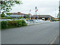
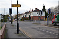
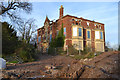
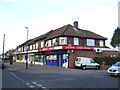
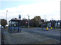
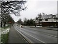
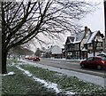
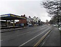
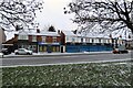
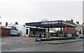
Photos of CV3 1HT


Area Information
CV3 1HT is a small, densely populated postcode area in Coventry, England, covering just 2.2 hectares and home to 2,798 residents. Its high population density of 127,673 people per square kilometre reflects a compact, residential cluster situated near the city’s southern edge. The area straddles the Coventry-Rugby railway line, with newer housing developments to the north and older industrial zones to the south. Historically linked to Pinley, it has roots in Saxon-era landholdings and 19th-century railway infrastructure. Today, it balances recent residential growth with remnants of light industry, creating a mix of tightly packed homes and small-scale commercial spaces. Proximity to Coventry’s city centre and multiple rail stations makes it accessible for commuters, while its proximity to former car manufacturing sites hints at a legacy of industrial activity. The area’s character is defined by its proximity to transport networks and its role as a transitional zone between urban and suburban Coventry. For buyers, it offers a compact, well-connected environment with a focus on practical living, though its density and industrial past may influence its appeal.
- Area Type
- Postcode
- Area Size
- 2.2 hectares
- Population
- Not available
- Population Density
- Not available
The property market in CV3 1HT is dominated by owner-occupied homes, with 70% of properties owned by residents rather than rented. The area’s accommodation type is primarily houses, reflecting a preference for standalone properties over flats or apartments. This suggests a market tailored to families and individuals seeking private, self-contained living spaces. Given the area’s small size and high density, housing stock is limited, and the immediate surroundings likely offer few alternatives. The proximity to former industrial sites and the railway line may influence property values, with newer developments to the north potentially commanding higher prices due to their residential focus. Buyers should consider the compact nature of the area and its industrial legacy when evaluating long-term suitability, as property options may be constrained by location and zoning.
House Prices in CV3 1HT
Showing 27 properties
| Address | Type | Beds | Baths | Last Sale Price | Last Sale Date | |
|---|---|---|---|---|---|---|
| 242 Binley Road, Coventry, CV3 1HT | Semi-detached | 4 | 1 | £415,000 | Mar 2025 | |
| 274 Binley Road, Coventry, CV3 1HT | house | 4 | 1 | £357,000 | Mar 2022 | |
| 262 Binley Road, Coventry, CV3 1HT | house | - | - | £405,000 | Nov 2021 | |
| 252 Binley Road, Coventry, CV3 1HT | Semi-detached | 4 | 1 | £353,000 | Jun 2020 | |
| 254 Binley Road, Coventry, CV3 1HT | Semi-detached | 4 | 1 | £364,125 | Sep 2019 | |
| 280 Binley Road, Coventry, CV3 1HT | Semi-detached | 4 | 1 | £285,000 | Jul 2019 | |
| 264 Binley Road, Coventry, CV3 1HT | Detached | 6 | 2 | £295,000 | Jun 2017 | |
| 260 Binley Road, Coventry, CV3 1HT | house | - | - | £321,500 | Nov 2015 | |
| 258 Binley Road, Coventry, CV3 1HT | Semi-detached | 4 | - | £275,000 | Nov 2015 | |
| 276 Binley Road, Coventry, CV3 1HT | house | - | - | £260,000 | Oct 2015 |
Energy Efficiency in CV3 1HT
The lifestyle in CV3 1HT is shaped by its proximity to retail and transport hubs. Nearby shops include Lidl Upper, Iceland Binley, and Budgens Aldermoor, offering everyday essentials within practical reach. The area’s rail stations—Coventry Arena, Canley, and Bedworth—provide easy access to Coventry’s city centre and regional connections, enhancing convenience for commuters. While the data does not mention parks or leisure facilities, the presence of multiple retail outlets and transport links suggests a practical, service-oriented lifestyle. The mix of residential and industrial zones may influence the character of daily life, blending convenience with a compact, connected environment.
Amenities
Schools
The nearest school to CV3 1HT is Pattison College, an independent institution. No other schools are listed in the data, so families relying on state education may need to look beyond the immediate area. Pattison College’s independent status means it likely operates on a fee-paying basis, offering a distinct educational model compared to state schools. For those prioritising independent education, this provides a direct option, but for others, commuting to nearby state schools in Coventry or surrounding areas would be necessary. The absence of additional schools highlights the importance of checking broader regional options for comprehensive schooling.
| Rank | School | Type | Entry gender | Ages |
|---|
Explore more schools in this area
Go to Schools tabDemographics
The population of CV3 1HT skews towards adults aged 30–64, with a median age of 47. This suggests a community of established professionals and families, rather than a younger or elderly demographic. Home ownership is high at 70%, indicating a stable, long-term resident base. The area is predominantly composed of houses, reflecting a preference for standalone properties over flats. The predominant ethnic group is White, with no specific data provided on other demographics. The high population density of 127,673 people per square kilometre means living spaces are closely packed, which could affect privacy and outdoor space availability. While no deprivation data is explicitly stated, the mix of owner-occupied homes and industrial proximity may influence local amenities and service accessibility. The area’s demographic profile aligns with a mature, settled community focused on practical housing needs.
Household Size
Accommodation Type
Tenure
Ethnic Group
Religion
Household Composition
Age
Household Deprivation
NS-SEC
Explore more demographic insights in this area
Go to Demographics tabPlanning
Planning Constraints
- Flood RiskPremium
- Ramsar Wetland SitesPremium
- Area of Outstanding Natural BeautyPremium
- Protected Nature ReservePremium
- Protected WoodlandPremium