Area Overview for CV3 1HH
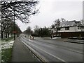
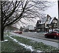
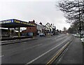
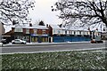
Photos of CV3 1HH


Area Information
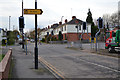
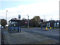
CV3 1HH occupies a small residential cluster of 8427 square metres with a population of 2798. This specific postcode sits within the Lower Stoke Ward of Coventry, placing it to the south-east of the city centre. The location straddles two distinct phases of development divided by the Coventry-Rugby railway line. Newer housing estates located to the north replace former car manufacturing works, while the area to the south retains light industrial estates and small warehouses. Residents navigate properties that are tightly packed, often square-shaped, with intermittent parking and grass verges on southern streets. While medieval remains and a potential moat lie near Wheler Road, most historic features have been erased by centuries of proximity to the city. The area is surrounded by other settlements, including those stretching towards Bedworth. Living in CV3 1HH means accepting a postcode that covers a small residential cluster but offers immediate access to major transport arteries. You are asking to live in an area where history merges with modern redevelopment. The character is defined by the railway line that bisects the ward, creating a clear boundary between industrial heritage and contemporary housing schemes. This specific postcode transforms a former industrial zone into a neighbourhood suitable for families and commuters.
- Area Type
- Postcode
- Area Size
- 8427 m²
- Population
- Not available
- Population Density
- Not available
Homes in CV3 1HH consist primarily of houses, which represents the standard accommodation type for this postcode. The area reflects a property market heavily skewed towards owner occupation, with 70% of residents owning their dwellings. This high ownership percentage indicates a stable market where families have invested in homes rather than relying on the private rental sector. The housing stock in this small area replaced former industrial sites such as the Humber and Peugeot factories in the north. These properties generally follow the pattern of newer residential development found on the northern side of the Coventry-Rugby railway line. Residents access properties that are tightly packed and square-shaped, consistent with the 8427 square metre footprint of the cluster. The market here serves buyers seeking a foothold in Coventry's expanding outer ring rather than the inner city fringe. You are looking at a district where light industry gives way to family housing. The property types are uniform, avoiding the diversity of large mixed-use blocks or student-led conversions. This consistency suits buyers who want a straightforward purchase process in a residential cluster surrounded by established settlements like Bedworth and Pinley.
House Prices in CV3 1HH
Showing 34 properties
| Address | Type | Beds | Baths | Last Sale Price | Last Sale Date | |
|---|---|---|---|---|---|---|
| 4 Uxbridge Avenue, Coventry, CV3 1HH | house | - | - | £180,000 | Apr 2024 | |
| 12 Uxbridge Avenue, Coventry, CV3 1HH | Block of Flats | 4 | 4 | £175,000 | Dec 2023 | |
| 27 Uxbridge Avenue, Coventry, CV3 1HH | house | - | - | £140,000 | Nov 2020 | |
| 11 Uxbridge Avenue, Coventry, CV3 1HH | Terraced | 3 | - | £131,500 | May 2017 | |
| 14 Uxbridge Avenue, Coventry, CV3 1HH | house | - | - | £134,500 | Jul 2011 | |
| 21 Uxbridge Avenue, Coventry, CV3 1HH | house | - | - | £131,000 | Mar 2011 | |
| 7 Uxbridge Avenue, Coventry, CV3 1HH | Terraced | 3 | 1 | £114,500 | Apr 2010 | |
| 29 Uxbridge Avenue, Coventry, CV3 1HH | house | 4 | 1 | £95,000 | Sep 2005 | |
| 9 Uxbridge Avenue, Coventry, CV3 1HH | Terraced | - | - | £87,000 | Dec 2003 | |
| 10 Uxbridge Avenue, Coventry, CV3 1HH | Terraced | - | - | £64,000 | Sep 2002 |
Energy Efficiency in CV3 1HH
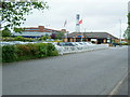
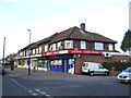
Daily life in CV3 1HH centres on practical convenience and access to essential services. Residents have five retail outlets within practical reach, including Lidl Upper, Iceland Binley, and Budgens Aldermoor. These shops provide food, groceries, and household necessities without requiring a long journey into the city centre. Five railway stations lie nearby, offering seamless connections for work and leisure. Two airports, both identified as Coventry Airport, sit close enough to facilitate occasional travel. The area sits within Lower Stoke Ward, historically characterised as a light industrial zone that has transitioned into a residential character area. This evolution means you gain access to urban infrastructure while retaining a quieter suburban feel. The lifestyle here avoids the congestion of inner-city living while maintaining proximity to key amenities. You can shop at Lidl or Iceland with minimal travel time. Commuting to bed工作或 opportunities in the wider West Midlands remains straightforward. The neighbourhood balances industrial heritage with modern residential comfort.
Amenities
Schools
Families considering CV3 1HH have access to specific educational institutions nearby, most notably Pattison College. This school operates as an independent institution, offering an alternative to the state sector for those seeking such options. For residents searching for schools near CV3 1HH, this represents a primary choice alongside potential local state schools not explicitly listed in the immediate data. The presence of an independent school indicates that the local community values educational choice and may have the financial capacity to support such facilities. Living in CV3 1HH means you are close to an area defined by character area 3, which historically supported light industry but now supports residential growth. The mix of school types provides flexibility for parents with different educational preferences. While the data highlights only one specific nearby institution, the location within Lower Stoke Ward places students within reasonable commuting distance of broader Coventry educational networks. You must verify current Ofsted ratings and intake policies directly with Pattison College or local authorities, as the provided data lists only the name and type. This reliance on independent provision suggests a community where education is a significant local priority.
| Rank | School | Type | Entry gender | Ages |
|---|
Explore more schools in this area
Go to Schools tabDemographics
The community in CV3 1HH reflects a mature demographic profile with a median age of 47 years. The most common age range comprises adults aged 30 to 64 years, indicating a population likely focused on working life and family stability rather than youthful dependency. Seventy per cent of residents own their homes, which establishes a stable, owner-occupied environment rather than a transient rental market. Houses remain the predominant accommodation type, aligning with the preference for detached or semi-detected structures common in suburban developments. The predominant ethnic group is White, mirroring the broader demographic makeup of the surrounding Coventry region. This area does not present significant deprivation issues; instead, it offers a standard running cost profile where residents benefit from local commerce and reliable services. The high home ownership rate of 70% suggests that many households have long-term roots in the neighbourhood. Families raising children between the ages of 30 and 64 will find a community where neighbours are likely established homeowners. This demographic stability contrasts with areas known for high turnover or youthful/student populations. You will find a settled community where residents have invested in their property and local surroundings over time.
Household Size
Accommodation Type
Tenure
Ethnic Group
Religion
Household Composition
Age
Household Deprivation
NS-SEC
Explore more demographic insights in this area
Go to Demographics tabPlanning
Planning Constraints
- Flood RiskPremium
- Ramsar Wetland SitesPremium
- Area of Outstanding Natural BeautyPremium
- Protected Nature ReservePremium
- Protected WoodlandPremium