Area Overview for CV3 1HF
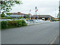
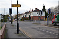
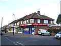
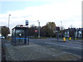
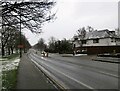
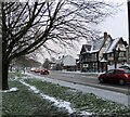
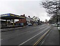
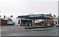
Photos of CV3 1HF


Area Information
CV3 1HF is a compact residential postcode in Coventry’s Lower Stoke Ward, covering just 1.1 hectares with a dense population of 1257 people. This area, part of a broader character zone defined by light industry and recent housing development, lies to the south-east of Coventry city centre. Its history is rooted in Saxon origins and medieval landholding, with 20th-century transformations from car manufacturing to modern housing. Today, the area splits along the Coventry-Rugby railway line: newer residential zones north of the line and older industrial estates south. Despite its small size, it offers proximity to Coventry’s core, with rail links to the city’s major stations and nearby airports. The community here is predominantly middle-aged adults (30–64 years), with 73% owning their homes. Daily life is shaped by its mix of residential and industrial landscapes, though historic features are scarce, replaced by modern housing and light industry. Living here means a compact, high-density environment with easy access to urban amenities, though the area’s character is defined by its post-industrial evolution and proximity to the city’s pulse.
- Area Type
- Postcode
- Area Size
- 1.1 hectares
- Population
- 1257
- Population Density
- 6523 people/km²
The property market in CV3 1HF is characterised by high home ownership (73%) and a predominance of houses. This suggests a market skewed towards owner-occupied properties rather than rental investments. Given the area’s small size (1.1 hectares) and high population density, housing stock is likely limited to smaller, tightly packed homes, reflecting the post-industrial redevelopment of former factory sites. The presence of recent housing developments north of the Coventry-Rugby railway line indicates a focus on residential expansion, while the southern part of the area retains older industrial infrastructure. Buyers should note that the market is not heavily reliant on rental demand, which may affect property value trends. For those considering the area, the compact nature of CV3 1HF means proximity to Coventry’s city centre is a key advantage, though the limited land area may restrict housing diversity. Potential buyers should also consider the area’s industrial heritage, which may influence property aesthetics and local amenities.
House Prices in CV3 1HF
Showing 37 properties
| Address | Type | Beds | Baths | Last Sale Price | Last Sale Date | |
|---|---|---|---|---|---|---|
| 14 Emscote Road, Coventry, CV3 1HF | house | - | - | £165,000 | Nov 2023 | |
| 22 Emscote Road, Coventry, CV3 1HF | Detached | 3 | 2 | £190,000 | Jun 2022 | |
| 15 Emscote Road, Coventry, CV3 1HF | house | 3 | 1 | £190,000 | Mar 2022 | |
| 11 Emscote Road, Coventry, CV3 1HF | house | - | - | £198,000 | Jul 2021 | |
| 5 Emscote Road, Coventry, CV3 1HF | house | - | - | £130,000 | Apr 2019 | |
| 6 Emscote Road, Coventry, CV3 1HF | Semi-detached | 2 | 1 | £162,000 | Jan 2018 | |
| 18 Emscote Road, Coventry, CV3 1HF | Terraced | 2 | 1 | £120,000 | Feb 2017 | |
| 13 Emscote Road, Coventry, CV3 1HF | Terraced | 4 | 2 | £162,000 | Mar 2016 | |
| 16 Emscote Road, Coventry, CV3 1HF | Terraced | 2 | 1 | £118,000 | Dec 2015 | |
| 33 Emscote Road, Coventry, CV3 1HF | Semi-detached | 3 | - | £147,500 | Aug 2014 |
Energy Efficiency in CV3 1HF
Living in CV3 1HF provides access to a range of retail and transport amenities within short distances. The area is served by five retail outlets, including Lidl Upper, Iceland Binley, and Tesco Ball Hill, offering everyday shopping needs. Nearby rail stations—Coventry Arena, Canley, and Bedworth—provide frequent services to Coventry’s core and regional hubs, while two airports (both named Coventry Airport in the data) are accessible for travel. The character of the area blends residential and industrial elements, with small, square-shaped factories and warehouses south of the Coventry-Rugby railway line. While there are no named parks or leisure facilities in the data, the proximity to Coventry’s city centre suggests access to larger recreational spaces. The compact layout means amenities are tightly clustered, making daily errands efficient. However, the absence of specific leisure venues or green spaces in the data highlights a potential limitation for those prioritising outdoor activities. Overall, the area’s lifestyle is practical, with a focus on connectivity and convenience over expansive recreational opportunities.
Amenities
Schools
| Rank | School | Type | Entry gender | Ages |
|---|
Explore more schools in this area
Go to Schools tabDemographics
The population of CV3 1HF is 1257 people, with a median age of 47, indicating a community skewed towards middle-aged adults. The most common age range is 30–64 years, suggesting a stable demographic with established households. Home ownership is high at 73%, reflecting a predominantly owner-occupied area rather than a rental market. Accommodation is primarily houses, which is unusual for a small postcode but aligns with the area’s post-industrial housing developments. The predominant ethnic group is White, with no data provided on other groups. The high population density of 118,985 people per square kilometre underscores the compact nature of the area, which may influence social dynamics and community cohesion. While specific deprivation data is absent, the high home ownership and mature age profile suggest a relatively stable, low-turnover community. This demographic profile indicates a neighbourhood where residents are likely to have long-term ties to the area, though the lack of diversity data limits broader conclusions about cultural or social diversity.
Household Size
Accommodation Type
Tenure
Ethnic Group
Religion
Household Composition
Age
Household Deprivation
NS-SEC
Explore more demographic insights in this area
Go to Demographics tabPlanning
Planning Constraints
- Flood RiskPremium
- Ramsar Wetland SitesPremium
- Area of Outstanding Natural BeautyPremium
- Protected Nature ReservePremium
- Protected WoodlandPremium