Area Overview for CV3 1HS
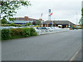
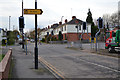
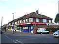
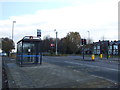
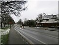
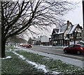
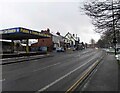
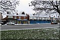
Photos of CV3 1HS


Area Information
CV3 1HS is a compact residential postcode in the Lower Stoke Ward of Coventry, England, covering 6,560 square metres and home to 1,676 residents. Its high population density of 255,497 people per square kilometre reflects a tightly knit community. The area sits on the edge of Coventry city centre, with a mix of newer housing developments to the north and older industrial zones to the south, shaped by historical car manufacturing and recent redevelopment. The Coventry-Rugby railway line divides the area, with nearby stations like Coventry Arena and Canley offering rail links to the city and beyond. While the postcode lacks protected natural sites or ancient monuments, its proximity to Coventry’s urban core provides access to cultural and commercial hubs. Daily life here balances the practicality of light industry with the convenience of nearby amenities, making it a pragmatic choice for those seeking a mix of residential and industrial living without the sprawl of larger cities.
- Area Type
- Postcode
- Area Size
- 6560 m²
- Population
- 1676
- Population Density
- 6254 people/km²
The property market in CV3 1HS is characterised by high home ownership (79%) and a focus on houses rather than flats or apartments. This suggests a community where long-term residency is common, with properties likely to be family homes rather than investment assets. The area’s small size and proximity to industrial zones may influence property values, with newer developments to the north offering modern housing and older areas to the south retaining historical character. Buyers should consider the limited availability of properties in such a small postcode, which may drive competition. The predominance of houses over other accommodation types means the market is less suited to renters seeking flexibility, though nearby towns like Coventry offer broader options. For those prioritising stability and space, CV3 1HS presents a focused, owner-occupied environment.
House Prices in CV3 1HS
Showing 8 properties
| Address | Type | Beds | Baths | Last Sale Price | Last Sale Date | |
|---|---|---|---|---|---|---|
| 294 Binley Road, Coventry, CV3 1HS | Semi-detached | 3 | 1 | £210,000 | Oct 2020 | |
| Grange Lodge, 300 Binley Road, Coventry, CV3 1HS | house | - | - | £439,750 | Mar 2018 | |
| 286 Binley Road, Coventry, CV3 1HS | Semi-detached | - | - | £239,000 | Mar 2014 | |
| 284 Binley Road, Coventry, CV3 1HS | Detached | - | - | £249,950 | Oct 2006 | |
| 290 Binley Road, Coventry, CV3 1HS | Semi-detached | - | - | £196,000 | Sep 2006 | |
| 296 Binley Road, Coventry, CV3 1HS | Semi-detached | 3 | 1 | £71,000 | Mar 2000 | |
| 288 Binley Road, Coventry, CV3 1HS | Semi-detached | - | - | - | - | |
| 292 Binley Road, Coventry, CV3 1HS | house | - | - | - | - |
Energy Efficiency in CV3 1HS
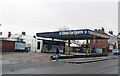
Living in CV3 1HS offers access to essential retail and transport hubs. Nearby shops include Lidl Upper, Iceland Binley, and Budgens Aldermoor, providing everyday convenience for groceries and household needs. The area’s rail connectivity, with stations like Coventry Arena and Canley, ensures easy access to Coventry’s cultural and commercial centres. While parks or green spaces are not explicitly mentioned in the data, the area’s proximity to Coventry’s urban fabric means residents can enjoy the city’s amenities, including museums, theatres, and shopping districts. The mix of retail, rail links, and proximity to Coventry creates a lifestyle that balances practicality with urban vibrancy, ideal for those prioritising accessibility over expansive natural landscapes.
Amenities
Schools
| Rank | School | Type | Entry gender | Ages |
|---|
Explore more schools in this area
Go to Schools tabDemographics
The population of CV3 1HS is predominantly adults aged 30–64, with a median age of 47. This suggests a mature, stable community with a strong presence of working-age residents. Home ownership is high at 79%, indicating a preference for long-term residency over renting. The area is largely composed of houses, reflecting a traditional, family-oriented housing stock. The predominant ethnic group is White, though specific data on diversity or deprivation is not provided. The age profile and ownership rates suggest a neighbourhood where many residents are established in their careers and homes, contributing to a sense of continuity. With no explicit data on deprivation, the area’s quality of life appears to align with its safety and connectivity metrics, though further local insights would clarify social dynamics.
Household Size
Accommodation Type
Tenure
Ethnic Group
Religion
Household Composition
Age
Household Deprivation
NS-SEC
Explore more demographic insights in this area
Go to Demographics tabPlanning
Planning Constraints
- Flood RiskPremium
- Ramsar Wetland SitesPremium
- Area of Outstanding Natural BeautyPremium
- Protected Nature ReservePremium
- Protected WoodlandPremium