Area Overview for CV2 5JY
Photos of CV2 5JY

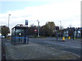
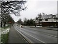
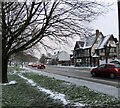
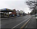
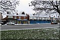
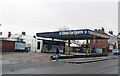
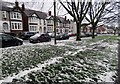
33 photos from this area
Area Information
Key information about the CV2 5JY including its size, population, and administrative classification.
- Area Type
- Postcode
- Area Size
- 1.0 hectares
- Population
- 1676
- Population Density
- 6254 people/km²
House Prices in CV2 5JY
29
Properties
£132,317
Average Sold Price
£43,800
Lowest Price
£252,500
Highest Price
Showing 29 properties
| Address | Type | Beds | Baths | Last Sale Price | Last Sale Date | |
|---|---|---|---|---|---|---|
| 16 Omar Road, Coventry, CV2 5JY | house | - | - | £252,500 | Feb 2021 | |
| 4 Omar Road, Coventry, CV2 5JY | Semi-detached | 3 | 1 | £225,000 | Apr 2019 | |
| 56 Omar Road, Coventry, CV2 5JY | Terraced | - | - | £190,000 | Mar 2019 | |
| 2 Omar Road, Coventry, CV2 5JY | Semi-detached | 3 | 2 | £226,000 | Mar 2017 | |
| 52 Omar Road, Coventry, CV2 5JY | Terraced | 3 | 1 | £125,000 | Apr 2014 | |
| 42 Omar Road, Coventry, CV2 5JY | Terraced | 3 | - | £137,000 | Mar 2014 | |
| 54 Omar Road, Coventry, CV2 5JY | Terraced | 3 | - | £131,500 | Aug 2013 | |
| 12 Omar Road, Coventry, CV2 5JY | house | 3 | - | £178,500 | Sep 2012 | |
| 14 Omar Road, Coventry, CV2 5JY | Semi-detached | 3 | 1 | £169,500 | Jan 2012 | |
| 24 Omar Road, Coventry, CV2 5JY | house | 3 | - | £145,000 | Sep 2010 |
Page 1 of 3
Energy Efficiency in CV2 5JY
Amenities
Schools
| Rank | School | Type | Entry gender | Ages |
|---|
Explore more schools in this area
Go to Schools tabDemographics
Household Size
Family (3-5 people)
most common
Accommodation Type
Houses
most common
Tenure
79
majority
Ethnic Group
White
most common
Religion
N/A
most common
Household Composition
N/A
most common
Age
47
median
Adults (30-64 years)
most common
Household Deprivation
N/A
with no deprivation
NS-SEC
34
in Lower managerial occupations
Explore more demographic insights in this area
Go to Demographics tabPlanning
Planning Constraints
- Flood RiskPremium
- Ramsar Wetland SitesPremium
- Area of Outstanding Natural BeautyPremium
- Protected Nature ReservePremium
- Protected WoodlandPremium