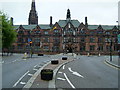
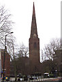
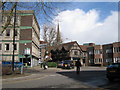
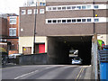
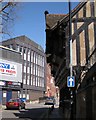
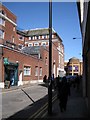
Area Overview for CV1 2UH
Photos of CV1 2UH


Area Information
Living in CV1 2UH means residing in a specific postcode area that covers a small residential cluster with a total size of 2,563 m². This compact residential zone forms part of the broader Coventry landscape in England. You are joining a community of 2,774 people who call this specific sector home. The area is defined by its residential focus, where daily life revolves around the immediate neighbourhood and nearby town centres. You will find yourself in an environment where ground-level amenities provide convenience without lengthy commutes. The area functions as a distinct pocket within the larger city, offering a sense of locality while remaining connected to wider transport networks. Residents here balance the intimacy of a small postcode cluster with the practical reach of nearby rail stations and retail hubs. Whether you are considering homes in this zone for the first time or relocating from elsewhere, the structure of CV1 2UH offers a defined space for living, work, and leisure activities close by.
- Area Type
- Postcode
- Area Size
- 2563 m²
- Population
- 2774
- Population Density
- 3470 people/km²
The property market in CV1 2UH is characterised primarily by houses, making it a unique pocket within the wider postcode system. With 46% home ownership, the area balances between investor properties and owner-occupied homes. This split suggests a market where long-term residents own their properties, while the remaining half may be rented to students or professionals working in Coventry. When looking at homes in this area, you will find a stock dominated by residential housing rather than student flats or purpose-built apartments. This is notable because the demographic median age of 22 usually correlates with high rental demand and smaller units. Instead, the presence of houses indicates either family housing or larger accommodation suitable for groups sharing costs. Buyers looking at this postcode should note that the small area size of 2,563 m² limits the scope of the immediate inventory. The housing stock supports a community of 2,774 people living in confined space. The mix of ownership means you can find both secured homes and investment rentals. The market does not cater to luxury high-end buyers seeking detached mansions, but rather practical housing suited to the youthful population. Understanding this split is key to finding a home that fits your living style and financial goals within CV1 2UH.
House Prices in CV1 2UH
Showing 10 properties
| Address | Type | Beds | Baths | Last Sale Price | Last Sale Date | |
|---|---|---|---|---|---|---|
| 3 Bushelton Close, Coventry, CV1 2UH | Terraced | 3 | 2 | £275,000 | Aug 2025 | |
| 5 Bushelton Close, Coventry, CV1 2UH | Terraced | 3 | 1 | £243,000 | Jun 2018 | |
| 6 Bushelton Close, Coventry, CV1 2UH | Terraced | 3 | 1 | £201,000 | Apr 2018 | |
| 8 Bushelton Close, Coventry, CV1 2UH | Semi-detached | 4 | 2 | £232,000 | Sep 2017 | |
| 1 Bushelton Close, Coventry, CV1 2UH | Terraced | 4 | - | £205,000 | Sep 2015 | |
| 12 Bushelton Close, Coventry, CV1 2UH | Terraced | 4 | 2 | £142,000 | Oct 2008 | |
| 2 Bushelton Close, Coventry, CV1 2UH | house | - | - | £153,000 | Oct 2006 | |
| 4 Bushelton Close, Coventry, CV1 2UH | house | - | - | £140,000 | Oct 2005 | |
| 14 Bushelton Close, Coventry, CV1 2UH | Terraced | 3 | - | £115,000 | May 2002 | |
| 10 Bushelton Close, Coventry, CV1 2UH | Terraced | 3 | 1 | £109,000 | Apr 2002 |
Energy Efficiency in CV1 2UH
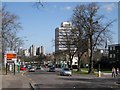
Your daily life in CV1 2UH is supported by a cluster of shops and transport links within practical reach. Five retail outlets form the core shopping experience, with notable venues including Sainsburys Coventry, M&S Coventry Rail SF, and another Sainsburys Coventry. These supermarkets provide essential groceries and household goods without needing long journeys. Transport convenience is amplified by five nearby railway stations, including Canley Railway Station and Coventry Arena Railway Station. This network gives you easy access to the wider city and regional destinations. Two Coventry Airport sites are accessible, offering quick departures for travel plans. You will find convenient access to essential amenities within the residential cluster. The presence of major supermarkets and multiple rail stations means daily tasks like shopping, commuting, and socialising are manageable locally. This layout suits commuters and families who prefer a balanced routine between home and work. The area supports a functional lifestyle where necessities are nearby while connectivity keeps you linked to the city at large.
Amenities
Schools
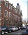
Families considering CV1 2UH have access to two specific independent schools in the immediate vicinity. Cheshunt School operates as an independent institution, catering to students with a private education focus. Rathbone Choices is similarly an independent school, offering alternative educational pathways for those seeking non-state schooling. The presence of these two independent schools does not indicate a large state school population directly within the postcode, but it does provide options for private education. You do not have comprehensive state primary or secondary school data for this specific sector from the available records, but these independent options represent the known educational institutions nearby. For parents attending school runs, these facilities are within practical reach. The independent nature of both Cheshunt School and Rathbone Choices means they offer distinct curricula and fee structures compared to local state schools. If you are seeking independent education, these venues are your primary options listed in the area data. Families must research further on curriculum fit and cost, as the provided data identifies the type and name only.
| Rank | School | Type | Entry gender | Ages |
|---|
Explore more schools in this area
Go to Schools tabDemographics
The community in CV1 2UH has a distinct age profile dominated by young adults aged 15 to 29 years. You will find that the median age across this postcode is just 22, indicating a population heavily weighted towards youth. This age demographic shapes the social fabric, creating an atmosphere more typical of a student or early-career hub than a family suburb. Housing tenure here is split, with 46% of residents owning their homes outright or via mortgage. The remaining population likely resides in rental properties given the high proportion of young adults. The predominant accommodation type consists of houses, which contrasts slightly with the region's typical high-rise or studio preference near university campuses. The ethnic composition is predominantly white, reflecting the historical makeup of many established parts of Coventry. These figures suggest a community in transition, where single households and young families coexist with fewer working-age families. The density of 1,082,185 people per km² highlights how efficiently this small land area is utilised. You should approach the data with an eye on the youth focus when considering neighbours, local services, and the general energy of streets in CV1 2UH.
Household Size
Accommodation Type
Tenure
Ethnic Group
Religion
Household Composition
Age
Household Deprivation
NS-SEC
Explore more demographic insights in this area
Go to Demographics tabPlanning
Planning Constraints
- Flood RiskPremium
- Ramsar Wetland SitesPremium
- Area of Outstanding Natural BeautyPremium
- Protected Nature ReservePremium
- Protected WoodlandPremium