Area Overview for CV1 2JT
Photos of CV1 2JT
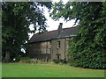
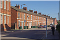
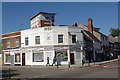

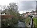
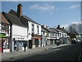

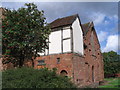
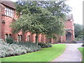
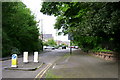
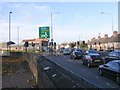
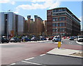
100 photos from this area
Area Information
Key information about the CV1 2JT including its size, population, and administrative classification.
- Area Type
- Postcode
- Area Size
- 9.9 hectares
- Population
- 2774
- Population Density
- 3470 people/km²
House Prices in CV1 2JT
26
Properties
£142,000
Average Sold Price
£142,000
Lowest Price
£142,000
Highest Price
Showing 26 properties
| Address | Type | Beds | Baths | Last Sale Price | Last Sale Date | |
|---|---|---|---|---|---|---|
| 80 London Road, Coventry, CV1 2JT | house | 1 | 1 | £142,000 | Jan 2015 | |
| 76 London Road, Coventry, CV1 2JT | Terraced | 1 | 1 | - | - | |
| Mess Room, London Road Cemetery, London Road, Coventry, CV1 2JT | Office | - | - | - | - | |
| Flat, 78 London Road, Coventry, CV1 2JT | Terraced | 2 | 1 | - | - | |
| Flat Over, 82 London Road, Coventry, CV1 2JT | Flat | - | - | - | - | |
| 76A London Road, Coventry, CV1 2JT | hotel | - | - | - | - | |
| Paxton Lodge, London Road Cemetery, London Road, Coventry, CV1 2JT | office_workshop | - | - | - | - | |
| Csm Coventry Car Sales, 84-86 London Road, Coventry, CV1 2JT | shop | - | - | - | - | |
| London Road Cemetery, London Road, Coventry, CV1 2JT | commercial | - | - | - | - | |
| Flat 7, 82-86 London Road, Coventry, CV1 2JT | Flat | - | 1 | - | - |
Page 1 of 3
Energy Efficiency in CV1 2JT
Amenities
Schools
| Rank | School | Type | Entry gender | Ages |
|---|
Explore more schools in this area
Go to Schools tabDemographics
Household Size
One person
most common
Accommodation Type
Houses
most common
Tenure
46
majority
Ethnic Group
White
most common
Religion
N/A
most common
Household Composition
N/A
most common
Age
22
median
Young Adults (15-29 years)
most common
Household Deprivation
N/A
with no deprivation
NS-SEC
25
in Lower managerial occupations
Explore more demographic insights in this area
Go to Demographics tabPlanning
Planning Constraints
- Flood RiskPremium
- Ramsar Wetland SitesPremium
- Area of Outstanding Natural BeautyPremium
- Protected Nature ReservePremium
- Protected WoodlandPremium