Area Overview for CV1 2UG
Photos of CV1 2UG
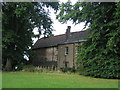
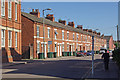
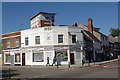
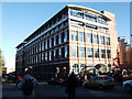
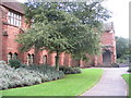
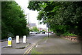
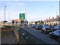
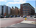
100 photos from this area
Area Information
Key information about the CV1 2UG including its size, population, and administrative classification.
- Area Type
- Postcode
- Area Size
- 6383 m²
- Population
- 2774
- Population Density
- 3470 people/km²
House Prices in CV1 2UG
41
Properties
£123,472
Average Sold Price
£94,500
Lowest Price
£150,000
Highest Price
Showing 41 properties
| Address | Type | Beds | Baths | Last Sale Price | Last Sale Date | |
|---|---|---|---|---|---|---|
| 4 Pipkin Court, Coventry, CV1 2UG | Flat | - | - | £146,000 | Aug 2023 | |
| 26 Pipkin Court, Coventry, CV1 2UG | Flat | 2 | - | £150,000 | Aug 2023 | |
| 19 Pipkin Court, Coventry, CV1 2UG | Flat | 2 | - | £145,000 | Feb 2022 | |
| 37 Pipkin Court, Coventry, CV1 2UG | Flat | 2 | 1 | £137,000 | Nov 2021 | |
| 32 Pipkin Court, Coventry, CV1 2UG | Flat | - | - | £135,000 | Oct 2021 | |
| 17 Pipkin Court, Coventry, CV1 2UG | Flat | 2 | - | £131,500 | Sep 2021 | |
| 29 Pipkin Court, Coventry, CV1 2UG | Detached | - | - | £138,000 | Feb 2021 | |
| 28 Pipkin Court, Coventry, CV1 2UG | Flat | - | - | £136,000 | Jan 2021 | |
| 36 Pipkin Court, Coventry, CV1 2UG | Flat | - | - | £145,000 | Oct 2020 | |
| 27 Pipkin Court, Coventry, CV1 2UG | Flat | - | - | £145,000 | Jan 2019 |
Page 1 of 5
Energy Efficiency in CV1 2UG
Amenities
Schools
| Rank | School | Type | Entry gender | Ages |
|---|
Explore more schools in this area
Go to Schools tabDemographics
Household Size
One person
most common
Accommodation Type
Houses
most common
Tenure
46
majority
Ethnic Group
White
most common
Religion
N/A
most common
Household Composition
N/A
most common
Age
22
median
Young Adults (15-29 years)
most common
Household Deprivation
N/A
with no deprivation
NS-SEC
25
in Lower managerial occupations
Explore more demographic insights in this area
Go to Demographics tabPlanning
Planning Constraints
- Flood RiskPremium
- Ramsar Wetland SitesPremium
- Area of Outstanding Natural BeautyPremium
- Protected Nature ReservePremium
- Protected WoodlandPremium