Area Overview for B90 2TA
Photos of B90 2TA
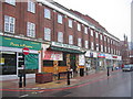


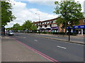
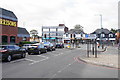

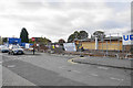


50 photos from this area
Area Information
Key information about the B90 2TA including its size, population, and administrative classification.
- Area Type
- Postcode
- Area Size
- 3.2 hectares
- Population
- 2297
- Population Density
- 4743 people/km²
House Prices in B90 2TA
66
Properties
£229,213
Average Sold Price
£70,950
Lowest Price
£423,000
Highest Price
Showing 66 properties
| Address | Type | Beds | Baths | Last Sale Price | Last Sale Date | |
|---|---|---|---|---|---|---|
| 45 Glascote Close, Shirley, Solihull, B90 2TA | Semi-detached | 3 | 1 | £353,030 | Aug 2024 | |
| 27 Glascote Close, Shirley, Solihull, B90 2TA | Semi-detached | 3 | 1 | £331,000 | May 2024 | |
| 2 Glascote Close, Shirley, Solihull, B90 2TA | Bungalow | 2 | 1 | £294,150 | Dec 2022 | |
| 73 Glascote Close, Shirley, Solihull, B90 2TA | house | 3 | 2 | £423,000 | Nov 2022 | |
| 61 Glascote Close, Shirley, Solihull, B90 2TA | Retail | 3 | 1 | £335,000 | Nov 2022 | |
| 31 Glascote Close, Shirley, Solihull, B90 2TA | Retail | 3 | 1 | £395,000 | Oct 2022 | |
| 36 Glascote Close, Shirley, Solihull, B90 2TA | house | - | - | £317,500 | May 2022 | |
| 60 Glascote Close, Shirley, Solihull, B90 2TA | house | - | - | £322,000 | Jun 2021 | |
| 63 Glascote Close, Shirley, Solihull, B90 2TA | house | - | - | £338,000 | Mar 2021 | |
| 30 Glascote Close, Shirley, Solihull, B90 2TA | house | - | - | £200,000 | Mar 2021 |
Page 1 of 7
Energy Efficiency in B90 2TA
Amenities
Schools
| Rank | School | Type | Entry gender | Ages |
|---|
Explore more schools in this area
Go to Schools tabDemographics
Household Size
Family (3-5 people)
most common
Accommodation Type
Houses
most common
Tenure
78
majority
Ethnic Group
White
most common
Religion
N/A
most common
Household Composition
N/A
most common
Age
47
median
Adults (30-64 years)
most common
Household Deprivation
N/A
with no deprivation
NS-SEC
39
in Lower managerial occupations
Explore more demographic insights in this area
Go to Demographics tabPlanning
Planning Constraints
- Flood RiskPremium
- Ramsar Wetland SitesPremium
- Area of Outstanding Natural BeautyPremium
- Protected Nature ReservePremium
- Protected WoodlandPremium